
Sông Cầu
Thị xã Sông Cầu | |
|---|---|
| Sông Cầu town | |
 Xuân Đài Bay | |
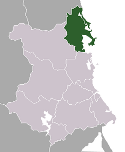 Location of Sông Cầu in Phú Yên Province | |
 | |
| Country | |
| Region | South Central Coast |
| Province | Phú Yên |
| Established | 28 August 2009 |
| Local government's offices | Xuân Phú |
| Area | |
| • Town (Class-4) | 188 sq mi (487 km2) |
| • Urban | 12.4266 sq mi (32.1848 km2) |
| Population (2009) | |
| • Town (Class-4) | 105,780 |
| • Density | 541/sq mi (208.7/km2) |
| • Urban | 32,437 |
| • Urban density | 2,610/sq mi (1,007.8/km2) |
| Time zone | UTC+7 (Indochina Time) |
| Website | songcau.phuyen.gov.vn |
Sông Cầu is a town (thị xã) of Phú Yên province in the South Central Coast region of Vietnam.
After the Vietnam War, Sông Cầu was merged into Đồng Xuân District in 1976. The latter was then combined with Tuy An District to become Xuân An District in March 1977, but Xuân An was soon split again into the two previous districts in September 1978. Sông Cầu Township was the seat for those districts. On 27 June 1985, Sông Cầu District was split from Đồng Xuân District.[1] On 28 August 2009, Sông Cầu District was upgraded to town status.[2]
Sông Cầu is subdivided into 4 wards (phường): Xuân Yên, Xuân Phú, Xuân Thành and Xuân Đài, and 10 communes (xã): Xuân Thọ 1, Xuân Thọ 2, Xuân Lâm, Xuân Phương, Xuân Thịnh, Xuân Cảnh, Xuân Hoà, Xuân Bình, Xuân Lộc and Xuân Hải. At the time of establishment (2009) it had a population of 101,521 and covered an area of 489.28 km².[2] The local government's offices are located in Xuân Phú Ward.
YouTube Encyclopedic
-
1/3Views:7 27918 7307 843
-
Bãi biển Vịnh Hòa - Sông Cầu - Phú Yên
-
Sôngcầu
-
Bãi Ôm Bãi Rạng Siêu Đẹp Ở Sông Cầu Phú Yên
Transcription
References
- ^ (Vietnamese) History of Sông Cầu
- ^ a b (Vietnamese) The foundation of Sông Cầu Town
13°33′N 109°12′E / 13.550°N 109.200°E
| Da Nang city |  | |
|---|---|---|
| Bình Định province | ||
| Bình Thuận province | ||
| Khánh Hòa province |
| |
| Ninh Thuận province | ||
| Phú Yên province | ||
| Quảng Nam province | ||
| Quảng Ngãi province | ||
※ denotes provincial seat. / § Sovereignty over the Hoàng Sa and Trường Sa archipelagoes is disputed as of 2 December 2023. | ||
This article about a location in Phú Yên province, Vietnam is a stub. You can help Wikipedia by expanding it. |