
São Pedro da Água Branca | |
|---|---|
Municipality | |
| The Municipality of São Pedro da Água Branca | |
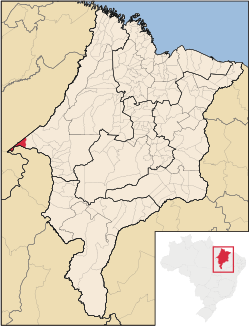 Location of São Pedro da Água Branca | |
| Coordinates: 05°05′06″S 48°25′44″W / 5.08500°S 48.42889°W | |
| Country | |
| Region | Northeast |
| State | |
| Founded | June 5, 1996 |
| Government | |
| • Mayor | Idelzio Gonçalves de Oliveira (PTB) |
| Area | |
| • Total | 720.492 km2 (278.184 sq mi) |
| Population (2020 [1]) | |
| • Total | 12,735 |
| • Density | 15.5/km2 (40/sq mi) |
| Time zone | UTC−3 (BRT) |
| HDI (2000) | 0.588 – medium[2] |
São Pedro da Água Branca is the westernmost municipality in the Brazilian state of Maranhão, bordering both Pará and Tocantins states.
The city has one of the most important railway stations on the Carajás Railway line.
References
 | This Maranhão, Brazil location article is a stub. You can help Wikipedia by expanding it. |