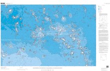
Ruwitūn̄tūn̄ is a guyot in the Pacific Ocean[1] which reaches a depth of 1,215 metres (3,986 ft) below sea level. It is capped off with a summit platform covered in sediments and some volcanic pinnacles with craters.[2] Basaltic rocks have been found on Ruwitūn̄tūn̄.[3]
History
Aptian to Campanian age has been inferred from fossils found on Ruwitūn̄tūn̄,[1] including Albian rudists. A Campanian limestone has also been found on Ruwitūn̄tūn̄.[4]
Geological context

A number of flat-topped seamounts rise from the floor of the western Pacific Ocean to depths of 1,000–2,000 metres (3,300–6,600 ft) below sea level. They are called guyots[5] and are clustered in an elongated region with and between the Marshall Islands and the Tuamotus. It is presumed that hotspots generated most of these seamounts.[6]
The Marshall Islands are grouped in two chains and three groups, the Ratak Chain including Limalok Guyot, the Ralik Chain including Wōdejebato Guyot and an isolated cluster farther west including Eniwetok Island.[5]
References
- ^ a b c Haggerty & Premoli Silva 1995, p. 937.
- ^ Hein et al. 1990, p. 4.
- ^ Hein et al. 1990, p. 54.
- ^ Hein et al. 1990, p. 13.
- ^ a b Haggerty & Premoli Silva 1995, p. 935.
- ^ Haggerty & Premoli Silva 1995, p. 936.
Sources
- Haggerty, J.A.; Premoli Silva, I. (December 1995), "Comparison of the Origin and Evolution of Northwest Pacific Guyots Drilled during Leg 144" (PDF), Proceedings of the Ocean Drilling Program, 144 Scientific Results, Proceedings of the Ocean Drilling Program, Ocean Drilling Program, vol. 144, doi:10.2973/odp.proc.sr.144.074.1995, retrieved 2018-07-15
- Hein, J.R.; Kang, Jung-Keuk; Schulz, M.S.; Park, Byong-Kwon; Kirschenbaum, Herbert; Yoon, Suk-Hoon; Olson, R.L.; Smith, V.K.; Park, Dong-Won (1990). "Geological, geochemical, geophysical, and oceanographic data and interpretations of seamounts and co-rich ferromanganese crusts from the Marshall Islands, KORDI-USGS R.V. FARNELLA cruise F10-89-CP". Open-File Report. doi:10.3133/ofr90407. ISSN 2331-1258.


