
Ruskin, Nebraska | |
|---|---|
 Downtown Ruskin: north side of Main Street | |
 Location of Ruskin, Nebraska | |
| Coordinates: 40°08′38″N 97°52′01″W / 40.14389°N 97.86694°W | |
| Country | United States |
| State | Nebraska |
| County | Nuckolls |
| Area | |
| • Total | 0.42 sq mi (1.08 km2) |
| • Land | 0.42 sq mi (1.08 km2) |
| • Water | 0.00 sq mi (0.00 km2) |
| Elevation | 1,673 ft (510 m) |
| Population (2020) | |
| • Total | 105 |
| • Density | 251.20/sq mi (96.92/km2) |
| Time zone | UTC-6 (Central (CST)) |
| • Summer (DST) | UTC-5 (CDT) |
| ZIP code | 68974 |
| Area code | 402 |
| FIPS code | 31-42810 |
| GNIS feature ID | 2399145[2] |
Ruskin is a village in Nuckolls County, Nebraska, United States. The population was 123 at the 2010 census.
YouTube Encyclopedic
-
1/2Views:6 19366 788
-
Biggest IRS Tax Audit Red Flags
-
✓Best Chicken Coop Designs & Plans-Ultimate Coop Ideas! How To Build A Chicken Coop-Best DIY Designs
Transcription
History
Ruskin was established in 1887 when the Chicago, Rock Island & Pacific Railroad was extended to that point.[3] It was named after John Ruskin, an English academic and art critic.[4][5]
Geography
According to the United States Census Bureau, the village has a total area of 0.42 square miles (1.09 km2), all land.[6]
Demographics
| Census | Pop. | Note | %± |
|---|---|---|---|
| 1910 | 339 | — | |
| 1920 | 360 | 6.2% | |
| 1930 | 239 | −33.6% | |
| 1940 | 223 | −6.7% | |
| 1950 | 214 | −4.0% | |
| 1960 | 203 | −5.1% | |
| 1970 | 229 | 12.8% | |
| 1980 | 224 | −2.2% | |
| 1990 | 187 | −16.5% | |
| 2000 | 195 | 4.3% | |
| 2010 | 123 | −36.9% | |
| 2020 | 105 | −14.6% | |
| U.S. Decennial Census[7] 2012 Estimate[8] | |||
2010 census
As of the census[9] of 2010, there were 123 people, 61 households, and 36 families residing in the village. The population density was 292.9 inhabitants per square mile (113.1/km2). There were 78 housing units at an average density of 185.7 per square mile (71.7/km2). The racial makeup of the village was 94.3% White and 5.7% from other races. Hispanic or Latino of any race were 7.3% of the population.
There were 61 households, of which 18.0% had children under the age of 18 living with them, 55.7% were married couples living together, 3.3% had a female householder with no husband present, and 41.0% were non-families. 39.3% of all households were made up of individuals, and 24.6% had someone living alone who was 65 years of age or older. The average household size was 2.02 and the average family size was 2.67.
The median age in the village was 51.5 years. 16.3% of residents were under the age of 18; 3.3% were between the ages of 18 and 24; 19.6% were from 25 to 44; 33.4% were from 45 to 64; and 27.6% were 65 years of age or older. The gender makeup of the village was 52.0% male and 48.0% female.
2000 census
As of the census of 2000, there were 195 people, 78 households, and 57 families residing in the village. The population density was 466.6 inhabitants per square mile (180.2/km2). There were 86 housing units at an average density of 205.8 per square mile (79.5/km2). The racial makeup of the village was 95.90% White, 3.59% from other races, and 0.51% from two or more races. Hispanic or Latino of any race were 6.15% of the population.
There were 78 households, out of which 33.3% had children under the age of 18 living with them, 71.8% were married couples living together, 1.3% had a female householder with no husband present, and 26.9% were non-families. 26.9% of all households were made up of individuals, and 16.7% had someone living alone who was 65 years of age or older. The average household size was 2.50 and the average family size was 3.04.
In the village, the population was spread out, with 26.2% under the age of 18, 4.6% from 18 to 24, 25.1% from 25 to 44, 22.1% from 45 to 64, and 22.1% who were 65 years of age or older. The median age was 40 years. For every 100 females, there were 87.5 males. For every 100 females age 18 and over, there were 97.3 males.
As of 2000 the median income for a household in the village was $28,750, and the median income for a family was $31,250. Males had a median income of $22,361 versus $17,344 for females. The per capita income for the village was $13,130. About 3.5% of families and 8.6% of the population were below the poverty line, including 22.6% of those under the age of eighteen and none of those 65 or over.
Notable person
- Aksel Andersen, musician
References
- ^ "ArcGIS REST Services Directory". United States Census Bureau. Retrieved September 18, 2022.
- ^ a b U.S. Geological Survey Geographic Names Information System: Ruskin, Nebraska
- ^ "Ruskin, Nuckolls County". Center for Advanced Land Management Information Technologies. University of Nebraska. Retrieved August 20, 2014.
- ^ "Profile for Ruskin, NE". ePodunk. Retrieved August 20, 2014.
- ^ Fitzpatrick, Lillian L. (1960). Nebraska Place-Names. University of Nebraska Press. p. 108. ISBN 0-8032-5060-6. A 1925 edition is available for download at University of Nebraska—Lincoln Digital Commons.
- ^ "US Gazetteer files 2010". United States Census Bureau. Archived from the original on January 25, 2012. Retrieved June 24, 2012.
- ^ United States Census Bureau. "Census of Population and Housing". Retrieved October 16, 2013.
- ^ "Annual Estimates of the Resident Population: April 1, 2010 to July 1, 2012". Archived from the original on October 19, 2013. Retrieved October 16, 2013.
- ^ "U.S. Census website". United States Census Bureau. Retrieved June 24, 2012.
Municipalities and communities of Nuckolls County, Nebraska, United States | ||
|---|---|---|
| Cities | 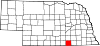 | |
| Villages | ||
| Unincorporated communities | ||
| Ghost town | ||