
Walpole No. 92
Pipestone No. 92 (1910–1911) | |
|---|---|
| Rural Municipality of Walpole No. 92 | |
 Grain elevator in Parkman | |
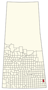 Location of the RM of Walpole No. 92 in Saskatchewan | |
| Coordinates: 49°52′52″N 101°51′22″W / 49.881°N 101.856°W[1] | |
| Country | Canada |
| Province | Saskatchewan |
| Census division | 1 |
| SARM division | 1 |
| Federal riding | Souris—Moose Mountain |
| Provincial riding | Cannington Moosomin |
| Formed[2] | December 12, 1910 |
| Name change[3] | February 15, 1911 (from RM of Pipestone No. 92) |
| Government | |
| • Reeve | Hugh Smyth |
| • Governing body | RM of Walpole No. 92 Council |
| • Administrator | Deborah C. Saville |
| • Office location | Wawota |
| Area (2016)[5] | |
| • Land | 844.66 km2 (326.13 sq mi) |
| Population (2016)[5] | |
| • Total | 326 |
| • Density | 0.4/km2 (1/sq mi) |
| Time zone | CST |
| • Summer (DST) | CST |
| Postal code | S0G 5A0 |
| Area code(s) | 306 and 639 |
| Website | walpolerm |
The Rural Municipality of Walpole No. 92 (2016 population: 326) is a rural municipality (RM) in the Canadian province of Saskatchewan within Census Division No. 1 and SARM Division No. 1.
History
The RM of Pipestone No. 92 was originally incorporated as a rural municipality on December 12, 1910.[2] Its name was changed to the RM of Walpole No. 92 on February 15, 1911.[3]
Geography
Communities and localities
The following unincorporated communities are within the RM:
- Localities
- Mair
- Kelso
- Parkman
- Riga
- Walpole
Demographics
In the 2021 Census of Population conducted by Statistics Canada, the RM of Walpole No. 92 had a population of 292 living in 116 of its 135 total private dwellings, a change of -10.4% from its 2016 population of 326. With a land area of 832.36 km2 (321.38 sq mi), it had a population density of 0.4/km2 (0.9/sq mi) in 2021.[8]
In the 2016 Census of Population, the RM of Walpole No. 92 recorded a population of 326 living in 126 of its 149 total private dwellings, a -3.6% change from its 2011 population of 338. With a land area of 844.66 km2 (326.13 sq mi), it had a population density of 0.4/km2 (1.0/sq mi) in 2016.[5]
Government
The RM of Walpole No. 92 is governed by an elected municipal council and an appointed administrator that meets on the second Wednesday of every month.[4] The reeve of the RM is Hugh Smyth while its administrator is Deborah C. Saville.[4] The RM's office is located in Wawota.[4]
Transportation
- Rail[9]
- Reston Section C.P.R. -- serves Reston, Ewart, Ebor, Maryfield, Fairlight, Walpole, Wawota, Dumas
- Roads[10]
See also
References
- ^ "Pre-packaged CSV files - CGN, Canada/Province/Territory (cgn_sk_csv_eng.zip)". Government of Canada. July 24, 2019. Retrieved May 23, 2020.
- ^ a b "Rural Municipality Incorporations (Alphabetical)". Saskatchewan Ministry of Municipal Affairs. Archived from the original on April 21, 2011. Retrieved May 9, 2020.
- ^ a b "Renamed Rural Municipalities". Saskatchewan Ministry of Municipal Affairs. Archived from the original on February 25, 2012. Retrieved May 9, 2020.
- ^ a b c d "Municipality Details: RM of Walpole No. 92". Government of Saskatchewan. Retrieved May 21, 2020.
- ^ a b c "Population and dwelling counts, for Canada, provinces and territories, and census subdivisions (municipalities), 2016 and 2011 censuses – 100% data (Saskatchewan)". Statistics Canada. February 8, 2017. Retrieved May 1, 2020.
- ^ "Saskatchewan Census Population" (PDF). Saskatchewan Bureau of Statistics. Archived from the original (PDF) on September 24, 2015. Retrieved May 9, 2020.
- ^ "Saskatchewan Census Population". Saskatchewan Bureau of Statistics. Retrieved May 9, 2020.
- ^ "Population and dwelling counts: Canada, provinces and territories, census divisions and census subdivisions (municipalities), Saskatchewan". Statistics Canada. February 9, 2022. Retrieved April 13, 2022.
- ^ Canadian Maps: January 1925 Waghorn's Guide. Post Offices in Man. Sask. Alta. and West Ontario.
- ^ Eversoft Streets and Trips
| Cities |  | ||||
|---|---|---|---|---|---|
| Towns | |||||
| Villages | |||||
| Rural municipalities | |||||
| First Nations | |||||
| Indian reserves | |||||
| Unincorporated communities |
| ||||