
Grey | |
|---|---|
| Rural Municipality of Grey | |
 Sacred Heart Of Jesus Roman Catholic Church in Fannystelle, Manitoba. | |
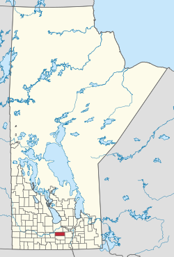 Location of the RM of Grey in Manitoba | |
| Coordinates: 49°42′34″N 98°04′25″W / 49.70944°N 98.07361°W | |
| Country | Canada |
| Province | Manitoba |
| Incorporated | February 9, 1906 |
| Amalgamated | January 1, 2015[1] |
| Time zone | UTC-6 (CST) |
| • Summer (DST) | UTC-5 (CDT) |
| Website | www |
The Rural Municipality of Grey (French: Municipalité rurale de Grey) is a rural municipality in the Canadian province of Manitoba. It is named after Albert Grey, 4th Earl Grey, the former Governor General of Canada.[2]
YouTube Encyclopedic
-
1/5Views:3 4685 0481 7054 2854 411
-
Conestoga Parkway - Waterloo Region, Ontario
-
Highway 8: Kitchener, Ontario
-
Wildhorse, Witchekan Lake Powwow 2011
-
אוסלו נורווגיה Norway Oslo
-
Region of Waterloo No Overtaking 2011
Transcription
History
The RM was incorporated on February 9, 1906.[2] It amalgamated with the Village of St. Claude on January 1, 2015, as a requirement of The Municipal Amalgamations Act for municipalities with a population less than 1,000 residents.[1][3] The Government of Manitoba initiated these amalgamations in order for municipalities to meet the 1997 minimum population requirement of 1,000 to incorporate a municipality.[4]
Communities
Demographics
In the 2021 Census of Population conducted by Statistics Canada, Grey had a population of 2,517 living in 959 of its 1,034 total private dwellings, a change of -4.9% from its 2016 population of 2,648. With a land area of 968.9 km2 (374.1 sq mi), it had a population density of 2.6/km2 (6.7/sq mi) in 2021.[5]
See also
References
- ^ a b "The Municipal Amalgamations Act (C.C.S.M. c. M235): Rural Municipality of Grey and Village of St. Claude Amalgamation Regulation" (PDF). Government of Manitoba. Retrieved October 26, 2014.
- ^ a b "Manitoba Communities: Grey (Rural Municipality)". Manitoba Historical Society. Retrieved May 24, 2020.
- ^ "The Municipal Amalgamations Act (C.C.S.M. c. M235)". Government of Manitoba. October 2, 2014. Retrieved October 27, 2014.
- ^ "Speech from the Throne: At the Opening of the Second Session of the 40th Legislature of the Province of Manitoba". Government of Manitoba. November 19, 2012. Retrieved October 27, 2014.
- ^ "Population and dwelling counts: Canada, provinces and territories, and census subdivisions (municipalities), Manitoba". Statistics Canada. February 9, 2022. Retrieved February 20, 2022.
External links
Places adjacent to Rural Municipality of Grey | |
|---|---|
| Cities | 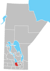 | ||
|---|---|---|---|
| Villages |
| ||
| Rural municipalities | |||
| First Nations | |||
| Indian reserves | |||
| Unincorporated communities | |||