
Caron No. 162 | |
|---|---|
| Rural Municipality of Caron No. 162 | |
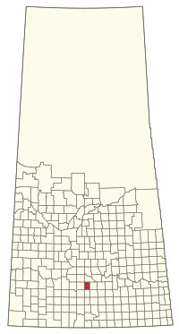 Location of the RM of Caron No. 162 in Saskatchewan | |
| Coordinates: 50°27′18″N 105°52′52″W / 50.455°N 105.881°W[1] | |
| Country | Canada |
| Province | Saskatchewan |
| Census division | 7 |
| SARM division | 2 |
| Formed[2] | December 9, 1912 |
| Government | |
| • Reeve | Gregory McKeown |
| • Governing body | RM of Caron No. 162 Council |
| • Administrator | John Morris |
| • Office location | Moose Jaw |
| Area (2016)[4] | |
| • Land | 569.87 km2 (220.03 sq mi) |
| Population (2016)[4] | |
| • Total | 576 |
| • Density | 1/km2 (3/sq mi) |
| Time zone | CST |
| • Summer (DST) | CST |
| Area code(s) | 306 and 639 |

The Rural Municipality of Caron No. 162 (2016 population: 576) is a rural municipality (RM) in the Canadian province of Saskatchewan within Census Division No. 7 and SARM Division No. 2. It is located in the southwest portion of the province.
History
The RM of Caron No. 162 incorporated as a rural municipality on December 9, 1912.[2]
Geography
The burrowing owl (Athene cunicularia), an endangered animal, makes its home in this area. As well, the smooth arid goosefoot (Chenopodium subglabrum) and long-billed curlew (Numenius americanus) is of special concern in the ecoregion.[5]
Communities and localities
The following urban municipalities are surrounded by the RM.
The following unincorporated communities are within the RM.
- Abound
- Archydal
- Archydal Airport
- Caron
- Grayburn
- Grayburn Airport
- McKeown Airport
Demographics
In the 2021 Census of Population conducted by Statistics Canada, the RM of Caron No. 162 had a population of 603 living in 220 of its 233 total private dwellings, a change of 4.7% from its 2016 population of 576. With a land area of 566.74 km2 (218.82 sq mi), it had a population density of 1.1/km2 (2.8/sq mi) in 2021.[11]
In the 2016 Census of Population, the RM of Caron No. 162 recorded a population of 576 living in 216 of its 234 total private dwellings, a 11.6% change from its 2011 population of 516. With a land area of 569.87 km2 (220.03 sq mi), it had a population density of 1.0/km2 (2.6/sq mi) in 2016.[4]
Attractions
Besant Recreation Site is along the Trans Canada Highway.[12]
Government
The RM of Caron No. 162 is governed by an elected municipal council and an appointed administrator that meets on the second Thursday of every month.[3] The reeve of the RM is Gregory McKeown while its administrator is John Morris.[3] The RM's office is located in Moose Jaw.[3]
References
- ^ "Pre-packaged CSV files - CGN, Canada/Province/Territory (cgn_sk_csv_eng.zip)". Government of Canada. July 24, 2019. Retrieved May 23, 2020.
- ^ a b "Rural Municipality Incorporations (Alphabetical)". Saskatchewan Ministry of Municipal Affairs. Archived from the original on April 21, 2011. Retrieved May 9, 2020.
- ^ a b c d "Municipality Details: RM of Caron No. 162". Government of Saskatchewan. Retrieved May 21, 2020.
- ^ a b c "Population and dwelling counts, for Canada, provinces and territories, and census subdivisions (municipalities), 2016 and 2011 censuses – 100% data (Saskatchewan)". Statistics Canada. February 8, 2017. Retrieved May 1, 2020.
- ^ "Saskatchewan Conservation Data Centre - Conservation Database". Saskatchewan Conservation Data Centre. 2007. Retrieved December 26, 2007.
- ^ "2019-2020 Rural Revenue Sharing Organized Hamlet Grant". Government of Saskatchewan. Retrieved May 4, 2020.[permanent dead link]
- ^ Saskatchewan Genealogy Association, retrieved December 29, 2007
- ^ "4707036 - Caron No. 162, geographical codes and localities, 2006", Statistics Canada, Government of Canada, retrieved December 29, 2007
- ^ "Saskatchewan Census Population" (PDF). Saskatchewan Bureau of Statistics. Archived from the original (PDF) on September 24, 2015. Retrieved May 9, 2020.
- ^ "Saskatchewan Census Population". Saskatchewan Bureau of Statistics. Retrieved May 9, 2020.
- ^ "Population and dwelling counts: Canada, provinces and territories, census divisions and census subdivisions (municipalities), Saskatchewan". Statistics Canada. February 9, 2022. Retrieved April 13, 2022.
- ^ "Caron No. 162", Sask biz, Government of Saskatchewan, retrieved December 29, 2007
Places adjacent to Rural Municipality of Caron No. 162 | ||||||||||||||||
|---|---|---|---|---|---|---|---|---|---|---|---|---|---|---|---|---|
| ||||||||||||||||
