
Big Quill No. 308 | |
|---|---|
| Rural Municipality of Big Quill No. 308 | |
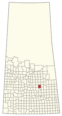 Location of the RM of Big Quill No. 308 in Saskatchewan | |
| Coordinates: 51°40′41″N 104°20′31″W / 51.678°N 104.342°W[1] | |
| Country | Canada |
| Province | Saskatchewan |
| Census division | 10 |
| SARM division | 4 |
| Formed[2] | December 13, 1909 |
| Government | |
| • Reeve | Howie Linnen |
| • Governing body | RM of Big Quill No. 308 Council |
| • Administrator | Santana Dawson |
| • Office location | Wynyard |
| Area (2016)[4] | |
| • Land | 739.86 km2 (285.66 sq mi) |
| Population (2016)[4] | |
| • Total | 519 |
| • Density | 0.7/km2 (2/sq mi) |
| Time zone | CST |
| • Summer (DST) | CST |
| Postal code | S0A 4T0 |
| Area code(s) | 306 and 639 |
The Rural Municipality of Big Quill No. 308 (2016 population: 519) is a rural municipality (RM) in the Canadian province of Saskatchewan within Census Division No. 10 and SARM Division No. 4. It is located in the east-central portion of the province.
YouTube Encyclopedic
-
1/1Views:3 822
-
Deeper Insights into the Illuminati Formula - Part A (Audio Book)
Transcription
History
The RM of Big Quill No. 308 incorporated as a rural municipality on December 13, 1909.[2]
There are two places on the Canadian Register of Historic Places in the RM of Big Qill:
- Amma's House on the Yellowhead Highway approximately 17 kilometres west of Wynyard was built by Icelandic carpenters in 1919.[5]
- St. John Bohoslav Krasne Ukrainian Catholic Church approximately 20 kilometres south-east of Wynyard was built in 1940.[6]
Geography
Communities and localities
The following urban municipalities are surrounded by the RM.[7]
- Towns
The following unincorporated communities are located within the RM.
- Dafoe
- Localities
- Copeland
- Krasne[9]
Demographics
In the 2021 Census of Population conducted by Statistics Canada, the RM of Big Quill No. 308 had a population of 520 living in 218 of its 246 total private dwellings, a change of -2.6% from its 2016 population of 534. With a land area of 730.34 km2 (281.99 sq mi), it had a population density of 0.7/km2 (1.8/sq mi) in 2021.[12]
In the 2016 Census of Population, the RM of Big Quill No. 308 recorded a population of 519 living in 221 of its 263 total private dwellings, a -11.6% change from its 2011 population of 587. With a land area of 739.86 km2 (285.66 sq mi), it had a population density of 0.7/km2 (1.8/sq mi) in 2016.[4]
Government
The RM of Big Quill No. 308 is governed by an elected municipal council and an appointed administrator that meets on the second Wednesday of every month.[3] The reeve of the RM is Howie Linnen while its administrator is Santana Dawson.[3] The RM's office is located in Wynyard.[3]
See also
References
- ^ "Pre-packaged CSV files - CGN, Canada/Province/Territory (cgn_sk_csv_eng.zip)". Government of Canada. July 24, 2019. Retrieved May 23, 2020.
- ^ a b "Rural Municipality Incorporations (Alphabetical)". Saskatchewan Ministry of Municipal Affairs. Archived from the original on April 21, 2011. Retrieved May 9, 2020.
- ^ a b c d "Municipality Details: RM of Big Quill No. 308". Government of Saskatchewan. Retrieved May 21, 2020.
- ^ a b c "Population and dwelling counts, for Canada, provinces and territories, and census subdivisions (municipalities), 2016 and 2011 censuses – 100% data (Saskatchewan)". Statistics Canada. February 8, 2017. Retrieved May 1, 2020.
- ^ "Amma's House". Retrieved November 10, 2013.
- ^ "St. John Bohoslav Krasne Church". Retrieved November 10, 2013.
- ^ Saskatchewan Genealogy Association, retrieved March 28, 2008
- ^ "2019-2020 Rural Revenue Sharing Organized Hamlet Grant". Government of Saskatchewan. Retrieved May 4, 2020.[permanent dead link]
- ^ "Krasne". Geographical Names Data Base. Natural Resources Canada. Retrieved July 4, 2015.
- ^ "Saskatchewan Census Population" (PDF). Saskatchewan Bureau of Statistics. Archived from the original (PDF) on September 24, 2015. Retrieved May 9, 2020.
- ^ "Saskatchewan Census Population". Saskatchewan Bureau of Statistics. Retrieved May 9, 2020.
- ^ "Population and dwelling counts: Canada, provinces and territories, census divisions and census subdivisions (municipalities), Saskatchewan". Statistics Canada. February 9, 2022. Retrieved April 13, 2022.
| Towns |  | ||||
|---|---|---|---|---|---|
| Villages | |||||
| Resort villages | |||||
| Rural municipalities | |||||
| First Nations | |||||
| Indian reserves | |||||
| Unincorporated communities |
| ||||