
Round Grove Township | |
|---|---|
 Part of the Meadow Lake Wind Farm in the township | |
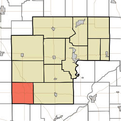 Location in White County | |
| Coordinates: 40°36′16″N 87°02′12″W / 40.60444°N 87.03667°W | |
| Country | United States |
| State | Indiana |
| County | White |
| Government | |
| • Type | Indiana township |
| Area | |
| • Total | 35.51 sq mi (92.0 km2) |
| • Land | 35.48 sq mi (91.9 km2) |
| • Water | 0.03 sq mi (0.08 km2) 0.08% |
| Elevation | 728 ft (222 m) |
| Population (2020) | |
| • Total | 252 |
| • Density | 7.1/sq mi (2.7/km2) |
| ZIP codes | 47906, 47923 |
| GNIS feature ID | 453815 |
Round Grove Township is one of twelve townships in White County, Indiana, United States. As of the 2020 census, its population was 252 and it contained 100 housing units.[1]
Round Grove Township was established in 1858.[2] The township was named for a former round grove in the southern half of the township.[3]
| Census | Pop. | Note | %± |
|---|---|---|---|
| 1890 | 779 | — | |
| 1900 | 890 | 14.2% | |
| 1910 | 628 | −29.4% | |
| 1920 | 641 | 2.1% | |
| 1930 | 537 | −16.2% | |
| 1940 | 494 | −8.0% | |
| 1950 | 446 | −9.7% | |
| 1960 | 418 | −6.3% | |
| 1970 | 382 | −8.6% | |
| 1980 | 282 | −26.2% | |
| 1990 | 250 | −11.3% | |
| 2000 | 246 | −1.6% | |
| 2010 | 259 | 5.3% | |
| 2020 | 252 | −2.7% | |
| Source: US Decennial Census[4] | |||
YouTube Encyclopedic
-
1/3Views:1 251 194463 373170 685
-
The 10 Worst Cities in Indiana Explained
-
$1,500 Down Payment - Owner Financed 15 acres with Natural Creek and gorgeous meadow! ID#PH13
-
If You See Square Waves In The Ocean Get Out Of The Water Immediately
Transcription
Geography
According to the 2010 census, the township has a total area of 35.51 square miles (92.0 km2), of which 35.48 square miles (91.9 km2) (or 99.92%) is land and 0.03 square miles (0.078 km2) (or 0.08%) is water.[5]
Unincorporated towns
(This list is based on USGS data and may include former settlements.)
Adjacent townships
- West Point Township (north)
- Prairie Township (east)
- Wabash Township, Tippecanoe County (southeast)
- Shelby Township, Tippecanoe County (south)
- Bolivar Township, Benton County (southwest)
- Pine Township, Benton County (west)
- Gilboa Township, Benton County (northwest)
School districts
- Tri-County School Corporation
Political districts
- Indiana's 4th congressional district
- State House District 15
- State Senate District 07
References
Citations
- ^ "Explore Census Data". data.census.gov. Retrieved April 14, 2024.
- ^ Hamelle, W. H. (1915). A Standard History of White County, Indiana: An Authentic Narrative of the Past, with an Extended Survey of Modern Developments in the Progress of Town and Country. Unigraphic. p. 284.
- ^ Counties of White and Pulaski, Indiana: Historical and Biographical. F.A. Battey & Company. 1883. p. 210.
- ^ "Township Census Counts: STATS Indiana".
- ^ "Population, Housing Units, Area, and Density: 2010 - County -- County Subdivision and Place -- 2010 Census Summary File 1". United States Census. Archived from the original on February 12, 2020. Retrieved May 10, 2013.
Sources
- United States Census Bureau 2007 TIGER/Line Shapefiles
- United States Board on Geographic Names (GNIS)
- IndianaMap
External links
Wikimedia Commons has media related to Round Grove Township, White County, Indiana.
Municipalities and communities of White County, Indiana, United States | ||
|---|---|---|
| City |  | |
| Towns | ||
| Townships | ||
| CDPs | ||
| Other unincorporated communities | ||