
| Romsdalshornet | |
|---|---|
 Romsdalshornet seen from the valley Credit: Axel Lindahl, 1890 | |
| Highest point | |
| Elevation | 1,550 m (5,090 ft) |
| Prominence | 410 m (1,350 ft) |
| Coordinates | 62°29′29″N 7°47′09″E / 62.4913°N 7.7859°E[1] |
| Geography | |
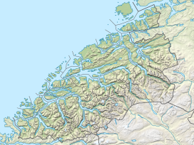 Romsdalshornet Location of the mountain  Romsdalshornet Romsdalshornet (Norway) | |
| Location | Møre og Romsdal, Norway |
| Parent range | Romsdalsalpane |
| Topo map | 1319 II Romsdalen |
| Climbing | |
| First ascent | ca. 1828 by Christen Smed & Hans Bjermeland |
| Easiest route | Climbing |
Romsdalshornet is a mountain in the municipality of Rauma in Møre og Romsdal county, Norway. The mountain is located 10 kilometres (6.2 mi) southeast of the town of Åndalsnes, along the Rauma River in the Romsdalen valley. The Rauma railway line and the European route E136 highway both pass by the mountain. The mountain Store Venjetinden lies 3 kilometres (1.9 mi) east of the mountain and 3 kilometres (1.9 mi) to the west (across the valley) lies the mountain Store Trolltind—part of the Troll Wall/Trollryggen ridge.

Romsdalshornet is a popular mountain for climbing, which is best done in late summer. Descent by rappel is recommended.
YouTube Encyclopedic
-
1/1Views:2 291
-
Romsdalshornet - heilt fantastisk!
Transcription
History
The first "official" ascent was 1 September 1881 by the Danish climber Carl Hall, together with Norwegians Erik Norahagen and Mathias Soggemoen. They arrived only to discover a cairn set up by Christen Smed and Hans Bjermeland around 1828. Previously none believed Romsdalshornet had been summitted.[2][3]
Arne Randers Heen made the first winter ascent of Romsdalshorn in 1930.

See also
References
- ^ "Romsdalshornet, Rauma (Møre og Romsdal)" (in Norwegian). yr.no. Retrieved 2019-07-06.
- ^ Dyer, Anthony; Baddeley, John; Robertson, Ian H. (2006). Walks and Scrambles in Norway. Rockbuy Limited. ISBN 978-1-904466-25-3.
- ^ Howard, Tony (1970). Climbs, Scrambles and Walks in Romsdal. Cordee. ISBN 978-1-904207-24-5.
External links
This Møre og Romsdal location article is a stub. You can help Wikipedia by expanding it. |