
Rocha | |
|---|---|
Capital city | |
 Plaza Independencia | |
 Rocha Location in Uruguay | |
| Coordinates: 34°29′0″S 54°21′0″W / 34.48333°S 54.35000°W | |
| Country | |
| Department | |
| Founded | 1793 |
| Population (2011 census) | |
| • Total | 25,422 |
| • Demonym | Rochense |
| Time zone | UTC -3 |
| Postal code | 27000 |
| Dial plan | +598 447 (+5 digits) |
| Climate | Cfa |
Rocha (Spanish pronunciation: [ˈrotʃa]) is the capital city of the Rocha Department in Uruguay.
YouTube Encyclopedic
-
1/5Views:16 3087 57932 35914 8092 821
-
【4K】WALK ROCHA Uruguay 4k video UY Travel vlog walking tour
-
LA PEDRERA | A Travel Guide to La Pedrera Rocha, Uruguay
-
【4K】WALK La Paloma Rocha URUGUAY 4K video UY travel vlog HDR
-
La Dama del Este, Balneario Aguas dulces, Rocha, Uruguay - Piscuajo 2023
-
Verano 2023 - La pedrera y La Paloma - Rocha - Gastronomía para todos los gustos y paladares!
Transcription
History
It was founded in 1793 and had acquired the status of "Villa" (town) before the independence of Uruguay. On 7 July 1880 it was made capital of the Department of Rocha by the Act of Ley Nº 1.474, while its status was elevated to "Ciudad" (city) on 10 January 1894 by the Act of Ley Nº 2.252.[1]
In literature
Rocha department features in Carlos María Domínguez's 2004 novel Casa de Papel (The house of paper). The narrator visits the ruins of a house of books, which had been built and then destroyed by an obsessive book collector on the sand spit separating Rocha lagoon from the ocean.
Population
In 2011[update] Rocha had a population of 25,422.[2]
| Year | Population |
|---|---|
| 1908 | 12,200 |
| 1963 | 19,484 |
| 1975 | 21,502 |
| 1985 | 24,013 |
| 1996 | 26,017 |
| 2004 | 25,538 |
| 2011 | 25,422 |
Source: Instituto Nacional de Estadística de Uruguay[1]
Geography
The city is located on the intersection of Route 9 with Route 15, about 70 kilometres (43 mi) northeast of San Carlos of Maldonado Department. The stream Arroyo Rocha flows along the west limits of the city.
Climate
Rocha has a mild humid subtropical climate (Cfa, according to the Köppen climate classification), with pleasant summers and cool winters. It was oceanic (Cfb) before the current climatic table (1961-1990 period). The precipitation is evenly distributed throughout the year, with an average of 1,123 mm (44.2 in). The hottest month, January, has an average temperature of 22.5 °C (72.5 °F), and the coldest month, July, has an average of 11.2 °C (52.2 °F). The average yearly temperature is 16.8 °C (62.2 °F).
| Climate data for Rocha (1991–2020, extremes 1944–2020) | |||||||||||||
|---|---|---|---|---|---|---|---|---|---|---|---|---|---|
| Month | Jan | Feb | Mar | Apr | May | Jun | Jul | Aug | Sep | Oct | Nov | Dec | Year |
| Record high °C (°F) | 41.5 (106.7) |
39.0 (102.2) |
39.0 (102.2) |
35.2 (95.4) |
31.8 (89.2) |
28.8 (83.8) |
30.6 (87.1) |
32.0 (89.6) |
33.6 (92.5) |
33.0 (91.4) |
38.6 (101.5) |
40.0 (104.0) |
41.5 (106.7) |
| Mean daily maximum °C (°F) | 28.1 (82.6) |
27.4 (81.3) |
25.8 (78.4) |
22.6 (72.7) |
19.3 (66.7) |
16.4 (61.5) |
15.5 (59.9) |
17.2 (63.0) |
18.2 (64.8) |
20.8 (69.4) |
23.7 (74.7) |
26.7 (80.1) |
21.8 (71.2) |
| Daily mean °C (°F) | 22.4 (72.3) |
22.0 (71.6) |
20.5 (68.9) |
17.6 (63.7) |
14.4 (57.9) |
11.8 (53.2) |
10.9 (51.6) |
12.3 (54.1) |
13.3 (55.9) |
15.8 (60.4) |
18.2 (64.8) |
20.9 (69.6) |
16.7 (62.1) |
| Mean daily minimum °C (°F) | 16.7 (62.1) |
16.6 (61.9) |
15.2 (59.4) |
12.6 (54.7) |
9.6 (49.3) |
7.2 (45.0) |
6.3 (43.3) |
7.3 (45.1) |
8.4 (47.1) |
10.8 (51.4) |
12.7 (54.9) |
15.0 (59.0) |
11.5 (52.7) |
| Record low °C (°F) | 5.2 (41.4) |
5.0 (41.0) |
4.6 (40.3) |
−1.6 (29.1) |
−1.2 (29.8) |
−5.8 (21.6) |
−5.6 (21.9) |
−4.2 (24.4) |
−3.4 (25.9) |
−0.2 (31.6) |
1.0 (33.8) |
3.5 (38.3) |
−5.8 (21.6) |
| Average precipitation mm (inches) | 110.5 (4.35) |
109.2 (4.30) |
134.8 (5.31) |
118.6 (4.67) |
107.9 (4.25) |
113.9 (4.48) |
108.2 (4.26) |
105.8 (4.17) |
95.5 (3.76) |
102.7 (4.04) |
90.7 (3.57) |
87.0 (3.43) |
1,284.8 (50.58) |
| Average precipitation days (≥ 1.0 mm) | 7 | 8 | 8 | 8 | 8 | 8 | 8 | 8 | 7 | 8 | 7 | 6 | 91 |
| Average relative humidity (%) | 73 | 75 | 78 | 80 | 82 | 82 | 81 | 79 | 79 | 78 | 75 | 72 | 78 |
| Mean monthly sunshine hours | 268.3 | 222.1 | 220.0 | 179.4 | 152.0 | 128.9 | 138.3 | 165.3 | 177.1 | 192.1 | 239.3 | 261.6 | 2,344.4 |
| Source 1: Instituto Uruguayo de Metereología[3][4] | |||||||||||||
| Source 2: NOAA (precipitation and sun 1991–2020),[5] Instituto Nacional de Investigación Agropecuaria (humidity 1980–2009)[6] | |||||||||||||
Transportation
Rocha is on the main road from Montevideo to the border with Brazil. Buses connect it to Montevideo. The rail station was closed in the 1980s. There is a small local airfield. There are plans to improve the local infrastructure substantially. The major project planned is to build a deep water port in or near La Paloma. There are also plans to build an airport to bring in tourism, for example, Rocha's lagoon has a circular bridge especially for it.[7]
Places of worship
- Parish Church of Our Lady of Remedies (Roman Catholic)
- Parish Church of Our Lady of Fatima (Roman Catholic)
Notable people
- Javier Barrios Amorín, politician
- Alberto Demicheli (1896–1980), Uruguayan political figure
- Gonzalo González (born 1993), Uruguayan footballer
- Gladys Castelvecchi, poet
- Carlos Malo, singer
- Carlos Julio Pereyra, politician
- Elio Rodríguez (born 1962), former Uruguayan footballer
- Renzo Sánchez (born 2004), Uruguayan footballer
- Jesús Toscanini, footballer
- Pedro Vaz, diplomat
- Constancio C. Vigil, author
References
- ^ a b "Statistics of urban localities (1908–2004)" (PDF). INE. 2012. Archived from the original (PDF) on Sep 25, 2015. Retrieved 5 September 2012.
- ^ "Censos 2011 Cuadros Rocha". INE. 2012. Archived from the original on 10 October 2012. Retrieved 25 August 2012.
- ^ "Estadísticas climatológicas : Estacion Meteorologica Rocha" (in Spanish). Instituto Uruguayo de Metereología. Retrieved 16 May 2023.
- ^ "RECORDS METEOROLOGICOS EN EL URUGUAY" (in Spanish). Dirección Nacional de Meteorología. Retrieved April 30, 2014.
- ^ "Rocha Climate Normals 1991–2020". World Meteorological Organization Climatological Standard Normals (1991–2020). National Oceanic and Atmospheric Administration. Archived from the original on 7 August 2023. Retrieved 7 August 2023.
- ^ Castaño, José; Giménez, Agustín; Ceroni, Mauricio; Furest, José; Aunchayna, Rossina. "Caracterización Agroclimática del Uruguay 1980–2009" (PDF) (in Spanish). Instituto Nacional de Investigación Agropecuaria. Archived from the original (PDF) on 12 December 2018. Retrieved 12 December 2018.
- ^ Laguna Garzón, Rocha 4K Drone on YouTube
External links
Capital: Rocha | ||
| Towns and villages | 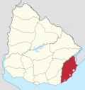 | |
| Sights | ||
| International | |
|---|---|
| National | |