
Robinson Township | |
|---|---|
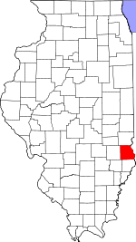
 Location in Crawford County | |
 Crawford County's location in Illinois | |
| Coordinates: 39°00′50″N 87°44′59″W / 39.01389°N 87.74972°W | |
| Country | United States |
| State | Illinois |
| County | Crawford |
| Established | November 5, 1867 |
| Area | |
| • Total | 57.42 sq mi (148.7 km2) |
| • Land | 57.18 sq mi (148.1 km2) |
| • Water | 0.24 sq mi (0.6 km2) 0.42% |
| Elevation | 548 ft (167 m) |
| Population (2020) | |
| • Total | 9,303 |
| • Density | 160/sq mi (63/km2) |
| Time zone | UTC-6 (CST) |
| • Summer (DST) | UTC-5 (CDT) |
| ZIP codes | 62433, 62454 |
| FIPS code | 17-033-64720 |
Robinson Township is one of ten townships in Crawford County, Illinois, USA. As of the 2020 census, its population was 9,303 and it contained 4,165 housing units.[2]
YouTube Encyclopedic
-
1/4Views:85910 550 0961 3404 313 415
-
Crawford County Illinois. Producing tract of oil production with 20 wells and 5 injection
-
This is Why You Never Mess With a Royal Guard...
-
Illinois County History
-
Hollywood Actor who Pass Away Recently in 2020
Transcription
Geography
According to the 2021 census gazetteer files, Robinson Township has a total area of 57.42 square miles (148.72 km2), of which 57.18 square miles (148.10 km2) (or 99.58%) is land and 0.24 square miles (0.62 km2) (or 0.42%) is water.[3]
Cities, towns, villages
- Robinson (the county seat)
Cemeteries
The township contains these six cemeteries: Duncanville, Kirk, Minnick, New Robinson, Newlin and Old Robinson.
Major highways
Airports and landing strips
- Crawford Memorial Hospital Heliport
Lakes
- Brooks Lake
- West Lake
Landmarks
- City Park
- Washington Park
Demographics
As of the 2020 census[2] there were 9,303 people, 3,371 households, and 2,217 families residing in the township. The population density was 162.01 inhabitants per square mile (62.55/km2). There were 4,165 housing units at an average density of 72.53 per square mile (28.00/km2). The racial makeup of the township was 86.69% White, 6.16% African American, 0.32% Native American, 0.51% Asian, 0.01% Pacific Islander, 2.46% from other races, and 3.85% from two or more races. Hispanic or Latino of any race were 3.88% of the population.
There were 3,371 households, out of which 32.90% had children under the age of 18 living with them, 49.69% were married couples living together, 12.22% had a female householder with no spouse present, and 34.23% were non-families. 30.00% of all households were made up of individuals, and 15.90% had someone living alone who was 65 years of age or older. The average household size was 2.14 and the average family size was 2.57.
The township's age distribution consisted of 17.0% under the age of 18, 7.8% from 18 to 24, 31.9% from 25 to 44, 25.6% from 45 to 64, and 17.7% who were 65 years of age or older. The median age was 40.8 years. For every 100 females, there were 145.4 males. For every 100 females age 18 and over, there were 154.0 males.
The median income for a household in the township was $47,254, and the median income for a family was $71,432. Males had a median income of $44,590 versus $25,724 for females. The per capita income for the township was $24,911. About 10.5% of families and 12.6% of the population were below the poverty line, including 11.1% of those under age 18 and 10.4% of those age 65 or o
| Census | Pop. | Note | %± |
|---|---|---|---|
| 1930 | 6,615 | — | |
| 1940 | 7,009 | 6.0% | |
| 1950 | 8,130 | 16.0% | |
| 1960 | 9,056 | 11.4% | |
| 1970 | 9,026 | −0.3% | |
| 1980 | 9,349 | 3.6% | |
| 1990 | 8,842 | −5.4% | |
| 2000 | 10,138 | 14.7% | |
| 2010 | 9,900 | −2.3% | |
| 2020 | 9,303 | −6.0% | |
| U.S. Decennial Census[4] | |||
School districts
- Robinson Community Unit School District 2
Political districts
- Illinois' 15th congressional district
- State House District 109
- State Senate District 55
References
- "Robinson Township, Crawford County, Illinois". Geographic Names Information System. United States Geological Survey, United States Department of the Interior. Retrieved January 10, 2010.
- United States Census Bureau 2007 TIGER/Line Shapefiles
- United States National Atlas
- ^ U.S. Geological Survey Geographic Names Information System: Robinson Township, Crawford County, Illinois
- ^ a b "Explore Census Data". data.census.gov. Retrieved January 22, 2023.
- ^ Bureau, US Census. "Gazetteer Files". Census.gov. Retrieved January 22, 2023.
- ^ "Census of Population and Housing". Census.gov. Retrieved June 4, 2016.
External links
Places adjacent to Robinson Township, Crawford County, Illinois | |
|---|---|
Municipalities and communities of Crawford County, Illinois, United States | ||
|---|---|---|
| City |  | |
| Villages | ||
| Townships | ||
| CDPs | ||
| Other unincorporated communities | ||
| Ghost town | ||
| Footnotes | ‡This populated place also has portions in an adjacent county or counties | |