
Roanoke Township | |
|---|---|
Township | |
 | |
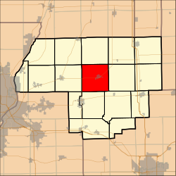 Location in Woodford County | |
| Country | United States |
| State | Illinois |
| County | Woodford |
| Established | November 7, 1854 |
| Area | |
| • Total | 36.86 sq mi (95.5 km2) |
| • Land | 36.81 sq mi (95.3 km2) |
| • Water | 0.05 sq mi (0.1 km2) 0.14% |
| Population (2010) | |
| • Estimate (2016)[1] | 2,540 |
| • Density | 69.5/sq mi (26.8/km2) |
| Time zone | UTC-6 (CST) |
| • Summer (DST) | UTC-5 (CDT) |
| FIPS code | 17-203-64603 |
Roanoke Township is located in Woodford County, Illinois at T27N, R1W. As of the 2010 census, its population was 2,558 and it contained 1,044 housing units.[2] Roanoke Township includes within its boundaries the village of Roanoke, Illinois.
YouTube Encyclopedic
-
1/1Views:407
-
ClearSpan Fabric Structures Covers Woodford County with Sand and Salt Fabric Storage Building
Transcription
Geography
According to the 2010 census, the township has a total area of 36.86 square miles (95.5 km2), of which 36.81 square miles (95.3 km2) (or 99.86%) is land and 0.05 square miles (0.13 km2) (or 0.14%) is water.[2]
Demographics
| Census | Pop. | Note | %± |
|---|---|---|---|
| 2016 (est.) | 2,540 | [1] | |
| U.S. Decennial Census[3] | |||
References
- ^ a b "Population and Housing Unit Estimates". Retrieved June 9, 2017.
- ^ a b "Population, Housing Units, Area, and Density: 2010 - County -- County Subdivision and Place -- 2010 Census Summary File 1". United States Census. Archived from the original on February 12, 2020. Retrieved May 28, 2013.
- ^ "Census of Population and Housing". Census.gov. Retrieved June 4, 2016.
External links
Municipalities and communities of Woodford County, Illinois, United States | ||
|---|---|---|
| Cities |  | |
| Villages | ||
| Townships | ||
| CDP | ||
| Other communities | ||
40°48′N 89°13′W / 40.800°N 89.217°W
This Woodford County, Illinois location article is a stub. You can help Wikipedia by expanding it. |