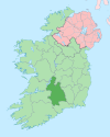
| Aherlow River | |
|---|---|
| Native name | An Eatharlach (Irish) |
| Location | |
| Country | Ireland |
| Physical characteristics | |
| Source | |
| • location | Anglesborough, County Tipperary |
| Mouth | |
• location | River Suir at Kilmoyler |
| Basin size | 99 km2 (38 sq mi) |
| Discharge | |
| • average | 1.070 m3/s (37.8 cu ft/s) |
| Basin features | |
| Tributaries | |
| • left | River Ara |
| • right | Clydagh River |
The Aherlow River (/ˌæhərˈloʊ/; Irish: An Eatharlach) is a river in County Limerick and County Tipperary, Ireland.
YouTube Encyclopedic
-
1/2Views:5541 136
-
What is Satsang with Canela like? - #2 - Aherlow, Tipperary, Ireland
-
LMS TREE SHEAR
Transcription
Name
The name Aherlow comes from eatharlach, an old Irish word believed to mean "lowland between two high lands", i.e. a valley, in this case between the Galtee Mountains and Slievenamuck.[1][2]
Course
The Aherlow River rises in Anglesborough, County Limerick, flowing westward towards Ballygibbon and then turning north, meeting two tributaries in Lyre and flowing northwards near Galbally, County Limerick. It then turns eastwards, passes under the R663 and for 5 km forms the County Limerick–County Tipperary border. It enters the Glen of Aherlow then, and follows a meandering course through the Glen, meeting the Clydagh River at Pollagh and another tributary at Ashgrove, where it passes under the five-arch Ashgrove Bridge.[3] The Aherlow River continues eastward, passing under the Limerick–Rosslare railway line in Tankerstown and is bridged by the N24. It meets the River Ara and another tributary at Ballymorris, and flows on southeastwards, flowing into the Suir at Kilmoyler.
Wildlife
As with many tributaries of the River Suir, the Aherlow River is a noted brown trout fishery.[4][5]
See also
References
- ^ "P.34-5. The Origin and History of Irish Names of Places". Archived from the original on 1 February 2015. Retrieved 1 February 2015.
- ^ "Office of Public Works" (PDF).
- ^ "Ashgrove Bridge, ARDANE, TIPPERARY SOUTH".
- ^ "Infowing - catch the best fishing in Ireland :: Waterway".
- ^ "The River Suir, County Tipperary". tipp.ie. Archived from the original on 7 December 2013. Retrieved 18 October 2021.
52°20′22″N 8°14′56″W / 52.339561°N 8.248872°W

