
Ringgold Township, Pennsylvania | |
|---|---|
 PA 536 in Ringgold Township | |
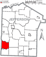 Map of Jefferson County, Pennsylvania Highlighting Ringgold Township | |
 Map of Jefferson County, Pennsylvania | |
| Country | United States |
| State | Pennsylvania |
| County | Jefferson |
| Settled | 1818 |
| Incorporated | 1848 |
| Government | |
| • Type | Township of the Second Class, having a three-member board of supervisors |
| Area | |
| • Total | 19.27 sq mi (49.91 km2) |
| • Land | 19.14 sq mi (49.57 km2) |
| • Water | 0.13 sq mi (0.34 km2) |
| Population | |
| • Total | 772 |
| • Estimate (2022)[2] | 761 |
| Time zone | UTC-5 (Eastern (EST)) |
| • Summer (DST) | UTC-4 (EDT) |
| FIPS code | 42-065-64960 |
Ringgold Township is a township in Jefferson County, Pennsylvania, United States. The population was 772 at the 2020 census.[2]
The township was named after Maj. Samuel Ringgold, a hero of the Battle of Palo Alto in the Mexican–American War.[3]
Geography
The township is in southwestern Jefferson County and is bordered to the west by Armstrong County. It is bordered to the southwest by the borough of Timblin and to the northeast by the borough of Worthville. Unincorporated communities in the township include Ringgold, Dora, and North Freedom.
According to the United States Census Bureau, Ringgold Township has a total area of 19.3 square miles (49.9 km2), of which 19.2 square miles (49.6 km2) are land and 0.1 square miles (0.3 km2), or 0.68%, are water.[4] Little Sandy Creek, a westward-flowing tributary of Redbank Creek, forms the northern border of the township, and Pine Run, a westward-flowing tributary of Mahoning Creek, forms the southern border. The entire township lies in the Allegheny River watershed.
Demographics
| Census | Pop. | Note | %± |
|---|---|---|---|
| 1850 | 665 | — | |
| 1860 | 909 | 36.7% | |
| 1870 | 1,006 | 10.7% | |
| 1880 | 1,078 | 7.2% | |
| 1890 | 1,004 | −6.9% | |
| 1900 | 1,037 | 3.3% | |
| 1910 | 1,190 | 14.8% | |
| 1920 | 1,178 | −1.0% | |
| 1930 | 1,239 | 5.2% | |
| 1940 | 1,189 | −4.0% | |
| 1950 | 916 | −23.0% | |
| 1960 | 771 | −15.8% | |
| 1970 | 735 | −4.7% | |
| 1980 | 883 | 20.1% | |
| 1990 | 705 | −20.2% | |
| 2000 | 764 | 8.4% | |
| 2010 | 741 | −3.0% | |
| 2020 | 772 | 4.2% | |
| 2022 (est.) | 761 | [2] | −1.4% |
| U.S. Decennial Census[5] | |||
As of the census[6] of 2000, there were 764 people, 305 households, and 228 families residing in the township. The population density was 39.9 inhabitants per square mile (15.4/km2). There were 330 housing units at an average density of 17.2/sq mi (6.7/km2). The racial makeup of the township was 99.48% White, 0.13% Asian, 0.13% from other races, and 0.26% from two or more races. Hispanic or Latino of any race were 0.65% of the population.
There were 305 households, out of which 31.1% had children under the age of 18 living with them, 66.6% were married couples living together, 4.9% had a female householder with no husband present, and 25.2% were non-families. 21.0% of all households were made up of individuals, and 11.8% had someone living alone who was 65 years of age or older. The average household size was 2.50 and the average family size was 2.89.
In the township the population was spread out, with 22.3% under the age of 18, 7.2% from 18 to 24, 27.1% from 25 to 44, 25.5% from 45 to 64, and 17.9% who were 65 years of age or older. The median age was 41 years. For every 100 females, there were 107.6 males. For every 100 females age 18 and over, there were 101.4 males.
The median income for a household in the township was $32,292, and the median income for a family was $34,706. Males had a median income of $28,672 versus $22,386 for females. The per capita income for the township was $14,669. About 7.0% of families and 8.4% of the population were below the poverty line, including 5.4% of those under age 18 and 7.5% of those age 65 or over.
References
- ^ "2016 U.S. Gazetteer Files". United States Census Bureau. Retrieved August 14, 2017.
- ^ a b c d Bureau, US Census. "City and Town Population Totals: 2020-2022". Census.gov. US Census Bureau. Retrieved September 4, 2023.
- ^ McKnight, William James (1917). Historical. J.H. Beers. p. 491.
- ^ "Geographic Identifiers: 2010 Census Summary File 1 (G001): Ringgold township, Jefferson County, Pennsylvania". American Factfinder. U.S. Census Bureau. Archived from the original on February 13, 2020. Retrieved November 19, 2018.
- ^ "Census of Population and Housing". Census.gov. Retrieved March 22, 2022.
- ^ "U.S. Census website". United States Census Bureau. Retrieved January 31, 2008.
External links
Municipalities and communities of Jefferson County, Pennsylvania, United States | ||
|---|---|---|
| Boroughs |  | |
| Townships | ||
| CDP | ||
| Other unincorporated communities |
| |
| Footnotes | ‡This populated place also has portions in an adjacent county or counties | |
41°00′05″N 79°09′44″W / 41.00139°N 79.16222°W