
Rinconada | |
|---|---|
Rural municipality and village | |
 | |
| Country | |
| Province | |
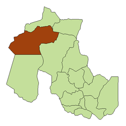
| Department | Rinconada Department |
| Government | |
| • Presidente comunal | Liberato Rubén Vilca, PJ |
| Elevation | 12,635 ft (3,851 m) |
| Population (2001) | |
| • Total | 364 |
| Time zone | UTC−3 (ART) |
| Postal Code | Y4643 |
| Area code | 03885 |
| Website | www.rinconada.gov.ar |
Rinconada is a rural municipality and village in Jujuy Province in Argentina.[1] It is located in the west of the province of Jujuy and is the head of the Rinconada Department.
Due to its altitude of 3851 meters, it is the highest city of Argentina, taking into account those cities possessing municipal organization.
The village is accessed by a 62 km gravel road (Provincial Route 7) that starts 4 km north of Abra Pampa, on National Route 9.T The Laguna de los Pozuelos, found along this route, contains 150 km2 of protected area (Monumento Natural Laguna de los Pozuelos).
YouTube Encyclopedic
-
1/3Views:486486956
-
LLAMAS Y VICUÑAS (CIENEGO GRANDE-RINCONADA-JUJUY)
-
CIENEGO GRANDE-RINCONADA-JUJUY
-
laguna farallon, jujuy, argentina
Transcription
Climate
Rinconada has an alpine climate (Köppen ETH) with mean temperatures below 10 °C (50 °F) in all months.
| Climate data for Rinconada, Jujuy (1972–1996) | |||||||||||||
|---|---|---|---|---|---|---|---|---|---|---|---|---|---|
| Month | Jan | Feb | Mar | Apr | May | Jun | Jul | Aug | Sep | Oct | Nov | Dec | Year |
| Daily mean °C (°F) | 9.4 (48.9) |
9.4 (48.9) |
9.1 (48.4) |
7.0 (44.6) |
4.0 (39.2) |
2.3 (36.1) |
1.7 (35.1) |
3.6 (38.5) |
5.2 (41.4) |
7.4 (45.3) |
8.7 (47.7) |
9.2 (48.6) |
6.4 (43.5) |
| Average precipitation mm (inches) | 162 (6.4) |
123 (4.8) |
74 (2.9) |
7 (0.3) |
0 (0) |
0 (0) |
0 (0) |
0 (0) |
1 (0.0) |
5 (0.2) |
23 (0.9) |
91 (3.6) |
486 (19.1) |
| Source: Instituto Nacional de Tecnología Agropecuaria[2] | |||||||||||||
Population
Taking into account its rural population, Rinconada is the most important town in the department with 1,352 inhabitants (INDEC, 2001), representing a decrease of 21.67% compared to 1645 inhabitants (INDEC, 1991) of the previous census.
Its urban, or clustered, population is only 364 inhabitants.
References
- ^ Ministerio del Interior (in Spanish)
- ^ "Estadísticos de Precipitaciones y Balance Hídrico". Las Precipitaciones del Noroeste Argentino (in Spanish). Instituto Nacional de Tecnología Agropecuaria. Retrieved 3 April 2016.
This article about a place in Jujuy Province, Argentina is a stub. You can help Wikipedia by expanding it. |
22°26′S 66°10′W / 22.433°S 66.167°W