
Rhenen | |
|---|---|
City and Municipality | |
 The Cunera Church in Rhenen | |
 Flag  Coat of arms | |
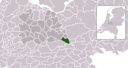 Location in Utrecht | |
| Coordinates: 51°58′N 5°34′E / 51.967°N 5.567°E | |
| Country | Netherlands |
| Province | Utrecht |
| Government | |
| • Body | Municipal council |
| • Mayor | Hans van der Pas (PvdA) |
| Area | |
| • Municipality | 43.76 km2 (16.90 sq mi) |
| • Land | 42.08 km2 (16.25 sq mi) |
| • Water | 1.68 km2 (0.65 sq mi) |
| Elevation | 43 m (141 ft) |
| Population (January 2021)[4] | |
| • Municipality | 20,203 |
| • Density | 480/km2 (1,200/sq mi) |
| Demonym | Rhenenaar |
| Time zone | UTC+1 (CET) |
| • Summer (DST) | UTC+2 (CEST) |
| Postcode | 3910–3922 |
| Area code | 0317, 0318 |
| Website | www |

Rhenen (Dutch pronunciation: [ˈreːnə(n)] ) is a municipality and a city in the central Netherlands. The municipality also includes the villages of Achterberg, Remmerden, Elst and Laareind. The town lies at a geographically interesting location, namely on the southernmost part of the chain of hills known as the Utrecht Hill Ridge (Utrechtse Heuvelrug), where this meets the river Rhine. Because of this Rhenen has a unique character with quite some elevation through town.
Directly to the east of the built-up area lies the Grebbeberg, a hill with a top elevation of about 50 metres (160 ft).
History
Before 1900
Rhenen received city rights probably between 1256 and 1258.[5][6] In 1346, the bishop of Utrecht ordered the construction of a defensive wall around the city, which was important because it lay near the border with Guelders. Although for some time the town collected toll from ships on the Rhine, it has never had a harbour. The three city gates were demolished in 1840. Small fragments of the wall remain.
The town is also famous for the Cunera Church, parts of which date back to the 15th century. Containing the relics of Saint Cunera, it attracted many pilgrims. Legend has it that Cunera was buried on a nearby hill now called the Cuneraheuvel. The church's tower was built between 1492 and 1531.
Between 1630 and 1631, the Koningshuis palace was constructed at Rhenen for the ousted Frederick V. It was demolished in 1812.
World War II
Part of the center of Rhenen, which was located near the defensive Grebbelinie (Grebbe line), was destroyed during the German attack on the Netherlands in May 1940. Part of the reconstruction took place during the war. In 1945, the town was damaged again during the liberation of the country from German occupation.
Many or all of the Dutch soldiers who were killed by the Germans near Rhenen lie buried at the Erebegraafplaats (Cemetery of Honor), located along the Grebbeweg (N 225) near the top of the Grebbeberg. Across the road is an important war monument with a poem by J.C. Bloem.
In 2008 Rhenen celebrated its 750th anniversary.
Main sights

- Ouwehands Dierenpark, a zoo, founded in 1932.
- The Cunera Church, a late-Gothic hall-church, built between 1492 and 1531.
- Modern Roman Catholic church Gedachteniskerk (Rhenen), built between 1958 and 1959.
- Building 'De Brakke' from 1787.
- Ruins of the 14th century Medieval defensive wall.
- The Binnenmolen (Rhenen), a round gristmill from 1893.
- The Prattenburg estate.
- Military War Cemetery Grebbeberg, a military cemetery on the Grebbeberg.
Transport
Politics and administration[7]
Municipal Council
The Municipal council (Netherlands) of Rhenen consists of 19 members sinds March 2022
| Party | 1994 | 1998 | 2002 | 2006 | 2010 | 2014 | 2018 | 2022 |
|---|---|---|---|---|---|---|---|---|
| SGP | 3 | 3 | 4 | 3 | 3 | 4 | 3 | 5 |
| VVD | 4 | 3 | 3 | 3 | 3 | 2 | 3 | 3 |
| Rhenens Belang | - | - | - | 1 | 2 | 2 | 2 | 3 |
| Progr. Rhenen/ Groenlinks | 1 | 2 | 2 | 4 | 3 | 3 | 3 | 3 |
| D66 | 2 | 1 | 1 | - | - | 1 | 2 | 2 |
| ChristenUnie | - | 1 | - | - | 1 | 2 | 2 | 1 |
| CDA | 4 | 4 | 4 | 3 | 3 | 2 | 1 | 1 |
| PvdA | 3 | 3 | 3 | 3 | 2 | 1 | 1 | 1 |
| Total | 17 | 17 | 17 | 17 | 17 | 17 | 17 | 19 |
Municipal Executive
The Municipal Executive of Rhenen in for the council term of 2022-2026 consists of:
- Corry van Rhee-Oud Ammerveld (PvdA), Acting mayor of Rhenen
- Gert van Laar (SGP), Alderman for the physical domain
- Dick Poortinga (Rhenens Belang), Alderman for welfare and sports, economy and recreation & tourism
- Hans Boerkamp (D66), Alderman for Finance, mobility, education and youth
- Bert Fintelman (CDA), Alderman for rural/agricultural areas, sustainability and nature.
Hans van der Pas (PvdA) left his position as mayor March 7, 2024[8]
Notable people

- Frederick V (1596–1632), Count Palatine and Elector of the Palatinate from 1610 to 1623 and King of Bohemia (as Frederick I) from 1619 to 1620
- Giedo van der Garde (born 1985), a Dutch racing driver
- Madelein Meppelink (born 1989), a Dutch beach volleyball player, competed in the 2012 and 2016 Summer Olympics
- Jacob Nienhuys (1836–1927), founded the tobacco producer Deli Company in Sumatra
- Remy Reynierse (born 1961), is a former football player with 312 club caps, current coach at Sheffield Wednesday F.C.
- Bibiane Schoofs (born 1988), a Dutch professional tennis player
- Jacobus Tollius (1633–1696), a Dutch classicist
- Eelco Uri (born 1973), a Dutch male former water polo player, competed in the 1966 and 2000 Summer Olympics
- Lisa van Viegen (born 1978), stage name iET, a Dutch singer-songwriter and multi-instrumentalist
- Nico Drost (born 1980), a Dutch Member of Parliament
Gallery
-
 War monument: Militair Ereveld Grebbeberg
 -
 Windmill: the Binnenmolen
 -
 Houses in Rhenen with characteristic wooden ornaments
 -
 Haven van Rhenen
 -
 View of Rhenen, Jan Van Goyen, 1656
 -
 Pandasia Ouwehands Dierenpark
 -
 Straatbeeld, Rhenen
 -
 Gezicht op Rhenen
 -
 Rhenen, panoramio
 -
 Rhenen, Frederik van de Paltshof Poort
References
- ^ "Wat is en doet het college van B en W?" (in Dutch). Gemeente Rhenen. Retrieved 12 September 2017.
- ^ "Kerncijfers wijken en buurten 2020" [Key figures for neighbourhoods 2020]. StatLine (in Dutch). CBS. 24 July 2020. Retrieved 19 September 2020.
- ^ "Postcodetool for 3911MG". Actueel Hoogtebestand Nederland (in Dutch). Het Waterschapshuis. Retrieved 9 April 2014.
- ^ "Bevolkingsontwikkeling; regio per maand" [Population growth; regions per month]. CBS Statline (in Dutch). CBS. 1 January 2021. Retrieved 2 January 2022.
- ^ Kolman C., et al. (1996). Monumenten in Nederland: Utrecht. Zwolle: Waanders Uitgevers. ISBN 90-400-9757-7.
- ^ Ph. J. van Dael, 'Over het Rhenense stadsrecht en het Rhenense (burger)zegel', in Oud Rhenen, 2002 no. 2, p. 5-38.
- ^ "Website van de gemeente Rhenen". Gemeente Rhenen (in Dutch). 2024-02-26. Retrieved 2024-02-26.
- ^ Utrecht, provincie (2023-12-22). "Burgemeester Hans van der Pas verlaat Rhenen". www.provincie-utrecht.nl (in Dutch). Retrieved 2024-05-20.
External links
![]() Media related to Rhenen at Wikimedia Commons
Media related to Rhenen at Wikimedia Commons
Places adjacent to Rhenen | ||||||||||||||||
|---|---|---|---|---|---|---|---|---|---|---|---|---|---|---|---|---|
| ||||||||||||||||
Municipalities of Utrecht | ||
|---|---|---|
 | ||
| ||
| International | |
|---|---|
| National | |
| Geographic | |