
Remedios T. Romualdez
Mina-ano | |
|---|---|
| Municipality of Remedios T. Romualdez | |
 Remedios T. Romualdez Municipal Public Market | |
 Flag  Seal | |
| Nickname: Agay | |
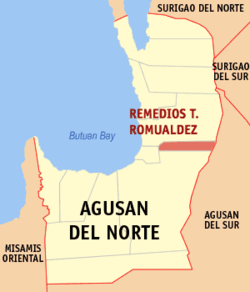 Map of Agusan del Norte with Remedios T. Romualdez highlighted | |
OpenStreetMap  | |
 Remedios T. Romualdez Location within the Philippines | |
| Coordinates: 9°03′N 125°35′E / 9.05°N 125.59°E | |
| Country | Philippines |
| Region | Caraga |
| Province | Agusan del Norte |
| District | 2nd district |
| Founded | September 08, 1982 |
| Named for | Remedios Trinidad Romualdez, Imelda Marcos' mother |
| Barangays | 8 (see Barangays) |
| Government | |
| • Type | Sangguniang Bayan |
| • Mayor | Richard P. Daquipil |
| • Vice Mayor | Eleuterio D. Enriquez |
| • Representative | Ma. Angelica Amante-Matba |
| • Municipal Council | Members |
| • Electorate | 13,580 voters (2022) |
| Area | |
| • Total | 79.15 km2 (30.56 sq mi) |
| Elevation | 26 m (85 ft) |
| Highest elevation | 2,013 m (6,604 ft) |
| Lowest elevation | 1 m (3 ft) |
| Population (2020 census)[3] | |
| • Total | 17,155 |
| • Density | 220/km2 (560/sq mi) |
| • Households | 4,035 |
| Economy | |
| • Income class | 5th municipal income class |
| • Poverty incidence | 27.74 |
| • Revenue | ₱ 88.26 million (2020) |
| • Assets | ₱ 247 million (2020) |
| • Expenditure | ₱ 69.91 million (2020) |
| • Liabilities | ₱ 50.66 million (2020) |
| Service provider | |
| • Electricity | Agusan del Norte Electric Cooperative (ANECO) |
| Time zone | UTC+8 (PST) |
| ZIP code | 8611 |
| PSGC | |
| IDD : area code | +63 (0)85 |
| Native languages | Agusan Butuanon Cebuano Higaonon Tagalog |
| Website | www |
Remedios T. Romualdez, officially the Municipality of Remedios T. Romualdez (Cebuano: Lungsod sa Remedios T. Romualdez; Tagalog: Bayan ng Remedios T. Romualdez), is a 5th class municipality in the province of Agusan del Norte, Philippines. According to the 2020 census, it has a population of 17,155 people.[3]
The town is one of the leading rice producers of Agusan del Norte province.
YouTube Encyclopedic
-
1/2Views:2 295525
-
Entry #6 Remedios T. Romualdez (Agay National High School)
-
Travel | Flyby R.T.Romualdez, Agusan del Norte
Transcription
Etymology
Remedios T. Romualdez was named after Remedios Trinidad Romualdez, the mother of former First Lady Imelda Marcos, the wife of former Philippine President Ferdinand Marcos.
History
Remedios T. Romualdez was created into a municipality on September 8, 1982, when the barangays of Agay, Basilisa, Humilog, Tagbongabong, San Antonio, and Panaytayon, all of the then-municipality of Cabadbaran, were constituted into the newly created town, through Batas Pambansa Blg. 236.[5]
The seat of the Municipal Government Center was designated in Barangay Agay, now Barangay Poblacion 1.
Remedios T. Romualdez is the youngest town in the Province of Agusan del Norte.
Geography
According to the Philippine Statistics Authority, the municipality has a land area of 79.15 square kilometres (30.56 sq mi) [6] constituting 2.90% of the 2,730.24-square-kilometre- (1,054.15 sq mi) total area of Agusan del Norte.
It is situated along the Maharlika Highway. It is bounded by Cabadbaran to the north, Municipality of Sibagat, Agusan del Sur to the east, Butuan to the south, and Magallanes, Agusan del Norte to the west.
Elevation
Remedios T. Romualdez is located at 9°03′N 125°35′E / 9.05°N 125.59°E. Elevation at these coordinates is estimated at 23.8 meters above sea level (M.a.s.l.).
Climate
| Climate data for Remedios T. Romualdez, Agusan del Norte | |||||||||||||
|---|---|---|---|---|---|---|---|---|---|---|---|---|---|
| Month | Jan | Feb | Mar | Apr | May | Jun | Jul | Aug | Sep | Oct | Nov | Dec | Year |
| Mean daily maximum °C (°F) | 27 (81) |
28 (82) |
28 (82) |
30 (86) |
30 (86) |
30 (86) |
30 (86) |
30 (86) |
30 (86) |
30 (86) |
29 (84) |
28 (82) |
29 (84) |
| Mean daily minimum °C (°F) | 23 (73) |
23 (73) |
23 (73) |
23 (73) |
24 (75) |
25 (77) |
24 (75) |
25 (77) |
25 (77) |
24 (75) |
24 (75) |
24 (75) |
24 (75) |
| Average precipitation mm (inches) | 277 (10.9) |
211 (8.3) |
155 (6.1) |
109 (4.3) |
166 (6.5) |
191 (7.5) |
154 (6.1) |
138 (5.4) |
127 (5.0) |
173 (6.8) |
241 (9.5) |
231 (9.1) |
2,173 (85.5) |
| Average rainy days | 22.7 | 19.1 | 20.0 | 19.9 | 25.9 | 27.6 | 27.6 | 26.1 | 25.1 | 26.8 | 24.3 | 23.1 | 288.2 |
| Source: Meteoblue[7] | |||||||||||||
Barangays
Remedios T. Romualdez is politically subdivided into 8 barangays.[8] Each barangay consists of puroks while some have sitios.
| PSGC | Barangay | Population | ±% p.a. | |||
|---|---|---|---|---|---|---|
| 2020[3] | 2010[9] | |||||
| 160212002 | Balangbalang | 14.5% | 2,482 | 2,362 | 0.50% | |
| 160212003 | Basilisa | 12.7% | 2,181 | 2,092 | 0.42% | |
| 160212004 | Humilog | 10.3% | 1,768 | 1,675 | 0.54% | |
| 160212005 | Panaytayon | 6.3% | 1,084 | 1,077 | 0.06% | |
| 160212001 | Poblacion I (Agay) | 15.2% | 2,611 | 2,581 | 0.12% | |
| 160212008 | Poblacion II | 10.3% | 1,764 | 2,027 | −1.38% | |
| 160212006 | San Antonio | 12.4% | 2,122 | 1,958 | 0.81% | |
| 160212007 | Tagbongabong | 11.9% | 2,046 | 1,963 | 0.41% | |
| Total | 17,155 | 15,735 | 0.87% | |||
Demographics
| Year | Pop. | ±% p.a. |
|---|---|---|
| 1990 | 10,490 | — |
| 1995 | 12,621 | +3.53% |
| 2000 | 13,359 | +1.23% |
| 2007 | 14,976 | +1.59% |
| 2010 | 15,735 | +1.82% |
| 2015 | 16,058 | +0.39% |
| 2020 | 17,155 | +1.31% |
| Source: Philippine Statistics Authority[10][9][11][12] | ||
In the 2020 census, Remedios T. Romualdez had a population of 17,155.[3] The population density was 220 inhabitants per square kilometre (570/sq mi).
Economy
Tourism
Nature and Man-made Attractions
- Tagnote Falls - located at Sitio Tagnote, Barangay San Antonio
- Sak-a Falls - located in Barangay San Antonio
- Mount Hilong-Hilong - accessible through Malvar Trail situated in Barangay San Antonio, the highest mountain peak in the entire Caraga Region. It is 2,012 meters above sea level (masl).
- Humilog Cave 1 - located in Barangay Humilog
References
- ^ Municipality of Remedios T. Romualdez | (DILG)
- ^ "2015 Census of Population, Report No. 3 – Population, Land Area, and Population Density" (PDF). Philippine Statistics Authority. Quezon City, Philippines. August 2016. ISSN 0117-1453. Archived (PDF) from the original on May 25, 2021. Retrieved July 16, 2021.
- ^ a b c d Census of Population (2020). "Caraga". Total Population by Province, City, Municipality and Barangay. Philippine Statistics Authority. Retrieved 8 July 2021.
- ^ "PSA Releases the 2018 Municipal and City Level Poverty Estimates". Philippine Statistics Authority. 15 December 2021. Retrieved 22 January 2022.
- ^ "Batas Pambansa Blg. 236 - An Act Creating the Municipality of Remedios T. Romualdez in the Province of Agusan Del Norte". Chan Robles Virtual Law Library. 12 September 1982. Archived from the original on 27 October 2013. Retrieved 17 October 2016.
- ^ "Province: Agusan del Norte". PSGC Interactive. Quezon City, Philippines: Philippine Statistics Authority. Retrieved 12 November 2016.
- ^ "Remedios T. Romualdez: Average Temperatures and Rainfall". Meteoblue. Retrieved 2 February 2020.
- ^ "Municipal: Remedios T. Romualdez". PSGC Interactive. Quezon City, Philippines: Philippine Statistics Authority. Retrieved 8 January 2016.
- ^ a b Census of Population and Housing (2010). "Caraga" (PDF). Total Population by Province, City, Municipality and Barangay. National Statistics Office. Retrieved 29 June 2016.
- ^ Census of Population (2015). "Caraga". Total Population by Province, City, Municipality and Barangay. Philippine Statistics Authority. Retrieved 20 June 2016.
- ^ Censuses of Population (1903–2007). "Caraga". Table 1. Population Enumerated in Various Censuses by Province/Highly Urbanized City: 1903 to 2007. National Statistics Office.
{{cite encyclopedia}}: CS1 maint: numeric names: authors list (link) - ^ "Province of Agusan del Norte". Municipality Population Data. Local Water Utilities Administration Research Division. Retrieved 17 December 2016.
- ^ "Poverty incidence (PI):". Philippine Statistics Authority. Retrieved December 28, 2020.
- ^ "Estimation of Local Poverty in the Philippines" (PDF). Philippine Statistics Authority. 29 November 2005.
- ^ "2003 City and Municipal Level Poverty Estimates" (PDF). Philippine Statistics Authority. 23 March 2009.
- ^ "City and Municipal Level Poverty Estimates; 2006 and 2009" (PDF). Philippine Statistics Authority. 3 August 2012.
- ^ "2012 Municipal and City Level Poverty Estimates" (PDF). Philippine Statistics Authority. 31 May 2016.
- ^ "Municipal and City Level Small Area Poverty Estimates; 2009, 2012 and 2015". Philippine Statistics Authority. 10 July 2019.
- ^ "PSA Releases the 2018 Municipal and City Level Poverty Estimates". Philippine Statistics Authority. 15 December 2021. Retrieved 22 January 2022.
External links
Places adjacent to Remedios T. Romualdez | ||||||||||||||||
|---|---|---|---|---|---|---|---|---|---|---|---|---|---|---|---|---|
| ||||||||||||||||
| Municipalities | |
|---|---|
| Component city | |
| Highly urbanized city |
|