
Ratlam district | |
|---|---|
 Sailana Palace | |
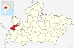 Location of Ratlam district in Madhya Pradesh | |
| Coordinates (Ratlam): 23°20′N 75°03′E / 23.33°N 75.05°E | |
| Country | |
| State | Madhya Pradesh |
| Division | Ujjain |
| Established | 26-1-1949 |
| Headquarters | Ratlam |
| Tehsils | 9 |
| Government | |
| • Lok Sabha constituencies | Ratlam |
| Area | |
| • Total | 4,861 km2 (1,877 sq mi) |
| Population (2011) | |
| • Total | 1,455,069 |
| • Density | 300/km2 (780/sq mi) |
| Demographics | |
| • Literacy | 68.03 per cent |
| • Sex ratio | 973 |
| Time zone | UTC+05:30 (IST) |
| Major highways | NH 79, NH 927A |
| Website | ratlam |
Ratlam District is a district of Madhya Pradesh state in central India. The town of Ratlam is administrative headquarters of the district.
YouTube Encyclopedic
-
1/5Views:3 656151 6865 690881 3302 277
-
रतलाम जिला के बारे में जानकारी | Ratlam District Information | History of Ratlam | Ratlam City
-
RATLAM (MADHYA PRADESH)!! RATLAM CITY!! RATLAM HISTORY!! RATLAM DISTRICT!! NEAR UJJAIN/DHAR
-
मध्यप्रदेश का सबसे अलग शहर रतलाम | Ratlam District Fact | History Of Ratlam | Tourist Places
-
Ratlam district। Ratlam information। Ratlam history। Ratlam tourism। Ratlam city facts।
-
MP GK Through Maps for MPPSC | Agar-malwa & Ratlam District | MP GK in Hindi for MPPSC 2020
Transcription
Geography
Ratlam District has an area of 4,861 square kilometres (1,877 sq mi). It is bounded by Mandsaur District to the north, Jhalawar District of Rajasthan state to the northwest, Ujjain District to the east, Dhar District to the south, Jhabua District to the southwest, and Pratapgarh District of Rajasthan to the west. It is divided into nine tehsils and is home to 9 at and 1,063 villages (as of 2001). The district is part of Ujjain Division.[1]
Tehsils
Information

Ratlam District was created after Indian independence in 1947, primarily out of the territories of the princely states of Ratlam State and Sailana State, the rulers of Ratlam and Sailana were descendants of Maharaja Ratan Singh Rathore. Other states included Jaora State which was created by the British in 1818 and Piploda State which was a tributary of Jaora but later became a small non-gunsalute state. Ratlam District was part of the new state of Madhya Bharat. The major stop for tourism in Ratlam district is the town of Sailana which is known for its cactus garden, Palace, Kharmor Bird Sanctuary and the cave temples of Kedareshwar. Ratlam city is known for Garadu (fried Yam), Sev and Gold. Ratlam also has a DRM office of Railway.[1]
Demographics
| Year | Pop. | ±% p.a. |
|---|---|---|
| 1901 | 238,624 | — |
| 1911 | 244,513 | +0.24% |
| 1921 | 245,021 | +0.02% |
| 1931 | 290,437 | +1.71% |
| 1941 | 335,147 | +1.44% |
| 1951 | 381,719 | +1.31% |
| 1961 | 483,521 | +2.39% |
| 1971 | 626,534 | +2.62% |
| 1981 | 782,729 | +2.25% |
| 1991 | 971,888 | +2.19% |
| 2001 | 1,215,393 | +2.26% |
| 2011 | 1,455,069 | +1.82% |
| source:[3] | ||
According to the 2011 census Ratlam District has a population of 1,455,069 [5] roughly equal to the nation of Eswatini[6] or the US state of Hawaii.[7] This gives it a ranking of 342nd in India (out of a total of 640).[5] The district has a population density of 299 inhabitants per square kilometre (770/sq mi) .[5] Its population growth rate over the decade of 2001-2011 was 19.67%.[5] Ratlam has a sex ratio of 973 females for every 1,000 males,[5] and a literacy rate of 68.03%. 29.90% of the population lives in urban areas. Scheduled Castes and Tribes made up 13.65% and 28.16% of the population respectively.[5]
At the time of the 2011 Census of India, 42.33% of the population in the district spoke Malvi, 41.38% Hindi, 13.59% Bhili and 1.27% Urdu as their first language.[8]
Tourist places
- Dholawad Dam
- Bibrod Tirth
- Cactus Garden Sailan
- Kharmour Bird Sanctuary
- Bilapakeshwara Temple
- Kalikamata Temple
- Kedareshwar Temple
References
- ^ a b "Ratlam". Ratlam district administration. Retrieved 12 August 2010.
- ^ https://ratlam.nic.in/en/tehsil/
- ^ "Table A-02 Decadal Variation in Population Since 1901: Madhya Pradesh" (PDF). census.gov.in. Registrar General and Census Commissioner of India.
- ^ "Table C-01 Population By Religion: Madhya Pradesh". census.gov.in. Registrar General and Census Commissioner of India.
- ^ a b c d e f "District Census Handbook: Ratlam" (PDF). Census of India. Registrar General and Census Commissioner of India. 2011.
- ^ US Directorate of Intelligence. "Country Comparison:Population". Archived from the original on 13 June 2007. Retrieved 1 October 2011.
Swaziland 1,370,424
- ^ "2010 Resident Population Data". U. S. Census Bureau. Retrieved 30 September 2011.
Hawaii 1,360,301
- ^ a b "Table C-16 Population by Mother Tongue: Madhya Pradesh". censusindia.gov.in. Registrar General and Census Commissioner of India.
External links
Places adjacent to Ratlam district | |
|---|---|
| International | |
|---|---|
| National | |
This article related to a location in Madhya Pradesh is a stub. You can help Wikipedia by expanding it. |