
Rathmannsdorf | |
|---|---|
 Coat of arms | |
Location of Rathmannsdorf within Sächsische Schweiz-Osterzgebirge district 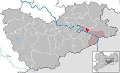 | |
 Rathmannsdorf  Rathmannsdorf | |
| Coordinates: 50°56′N 14°08′E / 50.933°N 14.133°E | |
| Country | Germany |
| State | Saxony |
| District | Sächsische Schweiz-Osterzgebirge |
| Municipal assoc. | Bad Schandau |
| Subdivisions | 5 |
| Government | |
| • Mayor (2022–29) | Uwe Thiele[1] (CDU) |
| Area | |
| • Total | 4.37 km2 (1.69 sq mi) |
| Elevation | 225 m (738 ft) |
| Population (2022-12-31)[2] | |
| • Total | 920 |
| • Density | 210/km2 (550/sq mi) |
| Time zone | UTC+01:00 (CET) |
| • Summer (DST) | UTC+02:00 (CEST) |
| Postal codes | 01814 |
| Dialling codes | 035022 |
| Vehicle registration | PIR |
| Website | www.rathmannsdorf.de |
Rathmannsdorf is a township in the Saxon district of Sächsische Schweiz-Osterzgebirge. Rathmannsdorf is 2 km (1 mi) down the Elbe from Bad Schandau.
YouTube Encyclopedic
-
1/1Views:18 910
-
Pirna-Neustadt(Sachs)-Sebnitz-Bad Schandau : Führerstandsmitfahrt
Transcription
Geography
The township's highest point is a plateau near Bad Schandau 200 meters above sea level, with the lowest point 120 meters above sea level along the Elbe. The township consists of the districts Wendischfähre, Höhe, Zauke, Plan and Gluto.[3]
History
Rathmannsdorf was first mentioned in a document in 1443. Rathmannsdorf along with Bad Schandau, Porschdorf, and Reinhardtsdorf-Schöna form a Verwaltungsgemeinschaft. The town is also a stop on the Sebnitztalbahn part of the Sächsische Semmering-Bahn, a local railroad.
References
- ^ Gewählte Bürgermeisterinnen und Bürgermeister im Freistaat Sachsen, Stand: 17. Juli 2022, Statistisches Landesamt des Freistaates Sachsen.
- ^ "Einwohnerzahlen nach Gemeinden als Excel-Arbeitsmappe" (XLS) (in German). Statistisches Landesamt des Freistaates Sachsen. 2024.
- ^ "Community information". Gemeinde Rathmannsdorf in the center of the Elbsandsteingebirge. Gemeinde Rathmannsdorf. Retrieved 2 February 2019.

| International | |
|---|---|
| National | |
This Sächsische Schweiz-Osterzgebirge location article is a stub. You can help Wikipedia by expanding it. |