
Rachaya Al Foukhar
راشيا الفخار | |
|---|---|
City | |
![Rachaya Al Foukhar, in the 1880s:[1]](/wikipedia/commons/thumb/a/a2/Rachaya_al-Foukhara.jpg/250px-Rachaya_al-Foukhara.jpg) Rachaya Al Foukhar, in the 1880s:[1] | |
 Rachaya Al Foukhar Location within Lebanon | |
| Coordinates: 33°21′12″N 35°40′02″E / 33.35333°N 35.66722°E | |
| Grid position | 148/157 L |
| Country | |
| Governorate | Nabatieh Governorate |
| District | Hasbaya District |
| Time zone | UTC+2 (EET) |
| • Summer (DST) | UTC+3 (EEST) |
| Dialing code | +961 |
Rachaya Al Foukhar (also spelled Rashaya Al Foukhar, Arabic: راشيا الفخار) is a Lebanese village in the district of Hasbaya in the Nabatiye Governorate in southern Lebanon. It is located on the western slopes of Mount Hermon at an altitude starting at 750 m with the highest summit being at 1,250 m. The population is Greek Orthodox.
YouTube Encyclopedic
-
1/3Views:12 8611 507942
-
Rashaya Village, Rachaya Beqaa Lebanon. البقاع بلـدة راشـيا
-
Mechwar - Rachaya Al Wadi 01/09/2013
-
Rachaya to Cheeba
Transcription
History
In 1838, during the Ottoman era, Eli Smith noted the population of Rachaya Al Foukhar as being "Greek" Christians.[2]
In 1852 Edward Robinson noted: "The village is celebrated for its pottery; for the manufacture of which it is one of the chief seats. There are many large dome-shaped furnaces for burning of ware; and many specimens were standing outside of the houses [..], tall jars, and the like. This pottery is sent around to all the fairs of the country, and far into the Hauran; as also to Hums and Hamah."[3]
In 1875, Victor Guérin found here a town with 700 inhabitants, mostly "Schismatic Greek". He also noted the pottery production, and that there was a small Protestant mission in the place.[4]
In 1990, U.S missionary William Robinson was killed here by masked gunmen.[5]
References
- ^ Wilson, ca 1881, vol 2, p 125: "This place, as the name implies, is famous for its potters´s clay. Its furnaces are dome-shaped and capable of burning enormous jars. The potter; mounted on a high seat, sets the wheel in motion with his foot and shapes the clay with his hand. The man beyond is adding handles to the jars."
- ^ Robinson and Smith, 1841, vol 3, 2nd appendix, p. 138
- ^ Robinson and Smith, 1856, pp. 415-416
- ^ Guérin, 1880, pp. 284-5
- ^ U.S. Missionary Shot to Death At Home in South Lebanon, Ihsan A. Hijazi, March 29, 1990, The New York Times
Bibliography
- Guérin, V. (1880). Description Géographique Historique et Archéologique de la Palestine (in French). Vol. 3: Galilee, pt. 2. Paris: L'Imprimerie Nationale.
- Robinson, E.; Smith, E. (1841). Biblical Researches in Palestine, Mount Sinai and Arabia Petraea: A Journal of Travels in the year 1838. Vol. 3. Boston: Crocker & Brewster.
- Robinson, E.; Smith, E. (1856). Later Biblical Researches in Palestine and adjacent regions: A Journal of Travels in the year 1852. London: John Murray.
- Wilson, C.W., ed. (c. 1881). Picturesque Palestine, Sinai and Egypt. Vol. 2. New York: D. Appleton.
External links
- Rachaiya El Foukhar, Localiban
Capital: Hasbaya | ||
| Towns and villages | 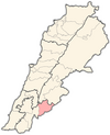 | |
| Other | ||