
| Tuira River | |
|---|---|
 | |
 Location of mouth | |
| Native name | Rio Tuira (Spanish) |
| Location | |
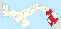
| Country | Panama |
| Province | Darién Province |
| Physical characteristics | |
| Mouth | |
• coordinates | 8°19′10″N 78°18′31″W / 8.3194°N 78.3086°W |
• elevation | 0 m (0 ft) |
| Length | 230 km (140 mi) |
| Basin size | 10,664.42 km2 (4,117.56 sq mi) |
| Discharge | |
| • average | 363.8 m³/s |

The Tuira River is located in the Darién Province of eastern Panama. It flows into the Bay of San Miguel at the province capital of La Palma.[1][2]
It is the largest river in Panama, and one of its tributaries, the Chucunaque River, is the longest river in Panama.
The river starts in highlands of Darien, and runs south/southeast, and then north and west. It runs past villages as it flows downstream including Matuganti, Sobiaquirú, El Balsal, Boca de Cupe, Capetí, Yape, Aruza, Unión Chocó, Vista Alegre, and Pinogana.[3] It meets the Chucunaque River at El Real de Santa María and then flows northwest towards La Palma.[4] Via the Chucunaque, one can reach Yaviza, which is the terminus of the northern end of the Pan-American Highway.
The Paya River joins the river downstream of Sobiaquirú, via which the village of Paya can be reached. The Púcuro River joins downstream of the Paya, via which the village of Púcuro can be reached.[5]
YouTube Encyclopedic
-
1/3Views:9751 083342
-
Panama (DJI) - Boca de Cupe, Tuira River, Rancho Frío, Chucunaque River, Darién, Drone DJI Mini 2
-
Leaving El Real towards Yaviza via Tuira River - Darien, Panama
-
Boca de Cupe, El Real, Rancho Frío, Darien National Park, Tuira River, Darien Province, Panama
Transcription
References
- ^ "Estategia de desarrollo sostenible de Darién" (PDF) (in Spanish). Ministerio de Presidencia-CONADES. 2009. pp. 52–53.
- ^ "Rio Tuira". GeoNames. National Geospatial Intelligence Agency. Retrieved July 28, 2021.
- ^ (30 April 2008). Panama: Weary repatriation, Relief Web
- ^ Tuira River, Britannica.com, Retrieved 30 November 2022
- ^ The Geology of the Darien, Panama, and the late Miocene-Pliocene collision of the Panama arc with northwestern South America, GSA Bulletin (2004) 116 (11-12): 1327–1344
| International | |
|---|---|
| National | |