
| Grande River | |
|---|---|
 Río Grande at Puerto Pailas | |
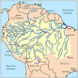 Map of the Amazon Basin showing Río Grande (highlighted) | |
| Native name | Río Grande (Spanish) |
| Location | |
| Country | Bolivia |
| Physical characteristics | |
| Source | Sierra de Cochabamba |
| • elevation | 3,693 m (12,116 ft) |
| Mouth | Mamoré River |
• elevation | 174 m (571 ft) |
| Length | 820 km (510 mi)[1] |
The Río Grande (or Río Guapay) in Bolivia rises on the southern slope of the Cochabamba mountains, east of the city Cochabamba, at 17°26′11″S 65°52′22″W / 17.43639°S 65.87278°W. At its source, it is known as the Rocha River. It crosses the Cochabamba valley basin in a westerly direction, turning south east after 65 kilometres (40 mi) and after another 50 km (31 mi) joining the Arque River at 17°42′10″S 66°14′45″W / 17.70278°S 66.24583°W and an elevation of 2,350 m (7,710 ft).
From this junction the river receives the name Caine River for 162 km (101 mi) and continues to flow in a south easterly direction, before it is called Río Grande. After a total of 500 km (310 mi) the river turns north east and in a wide curve flows round the lowland city of Santa Cruz.
After 1,438 km (894 mi), the Río Grande joins the Ichilo River at 15°48′09″S 64°43′47″W / 15.80250°S 64.72972°W which is a tributary to the Mamoré.
YouTube Encyclopedic
-
1/3Views:14 660549 1872 428 723
-
🔴La Republica del Rio Grande 1840 - El intento de Separación de 3 Estados de México
-
Los 10 Ríos más largos del mundo
-
Porqué El Río Del Amazonas No Tiene Ningún Puente
Transcription
References
- ^ Ziesler, R.; Ardizzone, G.D. (1979). "Amazon River System". The Inland waters of Latin America. Food and Agriculture Organization of the United Nations. ISBN 92-5-000780-9. Archived from the original on 21 October 2013.
| Authority control databases: National |
|---|