Querévalo | |
|---|---|
Village and corregimiento | |
 Querévalo | |
| Coordinates: 8°22′N 82°31′W / 8.367°N 82.517°W | |
| Country | |
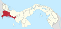
| Province | Chiriquí |
| District | Alanje |
| Area | |
| • Land | 34.5 km2 (13.3 sq mi) |
| Population (2010)[1] | |
| • Total | 1,751 |
| • Density | 50.8/km2 (132/sq mi) |
| Population density calculated based on land area. | |
| Time zone | UTC−5 (EST) |
Querévalo is a village and corregimiento in Alanje District, Chiriquí Province, Panama. It is located near Canas Blancas, on both banks of the Río Chico or Stone. It has a land area of 34.5 square kilometres (13.3 sq mi) and had a population of 1,751 as of 2010, giving it a population density of 50.8 inhabitants per square kilometre (132/sq mi).[1] Its population as of 1990 was 1,402; its population as of 2000 was 1,536.[1]
Within the township there are 2 elementary schools, one of which is located in the Querévalo header and one in River Edge, a Corregiduría, 2 Public Health Post, among other infrastructure. The water system is based on deep wells, which are administered by township residents through health committees.[citation needed]
The main economic activities are agriculture site and livestock, these being segmented according to the location of the territory (left or right margin of the Río Chico).[citation needed]
References
- ^ a b c d "Cuadro 11 (Superficie, población y densidad de población en la República...)" [Table 11 (Area, population, and population density in the Republic...)] {{webarchive |url=https://web.archive.org/web/20160304030354/http://www.contraloria.gob.pa/inec/archivos/P3601Cuadro11.xls |date=March 4, 2016 }} (.xls). In "Resultados Finales Básicos" [Basic Final Results] (in Spanish). National Institute of Statistics and Census of Panama. Archived from the original on July 10, 2015. Retrieved May 26, 2015.