
Queensborough
Koonspa | |
|---|---|
Neighbourhood of New Westminster | |
Queensborough in foreground | |
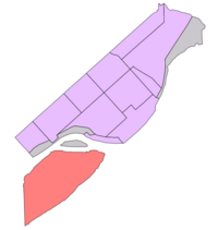 Location of Queensborough shown in red | |
 Queensborough Location of Queensborough within Metro Vancouver | |
| Coordinates: 49°11′00″N 122°56′00″W / 49.18333°N 122.93333°W | |
| Country | Canada |
| Province | British Columbia |
| Region | Lower Mainland |
| Regional District | Metro Vancouver |
| City | New Westminster |
| Incorporated | 1911 |
| Government | |
| • Mayor | Patrick Johnstone |
| • MP (Fed.) | Peter Julian (NDP) |
| • MLA (Prov.) | Aman Singh (BC NDP) |
| Population (2021) | |
| • Total | 10,983[1] |
| Time zone | UTC−8 (PST) |
| • Summer (DST) | UTC−7 (PDT) |

Queensborough is a neighbourhood in the city of New Westminster, British Columbia, Canada. It is on the eastern tip of Lulu Island on the Fraser River.[2]
At the north end of Queensborough is a new development called Port Royal. To the south is Thompson's Landing, to the west is the industrial area of Tree Island, and to the east is the Fraser River. Access to Annacis Island, an industrial park area and site of one of the GVRD's sewage plants, is via a bridge towards the east end of Queensborough, though the island itself is not part of the City of New Westminster.
YouTube Encyclopedic
-
1/3Views:1 8112 8011 607
-
Queensborough New Westminster BC Canada - Lulu Island - Driving Around Developing Community/Area
-
What's it like in New Westminster | Driving through New Westminster
-
Mexican folk music @ Queensborough Children's Festival, New Westminster, Canada
Transcription
History
Queensborough was the name originally chosen for the colonial capital by Royal Engineers Commander Colonel Richard Clement Moody. Queen Victoria designated New Westminster instead of Queensborough as her new capital's name. In the 1860s, a survey of Lulu Island by the Royal Engineers resulted in the eastern tip of the island being designated a military reserve for the defense of New Westminster. This portion of land was not incorporated into the new Township of Richmond in 1879. Instead the rapidly growing City of New Westminster annexed the area in 1889. The City received title to the entire Military Reserve from the Provincial Government and it decided to subdivide the area for sale in 1890. A bridge was constructed to reach the area from the Mainland and the lands sold at auction.
The name Queensborough for this neighbourhood of the City was formally established in 1911 when the Queensborough Post Office was opened by early community leader and Italian immigrant Anthony Sprice.[3] In the Chinook Jargon, it is said that an adaption of the name Queensborough – "Koonspa" – is the usual name for New Westminster as a whole.[4]
With its many lumber mills and canneries the area became a focus of new immigrants looking for employment and cheap lots to establish family homes. These early groups built their own cultural halls, churches and had many different mutual aid societies. However, the entire community united at time under the Queensborough Ratepayers Association founded in 1911. This group continues to operate and is often cited as the oldest ratepayers association in British Columbia. Early immigrants came from Asia and Europe; including the Japanese, Chinese, Indians, Italians, Greeks, Slovaks, Ukrainians, and Finns. The community grew slowly but developed a unique sense of place because of its unique cultural composition.

Queensborough is today a growing suburban district with a rapidly redeveloped waterfront area known as Port Royal. Queensborough is connected to the rest of New Westminster by the Queensborough Bridge and Annacis Island in Delta by the Derwent Way Bridge. Furthermore, the city of New Westminster has also implemented a ferry service that takes city inhabitants and tourists from Port Royal in Queensborough to the Westminster Quay.[5] It is served by Highway 91A. Many new homes in the area are built to resemble old heritage-style homes.
In the heart of Queensborough is Ryall Park. This is also where Queensborough Community Centre is located. The park has several features which include playgrounds, a spray park and Boro All Wheel Park (a skatepark and a bike park). Renovations are currently under way converting Ryall's bike park section of Boro All Wheel Park into an off-leash park for dogs. This park will be split and will have designated areas for small dogs, and all other dogs. Queensborough Middle School and Queen Elizabeth Elementary School are also located in the same park-block.
In 2004 a shopping centre called Queensborough Landing was built.
Demographics

| Year | Pop. | ±% |
|---|---|---|
| 2001 | 4,553 | — |
| 2006 | 5,502 | +20.8% |
| 2011 | 7,125 | +29.5% |
| 2016 | 8,727 | +22.5% |
| 2021 | 10,983 | +25.9% |
| Source: Statistics Canada | ||
A legacy of early 20th century settlement, the neighbourhood has a large South Asian population. In recent decades the European and East Asian population have grown with the area witnessing increasing residential development and infill. In the 1960s, there were many new European immigrants; Italians, Portuguese, Polish, Romanian and Russian. In the 1970s, Asian immigration increased; a new wave of Indian immigrants settled in the area, along with Chinese and Filipino newcomers.[citation needed]
| Panethnic group | 2021[6][1] | 2016[7] | 2011[8] | 2006[9] | 2001[10][11] | |||||
|---|---|---|---|---|---|---|---|---|---|---|
| Pop. | % | Pop. | % | Pop. | % | Pop. | % | Pop. | % | |
| South Asian | 2,990 | 27.36% | 2,370 | 27.26% | 2,600 | 36.65% | 2,080 | 37.96% | 1,940 | 42.68% |
| European[a] | 2,460 | 22.51% | 2,570 | 29.56% | 2,235 | 31.5% | 1,855 | 33.85% | 1,645 | 36.19% |
| East Asian[b] | 2,080 | 19.03% | 1,620 | 18.63% | 865 | 12.19% | 595 | 10.86% | 305 | 6.71% |
| Southeast Asian[c] | 2,010 | 18.39% | 1,470 | 16.91% | 915 | 12.9% | 455 | 8.3% | 175 | 3.85% |
| Latin American | 315 | 2.88% | 120 | 1.38% | 170 | 2.4% | 100 | 1.82% | 15 | 0.33% |
| Middle Eastern[d] | 310 | 2.84% | 75 | 0.86% | 110 | 1.55% | 55 | 1% | 155 | 3.41% |
| African | 200 | 1.83% | 155 | 1.78% | 65 | 0.92% | 110 | 2.01% | 165 | 3.63% |
| Indigenous | 160 | 1.46% | 160 | 1.84% | 40 | 0.56% | 185 | 3.38% | 65 | 1.43% |
| Other/multiracial[e] | 410 | 3.75% | 160 | 1.84% | 85 | 1.2% | 40 | 0.73% | 75 | 1.65% |
| Total responses | 10,930 | 99.52% | 8,695 | 99.63% | 7,095 | 99.58% | 5,480 | 99.6% | 4,545 | 99.82% |
| Total population | 10,983 | 100% | 8,727 | 100% | 7,125 | 100% | 5,502 | 100% | 4,553 | 100% |
Education
One elementary school, Queen Elizabeth Elementary School, and one middle school, Queensborough Middle School, are located in the neighbourhood.
A Library and community centre were also recently opened. The community centre has a newly renovated exercise area and a gymnasium where local residents partake in physical games.
See also
Notes
- ^ Statistic includes all persons that did not make up part of a visible minority or an indigenous identity.
- ^ Statistic includes total responses of "Chinese", "Korean", and "Japanese" under visible minority section on census.
- ^ Statistic includes total responses of "Filipino" and "Southeast Asian" under visible minority section on census.
- ^ Statistic includes total responses of "West Asian" and "Arab" under visible minority section on census.
- ^ Statistic includes total responses of "Visible minority, n.i.e." and "Multiple visible minorities" under visible minority section on census.
References
- ^ a b Government of Canada, Statistics Canada (26 October 2022). "Census Profile, 2021 Census of Population Profile table 9330200.02 British Columbia [Census tract]". www12.statcan.gc.ca. Retrieved 13 April 2024.
- ^ "Queensborough (community)". BC Geographical Names.
- ^ "New Westminster Archives Results Page".
- ^ A Voice Great Within Us, Charles Lillard and Terry Glavin, Transmontanus Books
- ^ "Quayside to Queensborough Ferry Back & Running All Summer Long!". Tourism New West. 1 August 2018. Retrieved 14 April 2020.
- ^ Government of Canada, Statistics Canada (26 October 2022). "Census Profile, 2021 Census of Population Profile table 9330200.01 British Columbia [Census tract]". www12.statcan.gc.ca. Retrieved 13 April 2024.
- ^ Government of Canada, Statistics Canada (27 October 2021). "Census Profile, 2016 Census 9330200.00 [Census tract], British Columbia and Vancouver [Census metropolitan area], British Columbia". www12.statcan.gc.ca. Retrieved 13 April 2024.
- ^ Government of Canada, Statistics Canada (27 November 2015). "NHS Profile, 9330200.00, British Columbia, 2011". www12.statcan.gc.ca. Retrieved 13 April 2024.
- ^ Government of Canada, Statistics Canada (23 July 2020). "Census tract profile for 0200.00 (CT), Vancouver (CMA) and British Columbia". www12.statcan.gc.ca. Retrieved 13 April 2024.
- ^ Government of Canada, Statistics Canada (23 December 2013). "2001 Census Area Profiles Profile of Citizenship, Immigration, Birthplace, Generation Status, Ethnic Origin, Visible Minorities and Aboriginal Peoples, for Census Metropolitan Areas, Tracted Census Agglomerations and Census Tracts, 2001 Census". www12.statcan.gc.ca. Retrieved 13 April 2024.
- ^ Government of Canada, Statistics Canada (23 December 2013). "Population and Dwelling Counts for Census Metropolitan Areas, Census Agglomerations and Census Tracts, 2001 and 1996 Censuses - 100% Data". www12.statcan.gc.ca. Retrieved 13 April 2024.
Neighbourhoods in New Westminster, British Columbia | |
|---|---|
| Main neighbourhoods |
|
| Other areas |
|