
Qoʻshrabot | |
|---|---|
urban-type settlement | |
 Qoʻshrabot Location in Uzbekistan | |
| Coordinates: 40°14′50″N 66°39′02″E / 40.24722°N 66.65056°E | |
| Country | |
| Region | Samarqand Region |
| District | Qoʻshrabot District |
| Population (2016) | |
| • Total | 8,500 |
| Time zone | UTC+5 (UZT) |
Qoʻshrabot (Uzbek: Qoʻshrabot, Russian: Кошрабад, romanized: Koshrabad) is an urban-type settlement in Samarqand Region, Uzbekistan. It is the capital of Qoʻshrabot District.[1] Its population was 1,999 people in 1989,[2] and 8,500 in 2016.[3]
Climate
Qoʻshrabot has a continental climate with Mediterranean influences (Köppen: Csa/Dsa) with cold winters and very hot, dry summers.[4]
| Climate data for Qoʻshrabot (1991–2020) | |||||||||||||
|---|---|---|---|---|---|---|---|---|---|---|---|---|---|
| Month | Jan | Feb | Mar | Apr | May | Jun | Jul | Aug | Sep | Oct | Nov | Dec | Year |
| Mean daily maximum °C (°F) | 5.7 (42.3) |
7.7 (45.9) |
14.2 (57.6) |
20.7 (69.3) |
26.6 (79.9) |
32.5 (90.5) |
35.0 (95.0) |
34.0 (93.2) |
29.0 (84.2) |
21.7 (71.1) |
13.6 (56.5) |
7.9 (46.2) |
20.7 (69.3) |
| Daily mean °C (°F) | 0.1 (32.2) |
2.0 (35.6) |
7.7 (45.9) |
13.8 (56.8) |
19.3 (66.7) |
24.8 (76.6) |
27.4 (81.3) |
26.0 (78.8) |
20.0 (68.0) |
12.7 (54.9) |
6.2 (43.2) |
1.8 (35.2) |
13.5 (56.3) |
| Mean daily minimum °C (°F) | −4.0 (24.8) |
−2.2 (28.0) |
2.6 (36.7) |
7.5 (45.5) |
11.6 (52.9) |
15.9 (60.6) |
18.5 (65.3) |
17.0 (62.6) |
11.0 (51.8) |
4.9 (40.8) |
0.7 (33.3) |
−2.4 (27.7) |
6.8 (44.2) |
| Average precipitation mm (inches) | 55.6 (2.19) |
69.2 (2.72) |
71.3 (2.81) |
57.6 (2.27) |
34.8 (1.37) |
9.5 (0.37) |
2.9 (0.11) |
2.2 (0.09) |
2.7 (0.11) |
11.9 (0.47) |
40.8 (1.61) |
47.0 (1.85) |
405.5 (15.96) |
| Average precipitation days (≥ 1.0 mm) | 11 | 11 | 11 | 10 | 7 | 3 | 1 | 1 | 1 | 4 | 8 | 10 | 78 |
| Source: NOAA[5] | |||||||||||||
References
- ^ "Classification system of territorial units of the Republic of Uzbekistan" (in Uzbek and Russian). The State Committee of the Republic of Uzbekistan on statistics. July 2020.
- ^ Всесоюзная перепись населения 1989 г. Численность сельского населения союзных республик - жителей сельских населенных пунктов - районных центров по полу Archived 2016-04-04 at the Wayback Machine(in Russian)
- ^ Soliyev, A.S. Shaharlar geografiyasi [Geography of cities] (PDF) (in Uzbek). p. 161.
- ^ "Table 1 Overview of the Köppen-Geiger climate classes including the defining criteria". Nature: Scientific Data. 23 October 2023.
- ^ "World Meteorological Organization Climate Normals for 1991-2020 — Qoʻshrabot". National Oceanic and Atmospheric Administration. Retrieved January 20, 2024.
Capital: Samarkand | ||
| Districts | 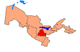 | |
| Cities | ||
| Towns | ||
This Uzbekistan location article is a stub. You can help Wikipedia by expanding it. |