
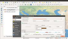
 QGIS 2.2 showing the redesigned menus. | |
| Developer(s) | QGIS Development Team |
|---|---|
| Initial release | July 2002 |
| Stable release | 3.34.3[1] |
| Repository | |
| Written in | C++, Python, Qt |
| Platform | Windows, Linux, Mac OS X, Android(beta) |
| Available in | Multilingual |
| Type | Geographic information system |
| License | GNU GPLv2 |
| Website | qgis |
QGIS is a geographic information system (GIS) software that is free and open-source.[2] QGIS supports Windows, macOS, and Linux.[3] It supports viewing, editing, printing, and analysis of geospatial data in a range of data formats. QGIS was previously also known as Quantum GIS.
YouTube Encyclopedic
-
1/5Views:1 036 82510 9721 48954 62430 973
-
An Absolute Beginner's Guide to QGIS 3
-
Introduction to QGIS
-
Take your GIS training into the field with Mergin Maps and QGIS
-
QGIS 3.22 Beginner’s Guide - Complete Tutorial - How to Make a MAP from ZERO
-
Exploring the QChatGPT plugin in QGIS
Transcription
Functionality
QGIS functions as geographic information system (GIS) software, allowing users to analyze and edit spatial information, in addition to composing and exporting graphical maps.[2] QGIS supports raster, vector, mesh, and point cloud layers.[4] Vector data is stored as either point, line, or polygon features. Multiple formats of raster images are supported, and the software can georeference images.
QGIS supports shapefiles, personal geodatabases, dxf, MapInfo, PostGIS, and other industry-standard formats.[5] Web services, including Web Map Service and Web Feature Service, are also supported to allow use of data from external sources.[6]
QGIS integrates with other open-source GIS packages, including PostGIS, GRASS GIS, SAGA GIS, and MapServer.[6] Plugins written in Python or C++ extend QGIS's capabilities. Plugins can geocode using the Google Geocoding API, perform geoprocessing functions similar to those of the standard tools found in ArcGIS, and interface with PostgreSQL/PostGIS, SpatiaLite and MySQL databases.
QGIS is built on top of, and standard installs include, broadly-used open-source GIS format and projection conversion libraries GDAL and proj.
Development
Gary Sherman began development of Quantum GIS in early 2002, and it became an incubator project of the Open Source Geospatial Foundation in 2007.[7] Version 1.0 was released in January 2009.[8]
In 2013, along with release of version 2.0 the name was officially changed from Quantum GIS to QGIS to avoid confusion as both names had been used in parallel.[9])
Written mainly in C++, QGIS makes extensive use of the Qt library.[6] In addition to Qt, required dependencies of QGIS include GEOS and SQLite. GDAL, GRASS GIS, PostGIS, and PostgreSQL are also recommended, as they provide access to additional data formats.[10]

As of 2017[update], QGIS is available for multiple operating systems including Mac OS X, Linux, Unix, and Microsoft Windows.[11] There are several third-party apps that allow use of QGIS on mobile devices such as QField (Android, iOS and Windows), Mergin Maps (Android, iOS and Windows) and IntraMaps Roam (Windows).[11]
QGIS can also be used as a graphical user interface to GRASS. QGIS has a small install footprint on the host file system compared to commercial GISs and generally requires less RAM and processing power; hence it can be used on older hardware or running simultaneously with other applications where CPU power may be limited.[citation needed]
QGIS is maintained by volunteer developers who regularly release updates and bug fixes. As of 2012[update], developers have translated QGIS into 48 languages and the application is used internationally in academic and professional environments. Several companies offer support and feature development services.[12]
Function
QGIS enables users to visualize their data using maps, charts, and diagrams while customizing the presentation with a variety of symbology choices. The capabilities for geographical analysis provided by QGIS, including as buffer construction, spatial querying, and geoprocessing. For more complex geographical analysis, users can additionally make use of plugins and algorithms. QGIS also makes it simple to share and publish geospatial data as maps, online services, or print maps in a variety of file formats, such as shapefiles, GeoTIFFs, and KML files.

In order to prepare printed map with QGIS, Print Layout is used. It can be used for adding multiple map views, labels, legends, etc.
Licensing
As a free software application under GNU GPLv2, QGIS can be freely modified to perform different or more specialized tasks. Two examples are the QGIS Browser and QGIS Server applications, which use the same code for data access and rendering, but present different front-end interfaces.[13]
Adoption
Many public and private organizations have adopted QGIS, including:
- US National Security Agency[14]
- National Geospatial-Intelligence Agency
- Austrian state of Vorarlberg
- The Economist[15]
- Swiss cantons of Glarus and Solothurn[16]
- New Zealand's Land Information public service department[17]
Release History
"LTR" indicates a Long Term Release. Detailed changelogs are available for releases 2.0 and later.[18]
| Version | Codename | Release Date | Notes |
|---|---|---|---|
| 0.0.1-alpha | 2002-07 | First public release. | |
| 1.0 | Kore | 2009-01-05 | |
| 2.0 | Dufour | 2013-09-08 | New vector API, integration of SEXTANTE geoprocessing, symbology and labeling overhaul. Dropped "Quantum" from the name. |
| 3.0 | Girona | 2018-02-23 | Significant rewrite, upgrading to Qt5, PyQt5, and Python 3. |
| 3.2 | Bonn | 2018-06-22 | |
| 3.4 LTR | Madeira | 2018-10-26 | |
| 3.6 | Noosa | 2019-02-22 | |
| 3.8 | Zanzibar | 2019-06-21 | |
| 3.10 LTR | A Coruña | 2019-10-25 | |
| 3.12 | Bucureşti | 2020-02-21 | |
| 3.14 | Pi | 2020-06-19 | New temporal controller. |
| 3.16 LTR | Hannover | 2020-10-23 | |
| 3.18 | Zürich | 2021-02-19 | |
| 3.20 | Odense | 2021-06-18 | |
| 3.22 LTR | Białowieża | 2021-10-22 | |
| 3.24 | Tisler | 2022-02-18 | |
| 3.26 | Buenos Aires | 2022-06-17 | Improved pointcloud and 3D support. New profile plotting framework. |
| 3.28 LTR | Firenze | 2022-10-21 | |
| 3.30 | 's-Hertogenbosch | 2023-03-03 | |
| 3.32 | Lima | 2023-06-23 | |
| 3.34 LTR | Prizren | 2023-10-27 | |
| 3.36 | Maidenhead | 2024-02-23 |
References
- ^ "Release 3.34.3". 19 January 2024. Retrieved 19 January 2024.
- ^ a b "QGIS Official Website". QGIS. Retrieved 16 October 2013.
- ^ "Download QGIS". www.qgis.org. Retrieved 2023-12-31.
- ^ "QGIS project README file". github.com/qgis. Retrieved 20 March 2024.
- ^ Gray, James (2008-03-26). "Getting Started With Quantum GIS". Linux Journal.
- ^ a b c Cavallini, Paolo (August 2007). "Free GIS desktop and analyses: QuantumGIS, the easy way". The Global Geospatial Magazine.
- ^ OSGeo (February 2008). "OSGeo Annual Report 2007".
- ^ Tim Sutton (January 23, 2009). "Announcing the release of QGIS 1.0 'Kore'". Retrieved 2009-01-26.
- ^ "Changelog for QGIS 2.0 - Quantum GIS is now known only as 'QGIS'". QGIS. Retrieved 1 January 2020.
- ^ "Project details for Quantum GIS - Quantum GIS 0.9.0". Freshmeat. Retrieved 2008-12-31.
- ^ a b "Download QGIS". QGIS.org. Retrieved March 31, 2017.
- ^ "Commercial support". www.qgis.org. Retrieved 2017-05-01.
- ^ "QGIS Server Guide/Manual — QGIS Documentation documentation". docs.qgis.org. Retrieved 2023-07-07.
- ^ "QGIS related repositories on GitHub - NSA". GitHub. Retrieved 31 March 2020.
- ^ "The Economist". view.e.economist.com. Archived from the original on 7 July 2023. Retrieved 2023-07-07.
- ^ "QuantumGIS (QGIS) – freie GIS-Software". Land Vorarlberg. Archived from the original on 16 October 2013. Retrieved 12 October 2013.
- ^ "QGIS related repositories on GitHub - LINZ". GitHub. Retrieved 31 March 2020.
- ^ "Visual Changelogs". www.qgis.org. Retrieved 2022-07-16.