
Pungoteague, Virginia | |
|---|---|
 Village General Store in Pungoteague, July 2018 | |
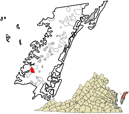 Location in Accomack County and the state of Virginia. | |
| Coordinates: 37°37′44″N 75°49′2″W / 37.62889°N 75.81722°W[1] | |
| Country | United States |
| State | Virginia |
| County | Accomack |
| Elevation | 26 ft (8 m) |
| Population (2010) | |
| • Total | 347 |
| Time zone | UTC−5 (Eastern (EST)) |
| • Summer (DST) | UTC−4 (EDT) |
| FIPS code | 51-48776 |
| GNIS feature ID | 2584905[1] |
Pungoteague is a census-designated place (CDP) in Accomack County, Virginia, United States. It was first listed as a CDP in 2010.[1] Per the 2020 census, the population was 346.[2]
The name itself is a derivative of the Native American term "Pungotekw," which means Sand Fly River and is the name used by the earliest inhabitants.[3]
In late summer of 1665, William Darby and two of his friends dared present a play at Cowle's Tavern. Entitled Ye Bear and Ye Cub, this drama is believed to have been the first theater performance of an English-language play in the American colonies.[3][4]
Another notable local landmark is Saint George's Church. It is believed that the first meetings of the Pungoteague Episcopal congregation were held in 1636, with the church's first building being constructed from 1666 to 1676. The original frame church was replaced in 1736 by a brick structure in the Flemish-bond pattern.[3] It was added to the National Register of Historic Places in 1970.[5] Shepherd's Plain was added in 1982.[5]
In the mid-19th century, Pungoteague was a point along the stagecoach route between Wilmington, Delaware and Eastville, Virginia.[6]
YouTube Encyclopedic
-
1/3Views:340768 074682
-
14461 Shore Drive, Melfa VA. 23410 Pungoteague Creek.mp4
-
The Cherokee language
-
How to Say or Pronounce USA Cities — Onancock, Virginia
Transcription
Geography

It lies at an elevation of 26 feet.[1]
Demographics
| Census | Pop. | Note | %± |
|---|---|---|---|
| 2010 | 347 | — | |
| 2020 | 346 | −0.3% | |
| U.S. Decennial Census[7] 2010[8] 2020[9] | |||
2020 census
| Race / Ethnicity | Pop 2010[8] | Pop 2020[9] | % 2010 | % 2020 |
|---|---|---|---|---|
| White alone (NH) | 215 | 221 | 61.96% | 63.87% |
| Black or African American alone (NH) | 117 | 74 | 33.72% | 21.39% |
| Native American or Alaska Native alone (NH) | 5 | 1 | 1.44% | 0.29% |
| Asian alone (NH) | 0 | 4 | 0.00% | 1.16% |
| Pacific Islander alone (NH) | 0 | 0 | 0.00% | 0.00% |
| Some Other Race alone (NH) | 0 | 1 | 0.00% | 0.29% |
| Mixed Race/Multi-Racial (NH) | 3 | 18 | 0.86% | 5.20% |
| Hispanic or Latino (any race) | 7 | 27 | 2.02% | 7.80% |
| Total | 347 | 346 | 100.00% | 100.00% |
References
- ^ a b c d e "Pungoteague Census Designated Place". Geographic Names Information System. United States Geological Survey, United States Department of the Interior.
- ^ "Pungoteague CDP, Virginia". United States Census Bureau. Retrieved December 25, 2022.
- ^ a b c "Down Home". Co-opliving.com. Retrieved October 3, 2012.
- ^ Londré, Felicia Hardison (1998). The history of North American theater : the United States, Canada, and Mexico : from pre-Columbian times to the present. New York: Continuum. p. 65. ISBN 9780826410795.
- ^ a b "National Register Information System". National Register of Historic Places. National Park Service. July 9, 2010.
- ^ Smith, John Calvin (1847). The Illustrated Hand-book, a New Guide for travelers through the United States of America. New York City: Sherman & Smith. pp. 127–128.
- ^ "Decennial Census by Decade". US Census Bureau.
- ^ a b "P2 HISPANIC OR LATINO, AND NOT HISPANIC OR LATINO BY RACE - 2010: DEC Redistricting Data (PL 94-171) - Pungoteague CDP, Virginia". United States Census Bureau.
- ^ a b "P2 HISPANIC OR LATINO, AND NOT HISPANIC OR LATINO BY RACE - 2020: DEC Redistricting Data (PL 94-171) - Pungoteague CDP, Virginia". United States Census Bureau.

This Accomack County, Virginia state location article is a stub. You can help Wikipedia by expanding it. |