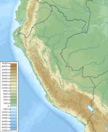
| Santa Cruz | |
|---|---|
| Pucaraju | |
 West face. | |
| Highest point | |
| Elevation | 6,259 m (20,535 ft)[1] |
| Coordinates | 8°53′39″S 77°42′30″W / 8.89429°S 77.7083°W |
| Geography | |
| Location | Ancash, Peru |
| Parent range | Cordillera Blanca, Andes |
| Climbing | |
| First ascent | 20 July 1948 by Frédéric Marmillod and Ali Szepessy-Schaurek |
Santa Cruz,[2][3][1][4] Pucaraju,[3][2][5] Pukaraju[1] (possibly from Quechua puka red,[6] rahu snow, ice, mountain with snow)[7] or Pico de Huaylas (Spanish for "peak of Huaylas")[1] is a mountain in the Cordillera Blanca in the Andes of Peru; within Santa Cruz District, Huaylas Province, Ancash.[5] It has a height of 6,259 metres (20,535 ft),[1] although other maps cite a height of 6,241 metres (20,476 ft).[2][3]
YouTube Encyclopedic
-
1/3Views:9 1311 2361 462
-
Visit the Redwoods of Santa Cruz Mountains
-
A Beautiful, Hazardous Haven: The Shaping of the Santa Cruz Mountains
-
Santa Cruz Mountains Hikes
Transcription
See also
References
- ^ a b c d e Ricker, John (1977). Yuraq Janka: A Guide to the Peruvian Andes. The Mountaineers Books. pp. 60–61. ISBN 9781933056708.
- ^ a b c Alpenvereinskarte 0/3a. Cordillera Blanca Nord (Peru). 1:100 000. Oesterreichischer Alpenverein. 2005. ISBN 3-928777-57-2.
- ^ a b c Peru 1:100 000, Corongo (18-h). IGN (Instituto Geográfico Nacional - Perú).
- ^ Biggar, John (2005). The Andes: A Guide for Climbers. Andes. p. 60. ISBN 9780953608720.
- ^ a b "UGEL Huaylas - Mapa" (PDF). ESCALE - Estadística de la Calidad Educativa - Mapas (in Spanish). MINEDU. Retrieved 2016-06-04.
- ^ Teofilo Laime Ajacopa (2007). Diccionario Bilingüe: Iskay simipi yuyayk’anch: Quechua – Castellano / Castellano – Quechua (PDF). La Paz, Bolivia: futatraw.ourproject.org.
- ^ babylon.com

