
Promised Land, South Carolina | |
|---|---|
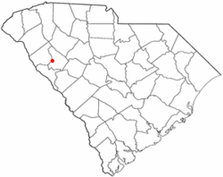 Location of Promised Land, South Carolina | |
| Coordinates: 34°7′53″N 82°14′18″W / 34.13139°N 82.23833°W | |
| Country | United States |
| State | South Carolina |
| County | Greenwood |
| Area | |
| • Total | 1.56 sq mi (4.04 km2) |
| • Land | 1.56 sq mi (4.04 km2) |
| • Water | 0.00 sq mi (0.00 km2) |
| Elevation | 623 ft (190 m) |
| Population | |
| • Total | 378 |
| • Density | 242.46/sq mi (93.59/km2) |
| Time zone | UTC-5 (Eastern (EST)) |
| • Summer (DST) | UTC-4 (EDT) |
| ZIP code | 29649 |
| Area code | 864 |
| FIPS code | 45-58615[3] |
| GNIS feature ID | 1250253[4] |
Promised Land is an unincorporated community and census-designated place (CDP) in Greenwood County, South Carolina, United States. The population was 511 at the 2010 census.[5]
YouTube Encyclopedic
-
1/2Views:1 704446
-
Summer at the Lower Lake, Promised Land, PA, USA
-
Promised Land Bound - 2 by Jim Surkamp jimsurkamp.com
Transcription
Geography
Promised Land is located in western Greenwood County at 34°8′N 82°14′W / 34.133°N 82.233°W (34.1315, -82.2382).[6] South Carolina Highway 10 passes through the community, leading northeast 6 miles (10 km) to Greenwood, the county seat, and south 6 miles to Bradley.
According to the United States Census Bureau, the Promised Land CDP has a total area of 1.5 square miles (4.0 km2), all land.[5]
Demographics
| Census | Pop. | Note | %± |
|---|---|---|---|
| 2020 | 378 | — | |
| U.S. Decennial Census[7] | |||
As of the census[3] of 2000, there were 559 people, 184 households, and 142 families residing in the CDP. The population density was 354.7 inhabitants per square mile (137.0/km2). There were 197 housing units at an average density of 125.0 per square mile (48.3/km2). The racial makeup of the CDP was 2.86% White, 95.89% African American, 0.89% Asian, and 0.36% from two or more races. Hispanic or Latino of any race were 1.07% of the population.
There were 184 households, out of which 31.5% had children under the age of 18 living with them, 51.1% were married couples living together, 22.8% had a female householder with no husband present, and 22.3% were non-families. 20.1% of all households were made up of individuals, and 8.7% had someone living alone who was 65 years of age or older. The average household size was 3.04 and the average family size was 3.55.
In the CDP, the population was spread out, with 27.4% under the age of 18, 10.0% from 18 to 24, 25.8% from 25 to 44, 25.2% from 45 to 64, and 11.6% who were 65 years of age or older. The median age was 36 years. For every 100 females, there were 82.7 males. For every 100 females age 18 and over, there were 77.3 males.
The median income for a household in the CDP was $40,288, and the median income for a family was $42,212. Males had a median income of $22,431 versus $25,000 for females. The per capita income for the CDP was $11,630. About 16.5% of families and 18.4% of the population were below the poverty line, including 4.8% of those under age 18 and 35.0% of those age 65 or over.
References
- ^ "ArcGIS REST Services Directory". United States Census Bureau. Retrieved October 15, 2022.
- ^ "Census Population API". United States Census Bureau. Retrieved October 15, 2022.
- ^ a b "U.S. Census website". United States Census Bureau. Retrieved January 31, 2008.
- ^ "US Board on Geographic Names". United States Geological Survey. October 25, 2007. Retrieved January 31, 2008.
- ^ a b "Geographic Identifiers: 2010 Demographic Profile Data (G001): Promised Land CDP, South Carolina". American Factfinder. U.S. Census Bureau. Retrieved February 16, 2017.[dead link]
- ^ "US Gazetteer files: 2010, 2000, and 1990". United States Census Bureau. February 12, 2011. Retrieved April 23, 2011.
- ^ "Census of Population and Housing". Census.gov. Retrieved June 4, 2016.
Municipalities and communities of Greenwood County, South Carolina, United States | ||
|---|---|---|
| City |  | |
| Towns | ||
| CDPs | ||
| Unincorporated community | ||
| Footnotes | ‡This populated place also has portions in an adjacent county or counties | |
| International | |
|---|---|
| National | |