
| Proffit Mountain | |
|---|---|
 Proffit Mountain | |
| Highest point | |
| Elevation | 1,700 ft (518 m)[1] |
| Prominence | 361 ft (110 m)[1] |
| Coordinates | 37°34′8″N 90°46′53″W / 37.56889°N 90.78139°W[2] |
| Geography | |
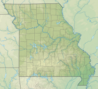
| Location | Reynolds County, Missouri |
| Parent range | St. Francois Mountains |
Proffit Mountain is a mountain located in Reynolds County, Missouri, the highest in the county. It is the location of the upper reservoir for the Taum Sauk Hydroelectric Power Station.
See also
References
- ^ a b "Proffit Mountain, Missouri". Peakbagger.com. Retrieved 2020-10-10.
- ^ "Proffit Mountain". Geographic Names Information System. United States Geological Survey, United States Department of the Interior. Retrieved 2020-10-10.