
Prairieton Township | |
|---|---|
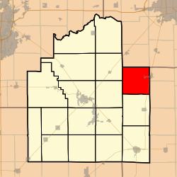 Location in Christian County | |
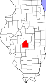 Christian County's location in Illinois | |
| Coordinates: 39°37′N 89°5′W / 39.617°N 89.083°W | |
| Country | |
| State | |
| County | Christian |
| Established | November 7, 1865 |
| Area | |
| • Total | 36.58 sq mi (94.7 km2) |
| • Land | 36.57 sq mi (94.7 km2) |
| • Water | 0.02 sq mi (0.05 km2) 0.05% |
| Elevation | 594 ft (181 m) |
| Population (2020) | |
| • Total | 425 |
| • Density | 12/sq mi (4.5/km2) |
| Time zone | UTC-6 (CST) |
| • Summer (DST) | UTC-5 (CDT) |
| ZIP codes | 62510, 62550, 62567 |
| FIPS code | 17-021-61730 |
Prairieton Township is one of seventeen townships in Christian County, Illinois, USA. As of the 2020 census, its population was 425 and it contained 177 housing units.[1]
Geography
According to the 2010 census, the township has a total area of 36.58 square miles (94.7 km2), of which 36.57 square miles (94.7 km2) (or 99.97%) is land and 0.02 square miles (0.052 km2) (or 0.05%) is water.[2]
Cities, towns, villages
- Moweaqua (west side)
Unincorporated towns
Cemeteries
The township contains these four cemeteries: Adams, Bilyeu, Hayes and Jacobs.
Major highways
Demographics
As of the 2020 census[1] there were 425 people, 182 households, and 160 families residing in the township. The population density was 11.61 inhabitants per square mile (4.48/km2). There were 177 housing units at an average density of 4.84 per square mile (1.87/km2). The racial makeup of the township was 95.53% White, 1.41% African American, 0.00% Native American, 0.00% Asian, 0.00% Pacific Islander, 0.00% from other races, and 3.06% from two or more races. Hispanic or Latino of any race were 0.94% of the population.
There were 182 households, out of which 58.80% had children under the age of 18 living with them, 87.91% were married couples living together, 0.00% had a female householder with no spouse present, and 12.09% were non-families. 12.10% of all households were made up of individuals, and 10.40% had someone living alone who was 65 years of age or older. The average household size was 2.93 and the average family size was 3.19.
The township's age distribution consisted of 34.1% under the age of 18, 2.8% from 18 to 24, 35% from 25 to 44, 20.2% from 45 to 64, and 7.7% who were 65 years of age or older. The median age was 34.1 years. For every 100 females, there were 87.0 males. For every 100 females age 18 and over, there were 123.6 males.
The median income for a household in the township was $99,688, and the median income for a family was $102,083. Males had a median income of $53,472 versus $34,063 for females. The per capita income for the township was $33,404. About 5.6% of families and 3.8% of the population were below the poverty line.
| Census | Pop. | Note | %± |
|---|---|---|---|
| 2010 | 449 | — | |
| 2020 | 425 | −5.3% | |
| U.S. Decennial Census[3] | |||
School districts
- Central A & M Community Unit School District 21
- Meridian Community Unit School District 15
- Taylorville Community Unit School District 3
Political districts
- State House District 87
- State Senate District 44
References
- "Prairieton Township, Christian County, Illinois". Geographic Names Information System. United States Geological Survey, United States Department of the Interior. Retrieved January 10, 2010.
- United States Census Bureau 2009 TIGER/Line Shapefiles
- United States National Atlas
- ^ a b "Explore Census Data". data.census.gov. Retrieved January 22, 2023.
- ^ "Population, Housing Units, Area, and Density: 2010 - County -- County Subdivision and Place -- 2010 Census Summary File 1". United States Census. Archived from the original on February 12, 2020. Retrieved May 28, 2013.
- ^ "Census of Population and Housing". Census.gov. Retrieved June 4, 2016.
External links
Adjacent Townships
Places adjacent to Prairieton Township, Christian County, Illinois | |
|---|---|
Municipalities and communities of Christian County, Illinois, United States | ||
|---|---|---|
| Cities |  | |
| Villages | ||
| Townships | ||
| CDP | ||
| Other unincorporated communities | ||
| Footnotes | ‡This populated place also has portions in an adjacent county or counties | |