| Peyto Glacier | |
|---|---|
 Peyto Glacier and part of the Wapta Icefield as seen from near the Peyto Lake lookout - Mt. Habel in the icefield. | |
| Type | Mountain glacier |
| Location | Alberta, Canada |
| Coordinates | 51°40′41″N 116°32′50″W / 51.67806°N 116.54722°W |
| Length | 90 km (56 mi) |
 | |
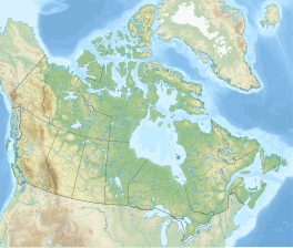
The Peyto Glacier is situated in the Canadian Rockies in Banff National Park, Alberta, Canada, approximately 90 km (56 mi) northwest of the town of Banff, and can be accessed from the Icefields Parkway.
Geography
Peyto Glacier is an outflow glacier from the Wapta Icefield, which rests along the Continental divide. The glacier snout is subject to high melt rates from season to season and there is marked surface lowering on several parts of the glacier. Glacial silt, which is carried from the glacier by streams, ensures a turquoise appearance to Peyto Lake, a popular touring destination. As is true for the vast majority of glaciers worldwide, Peyto Glacier has been retreating rapidly, especially since the last half of the 20th century, and has reportedly lost 70% of its mass since it was first researched (Demuth and Keller, 2006). Between 1896 and 1966, the total volume loss of the Peyto Glacier was 1088.5 x 106 m3 (Wallace, 1995). A 1896's photograph by Walter D. Wilcox was the first record of this glacier, although the significant research did not start until 1965.[1] In 1987, an automatic weather station was constructed near the glacier that monitors temperature changes, radiation and precipitation.
Peyto Glacier provides the most direct access to Peyto Hut, a base of both summer and winter mountaineering.
See also
References
- ^ "Global Cryosphere Watch - Station Information". globalcryospherewatch.org. Retrieved 2020-12-23.
- Demuth, M.N. and R. Keller, 2006. An assessment of the mass balance of Peyto Glacier (1966–1995) and its relation to recent and past century climatic variability. In – Peyto Glacier: One Century of Science, M.N. Demuth, D.S. Munro and G.J. Young Eds. National Hydrology Research Institute Science Report 8: 83–132.
- Wallace, Alistair Lennox (1995). The volumetric change of the Peyto Glacier, Alberta, Canada, 1896-1996 (M.A. thesis). Wilfrid Laurier University.
- CBC News (2003-01-10). "Prairies losing out on water from melting glacier". Retrieved 2006-07-02.
- Munro, D. Scott. "Temperature trends in the Peyto Glacier weather station record" (PDF). Archived from the original (PDF) on June 5, 2007. Retrieved 2006-07-02.
- Ommanney, C. Simon L. "Glaciers of the Canadian Rockies" (pdf). Satellite Image Atlas of Glaciers of the World. U.S. Geological Survey. Retrieved 2006-07-04.
- "Global Cryosphere Watch - Station Information". globalcryospherewatch.org. Retrieved 2020-12-23.


