
Petlovac | |
|---|---|
| Municipality of Petlovac Općina Petlovac | |
 | |
 Flag  Coat of arms | |
 Petlovac Location of Petlovac in Croatia  Petlovac Petlovac (Croatia)  Petlovac Petlovac (Europe) | |
| Coordinates: 45°45′31″N 18°31′41″E / 45.75861°N 18.52806°E | |
| Country | |
| County | |
| Government | |
| • Municipal mayor | Milan Knežević |
| Area | |
| • Municipality | 93.6 km2 (36.1 sq mi) |
| • Urban | 17.6 km2 (6.8 sq mi) |
| Elevation | 90 m (300 ft) |
| Population (2021)[2] | |
| • Municipality | 1,874 |
| • Density | 20/km2 (52/sq mi) |
| • Urban | 532 |
| • Urban density | 30/km2 (78/sq mi) |
| Time zone | UTC+1 (CET) |
| • Summer (DST) | UTC+2 (CEST) |
| Postal codes | 31321 Petlovac |
| Area code | (+385) 31 |
| Website | petlovac |
Petlovac (Hungarian: Baranyaszentistván, German: Sanktivan, Serbian Cyrillic: Петловац)[3] is a village and municipality in the western part of Baranja, which comprise the northern part of Osijek-Baranja County in Croatia. Petlovac is underdeveloped municipality which is statistically classified as the First Category Area of Special State Concern by the Government of Croatia.[4]
Until the end of World War II, the majority of the inhabitants was Danube Swabian, also called locally as Stifolder, because their ancestors arrived in the 17th and 18th centuries from Fulda (district).[5] Most of the former German settlers were expelled to Allied-occupied Germany and Allied-occupied Austria in 1945-1948, as a result of the Potsdam Agreement.[6]
YouTube Encyclopedic
-
1/4Views:51 7355 5041 1599 298
-
Izletnik Beograd - Radasinova kuca u Kukljinu - Tragom snimanja serije Selo gori a baba se ceslja
-
Izletnik Beograd - Skela u Kukljinu - Tragom snimanja serije ''Selo gori a baba se ceslja''
-
TIN KOVAČIĆ, PETLOVAC I BARANJSKO PETROVO SELO, 16.2.2015.
-
Selo gori, a baba se češlja (Niš-Kraljevo biciklom)
Transcription
Name
Its name derived from the word "petao" (which means "rooster" in English). The village had different names in history. During Hungarian rule, it was called Sent Ištvan (Saint Stephen), and German settlers named it Blumendorf, which means Village of Flowers.[7]
Municipality of Petlovac
Population
| population | 3734 | 4328 | 4181 | 4294 | 4784 | 4803 | 4605 | 4765 | 5607 | 5153 | 5303 | 4930 | 3949 | 3785 | 2743 | 2405 |
| 1857 | 1869 | 1880 | 1890 | 1900 | 1910 | 1921 | 1931 | 1948 | 1953 | 1961 | 1971 | 1981 | 1991 | 2001 | 2011 |
Municipality of Petlovac has 2,405 inhabitants (2011 census), including: [1]
- 73.22% Croats
- 13.72% Hungarians
- 5.07% Serbs
- 4.53% Romani
Geography
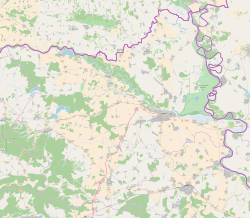
It is located between border with Hungary in the north-west, Baranja municipalities of Beli Manastir and Jagodnjak in the east and Slavonia region in the south-west.
The municipality of Petlovac include following settlements:
Politics
Minority councils
Directly elected minority councils and representatives are tasked with consulting tasks for the local or regional authorities in which they are advocating for minority rights and interests, integration into public life and participation in the management of local affairs.[9] At the 2023 Croatian national minorities councils and representatives elections Hungarians, Roma and Serbs of Croatia each fulfilled legal requirements to elect 10 members municipal minority councils of the Petlovac Municipality but the elections for Serb council were not held due to the lack of candidates.[10]
Petlovac (settlement)
History
Till 1991. part of settlement was Zeleno Polje which is now independent settlement.
Population
| population | 820 | 864 | 846 | 882 | 927 | 962 | 1196 | 1244 | 869 | 906 | 1167 | 1000 | 940 | 1012 | 801 | 714 |
| 1857 | 1869 | 1880 | 1890 | 1900 | 1910 | 1921 | 1931 | 1948 | 1953 | 1961 | 1971 | 1981 | 1991 | 2001 | 2011 |
Ethnic composition, 1991. census
| Petlovac |
|---|
| 1991 |
total: 1,012 Croats 843 (83.30%) Serbs 51 (5.03%) Yugoslavs 37 (3.65%) Hungarians 25 (2.47%) Slovenes 11 (1.08%) Montenegrins 7 (0.69%) Germans 5 (0.49%) ethnic Muslims 1 (0.09%) ethnically undeclared 15 (1.48%) unknown 17 (1.67%)
|
Austria-Hungary 1910. census
| Petlovac | |
|---|---|
| Population by ethnicity | Population by religion |
total: 962 Roman Catholics 944 (98.12%) jewish 10 (1.03%) eastern orthodox 5 (0.51%) calvinists 3 (0.31%)
| |
- In 1910. census together with settlement Zeleno Polje.
References
- ^ Register of spatial units of the State Geodetic Administration of the Republic of Croatia. Wikidata Q119585703.
- ^ "Population by Age and Sex, by Settlements, 2021 Census". Census of Population, Households and Dwellings in 2021. Zagreb: Croatian Bureau of Statistics. 2022.
- ^ "Archived copy" (PDF). Archived from the original (PDF) on 29 October 2013. Retrieved 8 March 2013.
{{cite web}}: CS1 maint: archived copy as title (link) - ^ Lovrinčević, Željko; Davor, Mikulić; Budak, Jelena (June 2004). "AREAS OF SPECIAL STATE CONCERN IN CROATIA- REGIONAL DEVELOPMENT DIFFERENCES AND THE DEMOGRAPHIC AND EDUCATIONAL CHARACTERISTICS". Ekonomski pregled, Vol.55 No.5-6. Archived from the original on 18 August 2018. Retrieved 25 August 2018.
- ^ "Stifolder Tortenet" (PDF).
- ^ "Die Vertreibung – Landsmannschaft der Deutschen aus Ungarn".
- ^ "O Baranji". Visit Baranja (in Croatian). Retrieved 10 April 2023.
- ^ Naselja i stanovništvo Republike Hrvatske 1857.-2001., www.dzs.hr
- ^ "Manjinski izbori prve nedjelje u svibnju, kreću i edukacije". T-portal. 13 March 2023. Retrieved 2 May 2023.
- ^ "Informacija o konačnim rezultatima izbora članova vijeća i izbora predstavnika nacionalnih manjina 2023. XIV. OSJEČKO-BARANJSKA ŽUPANIJA" (PDF) (in Croatian). Državno izborno povjerenstvo Republike Hrvatske. 2023. p. 34. Retrieved 3 June 2023.
- ^ Naselja i stanovništvo Republike Hrvatske 1857.-2001., www.dzs.hr
Literature
- Book: "Narodnosni i vjerski sastav stanovništva Hrvatske, 1880–1991: po naseljima, autor: Jakov Gelo, izdavač: Državni zavod za statistiku Republike Hrvatske, 1998., ISBN 953-6667-07-X, ISBN 978-953-6667-07-9;
Subdivisions of Osijek-Baranja County | ||
|---|---|---|
| Cities and towns |  | |
| Municipalities |
| |
This Osijek-Baranja County geography article is a stub. You can help Wikipedia by expanding it. |