
Pelalawan Regency
Kabupaten Pelalawan | |
|---|---|
 The Pelalawan palace | |
 Flag Coat of arms | |
 | |
| Country | Indonesia |
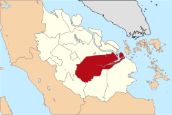
| Province | Riau |
| Regency seat | Pangkalan Kerinci |
| Area | |
| • Total | 13,408.72 km2 (5,177.14 sq mi) |
| Population (2023 estimate)[1] | |
| • Total | 415,469 |
| • Density | 31/km2 (80/sq mi) |
| Time zone | UTC+7 (WIB) |
| Website | pelalawankab.go.id |
Pelalawan is a regency (kabupaten) of Riau Province, Indonesia. It is located on the island of Sumatra. The regency was created on 4 October 1999 as a result of the division of Kampar Regency, of which it was previously the eastern 43%. It now has an area of 13,408.72 km² and had a population of 301,829 at the 2010 Census[2] and 390,046 at the 2020 Census;[3] the official estimate as at mid 2022 was 410,988 (comprising 212,139 males and 198,849 females).[1] The administrative centre is in the town of Pangkalan Kerinci.
Administrative districts
The regency is divided into twelve districts (kecamatan), listed below with their areas and their populations at the 2010 Census[2] and the 2020 Census,[3] together with the official estimates as at mid 2022.[1] The table also includes the locations of the district administrative centres, the number of administrative villages in each district (totaling rural desa and 14 urban kelurahan), and its post code; of the 14 kelurahan, one (the district administrative centre) was in each district, except that Pangkalan Kerinci District had 3 kelurahan.
| Kode Wilayah |
Name of District (kecamatan) |
Area in km2 |
Pop'n Census 2010 |
Pop'n Census 2020 |
Pop'n Estimate mid 2022 |
Admin centre |
No. of villages |
Post code |
|---|---|---|---|---|---|---|---|---|
| 14.05.05 | Langgam | 1,476.29 | 21,968 | 32,997 | 35,766 | Langgam | 8 | 28380 |
| 14.05.02 | Pangkalan Kerinci | 217.26 | 69,444 | 94,585 | 100,599 | Pangkalan Kerinci | 7 (a) | 28381 |
| 14.05.11 | Bandar Sei Kijang | 325.03 | 17,175 | 21,481 | 22,473 | Sekijang | 5 | 28383 |
| 14.05.03 | Pangkalan Kuras | 1,224.55 | 45,072 | 61,123 | 64,955 | Sorek Satu | 17 | 28382 |
| 14.05.01 | Ukui | 1,337.47 | 32,293 | 40,298 | 42,140 | Ukui Satu | 12 | 28388 |
| 14.05.04 | Pangkalan Lesung | 438.08 | 25,251 | 29,832 | 30,867 | Pangkalan Lesung | 10 | 28387 |
| 14.05.08 | Bunut | 444.65 | 11,754 | 15,465 | 16,339 | Pangkalan Bunut | 10 | 28386 |
| 14.05.06 | Pelalawan (district) | 1,469.38 | 15,388 | 19,120 | 19,978 | Pelalawan | 9 | 28353 |
| 14.05.12 | Bandar Petalangan | 361.85 | 12,635 | 16,447 | 17,340 | Rawang Empat | 11 | 28384 |
| 14.05.10 | Kuala Kampar | 683.39 | 17,622 | 17,837 | 17,912 | Teluk Dalam | 10 | 28385 |
| 14.05.07 | Kerumutan | 976.31 | 19,115 | 24,420 | 25,653 | Kerumutan | 10 | 28352 |
| 14.05.09 | Teluk Meranti (Meranti Bay) |
4,113.03 | 14,112 | 16,441 | 16,966 | Teluk Meranti | 9 | 28354 |
| Totals | 12,067.29 | 301,829 | 390,046 | 410,988 | Pangkalan Kerinci | 118 |
Note: (a) the 3 kelurahan in this district are Pangkalan Kerinci Barat, Pangkalan Kerinci Kota and Pangkalan Kerinci Timur.
References
0°16′00″N 101°40′01″E / 0.26667°N 101.66694°E
 | This Riau location article is a stub. You can help Wikipedia by expanding it. |