
Paulpietersburg | |
|---|---|
 View up Hoog Street with Dumbe hill in background | |
 Paulpietersburg  Paulpietersburg | |
| Coordinates: 27°25′S 30°49′E / 27.417°S 30.817°E | |
| Country | South Africa |
| Province | KwaZulu-Natal |
| District | Zululand |
| Municipality | eDumbe |
| Established | 1888[1] |
| Government | |
| • Councillor | BM Nxusa (NFP) |
| Area | |
| • Total | 36.56 km2 (14.12 sq mi) |
| Population (2011)[2] | |
| • Total | 1,859 |
| • Density | 51/km2 (130/sq mi) |
| Racial makeup (2011) | |
| • Black African | 56.7% |
| • Coloured | 1.0% |
| • Indian/Asian | 1.5% |
| • White | 37.3% |
| • Other | 3.6% |
| First languages (2011) | |
| • Zulu | 48.8% |
| • Afrikaans | 23.1% |
| • English | 11.5% |
| • Other | 16.6% |
| Time zone | UTC+2 (SAST) |
| Postal code (street) | 3180 |
| PO box | 3180 |
| Area code | 034 |
Paulpietersburg (Zulu: eDumbe) is a small town in KwaZulu-Natal, South Africa. It was established in 1888 and was then part of the Transvaal Republic. It was named after then President Paul Kruger and Voortrekker hero Piet Joubert.
The town is 72 km south of Piet Retief and 151 km north-east of Dundee. It was established in 1888, proclaimed a township in 1910, and attained municipal status in 1958. Named after President Paul Kruger and General Piet Joubert, it was first called Paulpietersrust, then Paulpietersdorp, and Paulpietersburg in 1896.[3]
References
- ^ Robson, Linda Gillian (2011). "Annexure A" (PDF). The Royal Engineers and settlement planning in the Cape Colony 1806–1872: Approach, methodology and impact (PhD thesis). University of Pretoria. pp. xlv–lii. hdl:2263/26503.
- ^ a b c d "Main Place Paulpietersburg". Census 2011.
- ^ "Dictionary of Southern African Place Names (Public Domain)". Human Science Research Council. p. 360.
Municipalities and communities of Zululand District Municipality, KwaZulu-Natal | ||
|---|---|---|
District seat: Ulundi | ||
| Ulundi | 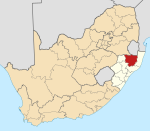 | |
| Nongoma | ||
| Abaqulusi | ||
| uPhongolo | ||
| EDumbe | ||
| Authority control databases: Geographic |
|---|
This KwaZulu-Natal location article is a stub. You can help Wikipedia by expanding it. |