
Patoka Township Pike County | |
|---|---|
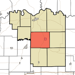 Location in Pike County | |
| Coordinates: 38°22′43″N 87°14′48″W / 38.37861°N 87.24667°W | |
| Country | |
| State | |
| County | Pike |
| Government | |
| • Type | Indiana township |
| Area | |
| • Total | 43.81 sq mi (113.5 km2) |
| • Land | 42.58 sq mi (110.3 km2) |
| • Water | 1.23 sq mi (3.2 km2) 2.81% |
| Elevation | 453 ft (138 m) |
| Population (2020) | |
| • Total | 2,826 |
| • Density | 65/sq mi (25/km2) |
| ZIP codes | 47567, 47598, 47660 |
| GNIS feature ID | 453710 |
Patoka Township is one of nine townships in Pike County, Indiana, United States. As of the 2020 census, its population was 2,826 and it contained 1,284 housing units.[1]
| Census | Pop. | Note | %± |
|---|---|---|---|
| 1890 | 3,095 | — | |
| 1900 | 3,926 | 26.8% | |
| 1910 | 4,253 | 8.3% | |
| 1920 | 4,738 | 11.4% | |
| 1930 | 3,947 | −16.7% | |
| 1940 | 4,150 | 5.1% | |
| 1950 | 3,808 | −8.2% | |
| 1960 | 3,084 | −19.0% | |
| 1970 | 2,898 | −6.0% | |
| 1980 | 3,213 | 10.9% | |
| 1990 | 2,935 | −8.7% | |
| 2000 | 3,169 | 8.0% | |
| 2010 | 3,062 | −3.4% | |
| 2020 | 2,826 | −7.7% | |
| Source: US Decennial Census[2] | |||
YouTube Encyclopedic
-
1/2Views:587 600648
-
10 Places In Indiana You Should NEVER Move To
-
Patoka Township Fire Department Field Fire 6/22/2011
Transcription
History
Patoka Township was organized in 1838.[3]
Geography
According to the 2010 census, the township has a total area of 43.81 square miles (113.5 km2), of which 42.58 square miles (110.3 km2) (or 97.19%) is land and 1.23 square miles (3.2 km2) (or 2.81%) is water.[4] The Patoka River flows through the township from east to west.
Cities, towns, villages
Unincorporated towns
- Arthur at 38°20′26″N 87°14′45″W / 38.340605°N 87.245842°W
- Ayrshire at 38°22′19″N 87°14′27″W / 38.371994°N 87.240843°W
- Campbelltown at 38°25′17″N 87°14′24″W / 38.421438°N 87.240010°W
- Glezen at 38°24′59″N 87°18′04″W / 38.416438°N 87.301124°W
- Littles at 38°24′04″N 87°17′14″W / 38.40116°N 87.287234°W
- Marysville at 38°21′07″N 87°16′42″W / 38.351993°N 87.278344°W
- Muren at 38°21′59″N 87°16′08″W / 38.366438°N 87.268899°W
(This list is based on USGS data and may include former settlements.)
Cemeteries
The township contains these eight cemeteries: Crow, Hedges, Martin, Oak Hill, Sugar Ridge, Sunset, Williams and Wyatt.
Major highways
School districts
- Pike County School Corporation
Political districts
- State House District 63
- State Senate District 48
References
- "Patoka Township, Pike County, Indiana". Geographic Names Information System. United States Geological Survey, United States Department of the Interior. Retrieved November 26, 2009.
- United States Census Bureau 2009 TIGER/Line Shapefiles
- IndianaMap
- ^ "Explore Census Data". data.census.gov. Retrieved April 13, 2024.
- ^ "Township Census Counts: STATS Indiana".
- ^ History of Pike and Dubois Counties, Indiana. Goodspeed Brothers. p. 276. ISBN 978-5-87521-222-2.
- ^ "Population, Housing Units, Area, and Density: 2010 - County -- County Subdivision and Place -- 2010 Census Summary File 1". United States Census. Archived from the original on February 12, 2020. Retrieved May 10, 2013.
External links
- Indiana Township Association
- United Township Association of Indiana
- City-Data.com page for Patoka Township
Places adjacent to Patoka Township, Pike County, Indiana | |
|---|---|
Municipalities and communities of Pike County, Indiana, United States | ||
|---|---|---|
| City |  | |
| Towns | ||
| Townships | ||
| CDPs | ||
| Other communities | ||
| Footnotes | ‡This populated place also has portions in an adjacent county or counties | |