
Parkwood, Washington | |
|---|---|
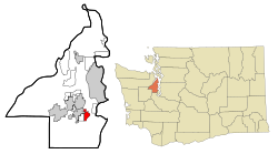 Location of Parkwood, Washington | |
| Coordinates: 47°31′41″N 122°36′9″W / 47.52806°N 122.60250°W | |
| Country | United States |
| State | Washington |
| County | Kitsap |
| Area | |
| • Total | 2.7 sq mi (6.9 km2) |
| • Land | 2.6 sq mi (6.8 km2) |
| • Water | 0.0 sq mi (0.1 km2) |
| Elevation | 266 ft (81 m) |
| Population (2010) | |
| • Total | 7,126 |
| • Density | 2,743.7/sq mi (1,059.3/km2) |
| Time zone | UTC-8 (Pacific (PST)) |
| • Summer (DST) | UTC-7 (PDT) |
| ZIP code | 98366 |
| Area code | 360 |
| FIPS code | 53-53440[1] |
| GNIS feature ID | 1510388[2] |
Parkwood is a census-designated place (CDP) in Kitsap County, Washington, United States. The population was 7,126 at the 2010 census.
Geography
Parkwood is located at 47°31′41″N 122°36′9″W / 47.52806°N 122.60250°W (47.527993, -122.602614).[3]
According to the United States Census Bureau, the CDP has a total area of 2.7 square miles (6.9 km2), of which, 2.6 square miles (6.8 km2) of it is land and 0.04 square miles (0.1 km2) of it (1.50%) is water.
Demographics
As of the census[1] of 2000, there were 7,213 people, 2,768 households, and 1,915 families residing in the CDP. The population density was 2,743.7 people per square mile (1,058.9/km2). There were 2,893 housing units at an average density of 1,100.4/sq mi (424.7/km2). The racial makeup of the CDP was 84.5% White, 2.5% African American, 1.2% Native American, 4.3% Asian, 1.0% Pacific Islander, 1.5% from other races, and 4.9% from two or more races. Hispanic or Latino of any race were 4.3% of the population.
There were 2,768 households, out of which 36.2% had children under the age of 18 living with them, 53.0% were married couples living together, 11.2% had a female householder with no husband present, and 30.8% were non-families. 24.4% of all households were made up of individuals, and 8.5% had someone living alone who was 65 years of age or older. The average household size was 2.60 and the average family size was 3.09.
In the CDP, the population was spread out, with 28.4% under the age of 18, 9.1% from 18 to 24, 29.1% from 25 to 44, 23.4% from 45 to 64, and 9.9% who were 65 years of age or older. The median age was 34 years. For every 100 females, there were 96.4 males. For every 100 females age 18 and over, there were 92.6 males.
The median income for a household in the CDP was $41,869, and the median income for a family was $48,866. Males had a median income of $36,312 versus $24,127 for females. The per capita income for the CDP was $17,643. About 6.4% of families and 9.1% of the population were below the poverty line, including 10.5% of those under age 18 and 5.0% of those age 65 or over.
References
- ^ a b "U.S. Census website". United States Census Bureau. Retrieved January 31, 2008.
- ^ "Parkwood". Geographic Names Information System. United States Geological Survey, United States Department of the Interior.
- ^ "US Gazetteer files: 2010, 2000, and 1990". United States Census Bureau. February 12, 2011. Retrieved April 23, 2011.
Municipalities and communities of Kitsap County, Washington, United States | ||
|---|---|---|
| Cities |  | |
| CDPs | ||
| Other communities | ||
| Indian reservation | ||