
Parguera | |
|---|---|
Barrio | |
 On the water in Parguera | |
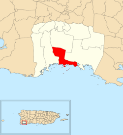 Location of Parguera within the municipality of Lajas shown in red | |
 Parguera Location of Puerto Rico | |
| Coordinates: 17°58′33″N 67°02′31″W / 17.975944°N 67.041922°W[1] | |
| Commonwealth | |
| Municipality | |
| Area | |
| • Total | 7.34 sq mi (19.0 km2) |
| • Land | 4.02 sq mi (10.4 km2) |
| • Water | 3.32 sq mi (8.6 km2) |
| Elevation | 36 ft (11 m) |
| Population (2010) | |
| • Total | 2,082 |
| • Density | 519.2/sq mi (200.5/km2) |
| Source: 2010 Census | |
| Time zone | UTC−4 (AST) |
Parguera is a barrio in the municipality of Lajas, Puerto Rico with a population of 2,082 in 2010.[3] La Parguera is the main settlement of the barrio, often referred to as Poblado de la Parguera. Parguera is home to La Parguera Nature Reserve, which encompasses the bioluminescent bay, its surrounding mangrove forests, wetlands and a number of keys such as Mata La Gata and Cayo Enrique. The name Parguera derives from pargo, the local name for the Northern red snapper (Lutjanus campechanus).[4]
YouTube Encyclopedic
-
1/1Views:321
-
Torneo Dorado Club Náutico de la Parguera, "A PESCAR" 2019
Transcription
History
The settlement of La Parguera was established as a villa pesquera (fishing village) in 1825.[4]
Parguera was in Spain's gazetteers[5] until Puerto Rico was ceded by Spain in the aftermath of the Spanish–American War under the terms of the Treaty of Paris of 1898 and became an unincorporated territory of the United States. In 1899, the United States Department of War conducted a census of Puerto Rico finding that the combined population of Parguera and Costa barrios was 1,256.[6]
| Census | Pop. | Note | %± |
|---|---|---|---|
| 1910 | 523 | — | |
| 1920 | 661 | 26.4% | |
| 1930 | 740 | 12.0% | |
| 1940 | 926 | 25.1% | |
| 1950 | 807 | −12.9% | |
| 1960 | 1,030 | 27.6% | |
| 1970 | 1,224 | 18.8% | |
| 1980 | 1,677 | 37.0% | |
| 1990 | 1,796 | 7.1% | |
| 2000 | 2,071 | 15.3% | |
| 2010 | 2,082 | 0.5% | |
| U.S. Decennial Census 1900 (N/A)[7] 1910-1930[8] 1930-1950[9] 1980-2000[10] 2010[11] | |||
Features
Parguera barrio is mainly known for La Parguera Bio Bay, a tourist spot from where sunset and night bioluminescent tours leave regularly. Tourists go out on a kayak or small boat at night to see the bay with its bioluminescent waters, caused by microorganisms called dinoflagellate and seen when the water is disturbed at night. A parador (country inn) called Parador Villa Parguera is located in Parguera.[12]
Climate
| Climate data for Parguera, Puerto Rico (1991–2020 normals, extremes 1959–present) | |||||||||||||
|---|---|---|---|---|---|---|---|---|---|---|---|---|---|
| Month | Jan | Feb | Mar | Apr | May | Jun | Jul | Aug | Sep | Oct | Nov | Dec | Year |
| Record high °F (°C) | 92 (33) |
93 (34) |
95 (35) |
96 (36) |
97 (36) |
97 (36) |
100 (38) |
98 (37) |
101 (38) |
103 (39) |
95 (35) |
94 (34) |
103 (39) |
| Mean daily maximum °F (°C) | 86.0 (30.0) |
85.8 (29.9) |
85.7 (29.8) |
86.7 (30.4) |
88.2 (31.2) |
89.8 (32.1) |
90.4 (32.4) |
90.6 (32.6) |
90.5 (32.5) |
90.0 (32.2) |
88.3 (31.3) |
87.5 (30.8) |
88.3 (31.3) |
| Daily mean °F (°C) | 78.0 (25.6) |
77.6 (25.3) |
78.0 (25.6) |
79.6 (26.4) |
81.5 (27.5) |
83.1 (28.4) |
83.2 (28.4) |
83.1 (28.4) |
83.3 (28.5) |
82.4 (28.0) |
80.7 (27.1) |
78.8 (26.0) |
80.8 (27.1) |
| Mean daily minimum °F (°C) | 70.0 (21.1) |
69.4 (20.8) |
70.3 (21.3) |
72.4 (22.4) |
74.8 (23.8) |
76.3 (24.6) |
75.9 (24.4) |
75.6 (24.2) |
76.1 (24.5) |
74.9 (23.8) |
73.0 (22.8) |
70.0 (21.1) |
73.2 (22.9) |
| Record low °F (°C) | 60 (16) |
50 (10) |
60 (16) |
58 (14) |
59 (15) |
67 (19) |
66 (19) |
62 (17) |
61 (16) |
66 (19) |
62 (17) |
60 (16) |
50 (10) |
| Average precipitation inches (mm) | 1.93 (49) |
1.86 (47) |
2.71 (69) |
3.57 (91) |
4.07 (103) |
2.54 (65) |
2.67 (68) |
4.32 (110) |
5.53 (140) |
6.26 (159) |
5.06 (129) |
1.96 (50) |
42.48 (1,079) |
| Source: NOAA[13][14] | |||||||||||||
Gallery
-
 Near Bioluminescent Tour and Parador Villa Parquera
 -
 Cays of La Parquera
 -
 Boats in the Caribbean Sea in Lajas
 -
 Boats at La Parguera
 -
 Roseate tern at La Parguera, (on the list of threatened species)
 -
 Pipefish camouflaged in Caribbean seagrass in La Parguera
See also
References
- ^ a b "US Gazetteer 2019". US Census. US Government.
- ^ U.S. Geological Survey Geographic Names Information System: Parguera barrio
- ^ Puerto Rico: 2010 Population and Housing Unit Counts.pdf (PDF). U.S. Dept. of Commerce, Economics and Statistics Administration, U.S. Census Bureau. 2010.
- ^ a b López, Por Roberto (11 September 2014). "La Parguera, destino en Puerto Rico". Viaje a América (in Spanish). Retrieved 15 December 2021.
- ^ "Anuario del comercio, de la industria, de la magistratura y de la administración. 1881". Biblioteca Nacional de España (in Spanish). p. 1614. Retrieved 4 April 2023.
- ^ Joseph Prentiss Sanger; Henry Gannett; Walter Francis Willcox (1900). Informe sobre el censo de Puerto Rico, 1899, United States. War Dept. Porto Rico Census Office (in Spanish). Imprenta del gobierno. p. 164.
- ^ "Report of the Census of Porto Rico 1899". War Department Office Director Census of Porto Rico. Archived from the original on 16 July 2017. Retrieved 21 September 2017.
- ^ "Table 3-Population of Municipalities: 1930 1920 and 1910" (PDF). United States Census Bureau. Archived (PDF) from the original on 17 August 2017. Retrieved 21 September 2017.
- ^ "Table 4-Area and Population of Municipalities Urban and Rural: 1930 to 1950" (PDF). United States Census Bureau. Archived (PDF) from the original on 30 August 2015. Retrieved 21 September 2014.
- ^ "Table 2 Population and Housing Units: 1960 to 2000" (PDF). United States Census Bureau. Archived (PDF) from the original on 24 July 2017. Retrieved 21 September 2017.
- ^ Puerto Rico: 2010 Population and Housing Unit Counts.pdf (PDF). U.S. Dept. of Commerce Economics and Statistics Administration U.S. Census Bureau. 2010. Archived (PDF) from the original on 20 February 2017. Retrieved 2 August 2019.
- ^ "La Parguera Bioluminescent Bay". Discover Puerto Rico. Retrieved 18 April 2021.
- ^ "NOWData - NOAA Online Weather Data". National Oceanic and Atmospheric Administration. Retrieved 8 April 2024.
- ^ "Summary of Monthly Normals 1991-2020". National Oceanic and Atmospheric Administration. Retrieved 8 April 2024.
This Lajas, Puerto Rico location article is a stub. You can help Wikipedia by expanding it. |