
Pancoran | |
|---|---|
 The Dirgantara Monument in Pancoran, bordering with Tebet district. | |
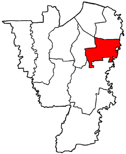 Map showing the Pancoran District in South Jakarta | |
| Coordinates: 6°15′28″S 106°49′23″E / 6.2579045°S 106.823041814°E | |
| Country | Indonesia |
| Province | Special Capital Region of Jakarta |
| Administrative City | South Jakarta |
| Government | |
| • District Mayor | Alamsah[1] |
| Area | |
| • Total | 8.53 km2 (3.29 sq mi) |
| Population | |
| • Total | 168,600 |
| Time zone | UTC+7 |
| Area code | (+62) 21 |
| Vehicle registration | B |
| Website | https://selatan.jakarta.go.id/ |


Pancoran is a district (kecamatan) of South Jakarta, one of the five administrative cities that form Jakarta, Indonesia. Pancoran District was originally part of Mampang Prapatan District until it was split off to form its district in 1990.[4]
The boundaries of Pancoran District are the Ciliwung River to the east, the Mampang River to the west, and Kapten Tendean Road - Jend. Gatot Subroto - Letjen. MT Haryono and the Jakarta Inner Ring Road to the north.
Kelurahan (urban villages)
The district of Pancoran is divided into six kelurahan or administrative villages:
- Kalibata - area code 12740
- Rawa Jati - area code 12750
- Duren Tiga - area code 12760
- Cikoko - area code 12770
- Pengadegan - area code 12770
- Pancoran - area code 12780
List of important places
References
- ^ "Pejabat Pemerintahan" [Government Official]. Pemerintah Kota Administrasi Jakarta Selatan (in Indonesian). 30 November 2022. Retrieved 6 August 2023.
- ^ "Luas Wilayah Menurut Kecamatan di Jakarta Selatan 2015-2021" [Area by District in South Jakarta 2015-2021]. Statistics Indonesia (BPS) (in Indonesian). 2021. Retrieved 6 August 2023.
- ^ "Jumlah Penduduk Menurut Kecamatan (ribu), 2019-2021" [Total Population by District (in thousands), 2019-2021] (in Indonesian). South Jakarta Statistics Indonesia. Retrieved 6 August 2023.
- ^ "Peraturan Pemerintah (PP) No. 60 Tahun 1990" [Government Regulation (GR) No. 60 of 1990]. Audit Board of Indonesia (in Indonesian). 18 December 1990. Retrieved 6 August 2023.
Wikimedia Commons has media related to Pancoran.
This Jakarta location article is a stub. You can help Wikipedia by expanding it. |