
Panchbibi
পাঁচবিবি | |
|---|---|
 Shrine in Patharghata | |
 | |
| Coordinates: 25°11.7′N 89°1.2′E / 25.1950°N 89.0200°E | |
| Country | |
| Division | Rajshahi |
| District | Joypurhat |
| Area | |
| • Total | 311.77 km2 (120.38 sq mi) |
| Population (2011) | |
| • Total | 235,568 |
| • Density | 760/km2 (2,000/sq mi) |
| Time zone | UTC+6 (BST) |
| Website | Official Map of Panchbibi |
Panchbibi (Bengali: পাঁচবিবি) is an upazila of Joypurhat District in the Division of Rajshahi, Bangladesh.[1]
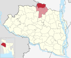
Geography
Panchbibi is located at 25°11′45″N 89°01′15″E / 25.1958°N 89.0208°E. It has 60,983 household units and a total area of 311.77 km2.
Panchbibi Upazila is bounded by Hakimpur and Ghoraghat Upazilas in Dinajpur district, and Hili CD Block in Dakshin Dinajpur district, West Bengal, India, on the north, Gobindaganj Upazila in Gaibandha District and Kalai Upazila in Joypurhat District on the east, Joypurhat Sadar Upazila on the south and Joypurhat Sadar Upazila and Balurghat CD Block in Dakshin Dinajpur district, West Bengal, India, on the west.[2][3][4]
Demographics
According to the 2011 Bangladesh census, Panchbibi Upazila had 60,983 households and a population of 235,568. 46,234 (19.63%) were under 10 years of age. Panchbibi had a literacy rate (age 7 and over) of 54.57%, compared to the national average of 51.8%, and a sex ratio of 983 females per 1000 males. 22,475 (9.54%) lived in urban areas.[5] Ethnic population was 13,411 (5.69%), of which Oraon were 3,474, Barman 2,763 and Santal 2,186.[6]
According to the 2001 Bangladesh census, Population of the upazila was: Total 215,806; male 110,588, female 105,218; Muslim 183,355, Hindu 23,925, Buddhist 3,451, Christian 81 and others 4,994. Indigenous communities such as santal, munda and oraon belong to this upazila.[1]
As of the 1991 Bangladesh census, Panchbibi has a population of 193,365. Males constitute 51.06% of the population, and females 48.94%. This Upazila's population of people aged eighteen and higher is 99,108. Panchbibi has an average literacy rate of 30.6% (7+ years), against the national average of 32.4% literate.[7]
Administration
Panchbibi Thana, now an upazila, was formed in 1868.[1]
Panchbibi Upazila is divided into Panchbibi Municipality and eight union parishads: Aolai, Atapur, Aymarasulpur, Bagjana, Balighata, Dharanji, Kusumba, and Mohammadpur. The union parishads are subdivided into 222 mauzas and 247 villages.[5]
Panchbibi Municipality is subdivided into 9 wards and 14 mahallas.[5]
See also
References
- ^ a b c Shahnaz Parveen (2012), "Panchbibi Upazila", in Sirajul Islam and Ahmed A. Jamal (ed.), Banglapedia: National Encyclopedia of Bangladesh (Second ed.), Asiatic Society of Bangladesh
- ^ "Panchbibi Upazila". Banglapedia. Retrieved 8 December 2018.
- ^ "District Census Handbook 2011 Dakshin Dinajpur" (PDF). Map of Dakshin Dinajpur showing CD Blocks on the fourth page. Directorate of Census Operations. Retrieved 8 December 2018.
- ^ "District Human Development Report" (PDF). Uttar Dinajpur. Page 14: Map showing locational setting of Uttar Dinajpur district (includes Dakshin Dinajpur district). Department of Planning, Statistics and Programme Implementation, Government of West Bengal. Archived from the original (PDF) on 24 December 2019. Retrieved 8 December 2018.
- ^ a b c d "Bangladesh Population and Housing Census 2011 Zila Report – Joypurhat" (PDF). bbs.gov.bd. Bangladesh Bureau of Statistics.
- ^ "Community Tables: Joypurhat district" (PDF). bbs.gov.bd. Bangladesh Bureau of Statistics. 2011.
- ^ "Population Census Wing, BBS". Archived from the original on 2005-03-27. Retrieved November 10, 2006.
| Upazila/Thana: | ||
|---|---|---|
Headquarters: Rajshahi | ||
| Bogra District |  | |
| Joypurhat District | ||
| Naogaon District | ||
| Natore District | ||
| Nawabganj District | ||
| Pabna District | ||
| Rajshahi District | ||
| Sirajganj District | ||
This Rajshahi Division location article is a stub. You can help Wikipedia by expanding it. |