
Palo Verde Airport Aeropuerto Nacional Palo Verde | |||||||||||
|---|---|---|---|---|---|---|---|---|---|---|---|
| Summary | |||||||||||
| Airport type | Public | ||||||||||
| Serves | Santa Rosalía | ||||||||||
| Location | Mulegé Municipality, Baja California Sur, Mexico | ||||||||||
| Elevation AMSL | 55 ft / 17 m | ||||||||||
| Coordinates | 27°05′35″N 112°05′56″W / 27.09306°N 112.09889°W | ||||||||||
| Map | |||||||||||
 SRL Location of airport in Baja California Sur 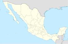 SRL SRL (Mexico) | |||||||||||
| Runways | |||||||||||
| |||||||||||
| Statistics (2019) | |||||||||||
| |||||||||||
Source: Agencia Federal de Aviación Civil[1] | |||||||||||
Palo Verde Airport (IATA: SRL) is a paved airstrip located in San Bruno, a town 30 km south of Santa Rosalía, Baja California Sur, Mexico. The airstrip is also known as "Chivato Bay" and the CIB code is used as its identifier. It handles aviation for the city of Santa Rosalía.
YouTube Encyclopedic
-
1/3Views:675488753
-
Palo Verde National Park boat tour day
-
Costa Rica tour, Palo Verde boat tour, Liberia HD
-
Palo Verde Boat Tour
Transcription
References
- ^ "Base de Datos de Aeródromos y Helipuertos". Secretaría de Comunicaciones y Transportes. January 2020. Retrieved April 9, 2020.
External links
- Fallingrain.com: SRL—Palo Verde Airport
- Baja-web.com: Info about Palo Verde Airstrip
- Mulege.net: Photo of the airstrip office
This article about a Mexican airport is a stub. You can help Wikipedia by expanding it. |