
Paiko | |
|---|---|
semi-urban town | |
| Nickname: PK | |
 Paiko Location in Nigeria | |
| Coordinates: 9°26′N 6°38′E / 9.433°N 6.633°E | |
| Country | |
| State | Niger State |
| Government | |
| • Local Government Chairman and the Head of the Local Government Council | Yahanna Yakubu (APC) |
| Area | |
| • Total | 2,066 km2 (798 sq mi) |
| Population (2006 census) | |
| • Total | 158,086 |
| • Density | 107.5/km2 (278/sq mi) |
| Time zone | UTC+1 (WAT) |
| 3-digit postal code prefix | 920 |
| ISO 3166 code | NG.NI.PA |
 | |
Paikoro Local Government is one of the 774 Local Government Areas of Nigeria and one of 25 Local Government areas in Niger-State Nigeria. Paikoro Local Government headquarter is located in Paiko town about 25 km south-east of the state capital Minna.
It has an area of 2,066 km2 and a population of 158,086 at the 2006 census; projected to grow by 35% annually. Paikoro local government area is one of the 25 local government areas in Niger state Nigeria. It has its administrative headquarter situated in Paiko town. Paiko town is located in the south-eastern region of Niger State. Paikoro local government council oversees the public administration of Paikoro local government 11 wards and its Legislative council consisting of 11 councillors makes laws that governs the local government areas. Paikoro local government area council consist of eleven (11) wards namely: Adunu, Chimbi, Gwam, Ishau, Jere, Kaffin Koro, Kwagana, Kwakuti, Nikuchi/Tungan Mallam, Paiko Central and Tutungo/Jedna.
The postal code of the area is 920.[1]
YouTube Encyclopedic
-
1/2Views:17 296383
-
Sayyadi Usman Sheikh Tahiru Bauchi / Maulid New York City'14 1
-
In Minna For A Wedding
Transcription
Climate
In contrast to the hot, humid dry season, the temperature rarely falls below 54°F or rises above 100°F during the wet season, which is typically warm and oppressive.[2]
From January 29 to April 16, the hot season, with an average daily high temperature exceeding 91°F, lasts for 2.6 months. Paikoro experiences its warmest weather in April, with an average high temperature of 91°F and low temperature of 74°F.[3]
Between June 25 and September 29, which is the length of the chilly season, the daily high temperature typically falls below 84°F. With an average low of 61°F and high of 89°F, December is the coldest month of the year in Paikoro.
References
- ^ "Post Offices- with map of LGA". NIPOST. Archived from the original on 2012-11-26. Retrieved 2009-10-20.
- ^ "Paiko Climate, Weather By Month, Average Temperature (Nigeria) - Weather Spark". weatherspark.com. Retrieved 2023-09-10.
- ^ Vizzuality. "Paikoro, Niger, Nigeria Deforestation Rates & Statistics | GFW". www.globalforestwatch.org. Retrieved 2023-09-26.
State capital: Minna | ||
| Local Government Areas | 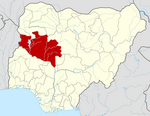 | |
This Niger State, Nigeria location article is a stub. You can help Wikipedia by expanding it. |