Pabellón de Arteaga | |
|---|---|
 Templo de San Isidro Labrador in the Hacienda de Garabato | |
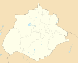
 Municipality location in Aguascalientes | |
 Pabellón de Arteaga Location in Mexico  Pabellón de Arteaga Pabellón de Arteaga (Mexico) | |
| Coordinates: 22°09′N 102°16′W / 22.150°N 102.267°W | |
| Country | |
| State | Aguascalientes |
| Municipality | Pabellón de Arteaga |
| Founded | 14 May 1929 |
| Government | |
| • Municipal President | Humberto Ambriz Delgadillo ( |
| Population (2020) | |
| • Total | 47,646 |
Pabellón de Arteaga is a city in the Mexican state of Aguascalientes. It stands at 22°09′N 102°16′W / 22.150°N 102.267°W in the central part of the state. The city serves as the municipal seat of the municipality of Pabellón de Arteaga. As of 2010, the city had a total population of 28,633,[1] up from 26,797 in 2005. It is the third-largest city in the state behind Aguascalientes and Jesús María.
Its principal public party is on November 20 in a party called Feria de La Revolucion who commemorates the national uprising against Porfirio Díaz in 1910. Most of the people in this town study and work in the city of Aguascalientes. It is a half hour drive from Pabellon de Arteaga to Aguascalientes. Also every half hour a public transportation service called Las Combis go to Aguascalientes.
Pabellon has three high schools, two junior high schools, and several elementary schools. On Mondays a traveling marketplace called "El Tianguis" set shop on the streets of Pabellon.
YouTube Encyclopedic
-
1/3Views:7 6037 1241 589
-
Dando una vuelta en Pabellón de Arteaga, Aguascalientes - Parte 1
-
Candidatas a Reina 2012 Pabellon de Arteaga Ags
-
Pequeñas Alegrías "Pabellón de Arteaga Mayo 2014"
Transcription
Geography
Climate
| Climate data for Pabellón de Arteaga (1951–2010) | |||||||||||||
|---|---|---|---|---|---|---|---|---|---|---|---|---|---|
| Month | Jan | Feb | Mar | Apr | May | Jun | Jul | Aug | Sep | Oct | Nov | Dec | Year |
| Record high °C (°F) | 31.0 (87.8) |
32.5 (90.5) |
36.0 (96.8) |
38.5 (101.3) |
39.5 (103.1) |
37.0 (98.6) |
35.0 (95.0) |
34.5 (94.1) |
34.0 (93.2) |
35.0 (95.0) |
32.5 (90.5) |
30.5 (86.9) |
39.5 (103.1) |
| Mean daily maximum °C (°F) | 23.2 (73.8) |
25.3 (77.5) |
27.8 (82.0) |
30.0 (86.0) |
31.7 (89.1) |
30.4 (86.7) |
28.4 (83.1) |
28.3 (82.9) |
27.3 (81.1) |
26.9 (80.4) |
25.8 (78.4) |
23.8 (74.8) |
27.4 (81.3) |
| Daily mean °C (°F) | 13.6 (56.5) |
15.4 (59.7) |
17.8 (64.0) |
20.3 (68.5) |
22.6 (72.7) |
22.8 (73.0) |
21.4 (70.5) |
21.3 (70.3) |
20.6 (69.1) |
18.8 (65.8) |
16.2 (61.2) |
14.2 (57.6) |
18.8 (65.8) |
| Mean daily minimum °C (°F) | 4.1 (39.4) |
5.6 (42.1) |
7.7 (45.9) |
10.7 (51.3) |
13.4 (56.1) |
15.3 (59.5) |
14.4 (57.9) |
14.3 (57.7) |
13.9 (57.0) |
10.7 (51.3) |
6.6 (43.9) |
4.5 (40.1) |
10.1 (50.2) |
| Record low °C (°F) | −3.5 (25.7) |
−2.5 (27.5) |
−2.0 (28.4) |
2.0 (35.6) |
6.0 (42.8) |
10.0 (50.0) |
5.0 (41.0) |
8.5 (47.3) |
6.0 (42.8) |
1.5 (34.7) |
−1.5 (29.3) |
−6.0 (21.2) |
−6.0 (21.2) |
| Average precipitation mm (inches) | 20.3 (0.80) |
12.0 (0.47) |
3.3 (0.13) |
4.1 (0.16) |
12.3 (0.48) |
71.9 (2.83) |
115.3 (4.54) |
90.2 (3.55) |
79.2 (3.12) |
35.4 (1.39) |
5.0 (0.20) |
4.1 (0.16) |
453.1 (17.84) |
| Average precipitation days (≥ 0.1 mm) | 2.2 | 1.8 | 0.9 | 1.2 | 3.7 | 9.5 | 12.7 | 10.9 | 10.0 | 4.4 | 1.2 | 1.0 | 59.5 |
| Source: Servicio Meteorologico Nacional[2][3] | |||||||||||||
References
- ^ "Pabellón de Arteaga". Catálogo de Localidades. Secretaría de Desarrollo Social (SEDESOL). Retrieved 23 April 2014.
- ^ "Estado de Aguascalientes-Estacion: Pabellón de Arteaga (DGE)". Normales Climatologicas 1951–2010 (in Spanish). Servicio Meteorologico Nacional. Archived from the original on 18 May 2015. Retrieved 8 May 2015.
- ^ "Extreme Temperatures and Precipitation for Pabellón de Arteaga (DGE) 1990–2010" (in Spanish). Servicio Meteorológico Nacional. Archived from the original on 18 May 2015. Retrieved 8 May 2015.
- Link to tables of population data from Census of 2005 Instituto Nacional de Estadística, Geografía e Informática (INEGI)
- Aguascalientes Enciclopedia de los Municipios de México
External links
- Ayuntamiento de Pabellón de Arteaga Official website