
Oudega
Aldegea | |
|---|---|
Village | |
 St Agatha church | |
 Flag  Coat of arms | |
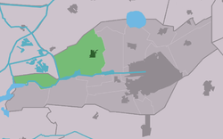 Location in Smallingerland municipality | |
 Oudega Location in the Netherlands  Oudega Oudega (Netherlands) | |
| Coordinates: 53°7′30″N 5°59′57″E / 53.12500°N 5.99917°E | |
| Country | |
| Province | |
| Municipality | |
| Area | |
| • Total | 21.00 km2 (8.11 sq mi) |
| Elevation | 1.7 m (5.6 ft) |
| Population (2021)[1] | |
| • Total | 1,675 |
| • Density | 80/km2 (210/sq mi) |
| Postal code | 9216[1] |
| Dialing code | 0512 |
Oudega (West Frisian: Aldegea) is a village in Smallingerland in the province of Friesland, the Netherlands. It had a population of around 1,701 in January 2017.[3]
YouTube Encyclopedic
-
1/3Views:5 1843 548875
-
Dorpsfilm Oudega (Smallingerland)
-
Dorpsfilm Oudega (Smallingerland), 1965
-
Dorpsfilm Oudega; Idzega; Sandfirden (Súdwest-Fryslân), 1955
Transcription
History
The village was first mentioned in 1439 as Aldga, and means "old village". Oude (old) has been added to distinguish from Nijega.[4] Oudega developed in a sandy ridge in the early middle ages. Until 1795, it was the capital of the grietenij (predecessor of the municipality) Smallingerland. The Protestant church was built in the early 12th century. The tower was built around 1250. The church was modified several times during its history and restored in 1921.[5]
Oudega was home to 603 people in 1840.[6]
Notable buildings
Gallery
-
 Former forge in Oudega
 -
 The harbour of Oudega
 -
 Street view
 -
 Stork Statue
References
- ^ a b c "Kerncijfers wijken en buurten 2021". Central Bureau of Statistics. Retrieved 3 April 2022.
- ^ "Postcodetool for 9216VA". Actueel Hoogtebestand Nederland (in Dutch). Het Waterschapshuis. Retrieved 3 April 2022.
- ^ Bevolkingscijfers Archived 2017-11-07 at the Wayback Machine - Smallingerland
- ^ "Oudega - (geografische naam)". Etymologiebank (in Dutch). Retrieved 3 April 2022.
- ^ Ronald Stenvert & Sabine Broekhoven (2000). "Oudega" (in Dutch). Zwolle: Waanders. ISBN 90 400 9476 4. Retrieved 3 April 2022.
- ^ "Oudega (Smallingerland)". Plaatsengids (in Dutch). Retrieved 3 April 2022.
External links
![]() Media related to Oudega (Smallingerland) at Wikimedia Commons
Media related to Oudega (Smallingerland) at Wikimedia Commons
This Friesland location article is a stub. You can help Wikipedia by expanding it. |