
Orhangazi | |
|---|---|
District and municipality | |
 | |
 Map showing Orhangazi District in Bursa Province | |
 Orhangazi Location in Turkey  Orhangazi Orhangazi (Marmara) | |
| Coordinates: 40°29′20″N 29°18′30″E / 40.48889°N 29.30833°E | |
| Country | Turkey |
| Province | Bursa |
| Government | |
| • Mayor | Bekir Aydın (AKP) |
| Area | 506 km2 (195 sq mi) |
| Population (2022)[1] | 81,110 |
| • Density | 160/km2 (420/sq mi) |
| Time zone | TRT (UTC+3) |
| Postal code | 16800 |
| Area code | 0224 |
| Website | www |
Orhangazi is a municipality and district of Bursa Province, Turkey.[2] Its area is 506 km2,[3] and its population is 81,110 (2022).[1]
Olive production is a major part of the economy. The archeological digs of Ilıpınar Höyüğü are in the region of Orhangazi, and can be visited.
Orhangazi is located near the lake Iznik and near the Sea of Marmara. Orhangazi has a number of villages around it, connected with local buses. One of the villages, Keramet, has a natural hot springs. Main roads leading to the villages have olive fields on both sides.
YouTube Encyclopedic
-
1/5Views:737 396557 92317 3504 3712 385
-
ORHAN GAZİ BELGESELİ (TEK PARÇA) || OSMANLININ KURULUŞU
-
OSMAN OĞLU ORHAN GAZİ
-
2 -ORHAN GAZİ DÖNEMİ |OSMANLI PADİŞAHLARI|
-
İznik Gölü Kıyısında Bir Cennet Sölöz Köyü | Orhangazi Bursa Türkiye Sony a7 iii
-
Orhangazi Gezimiz (Bursa)
Transcription
History
Orhangazi is named after Orhan I, the second sultan of the Ottoman Empire, who conquered the area of present Orhangazi in 1326. From 1867 until 1922, Orhangazi was part of Hüdavendigâr vilayet. The town was captured by the Greek Army in 1919 and its population was massacred.
Composition
There are 31 neighbourhoods in Orhangazi District:[4]
Sport
The route of the 130k İznik Ultramarathon, established in 2012, passes through villages in Orhangazi district around Lake İznik. An 80k part of it, the Orhangazi Ultra, ends in Örnekköy in Orhangazi district on the route's westernmost point.[5]
References
- ^ a b "Address-based population registration system (ADNKS) results dated 31 December 2022, Favorite Reports" (XLS). TÜİK. Retrieved 12 July 2023.
- ^ Büyükşehir İlçe Belediyesi, Turkey Civil Administration Departments Inventory. Retrieved 12 July 2023.
- ^ "İl ve İlçe Yüz ölçümleri". General Directorate of Mapping. Retrieved 12 July 2023.
- ^ Mahalle, Turkey Civil Administration Departments Inventory. Retrieved 12 July 2023.
- ^ "Orhangazi Ultra Maratonu 80K" (in Turkish). İznik Ultra. Retrieved 2013-11-26.
Orhangazi in Bursa Province of Turkey | |||||||||||||||||||||||||||
|---|---|---|---|---|---|---|---|---|---|---|---|---|---|---|---|---|---|---|---|---|---|---|---|---|---|---|---|
| Districts |  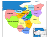 | ||||||||||||||||||||||||||
|
Metropolitan municipalities are bolded. | |||||||||||||||||||||||||||
| International | |
|---|---|
| National | |
This geographical article about a location in Bursa Province, Turkey is a stub. You can help Wikipedia by expanding it. |