
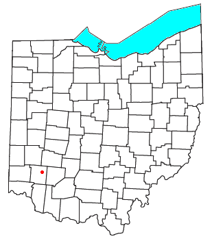
Oregonia is an unincorporated community in northwestern Washington Township, Warren County, Ohio, United States,[1] on the east shore of the Little Miami River about five miles northeast of Lebanon and six miles south of Waynesville. The ZIP Code for Oregonia is 45054.[2]
The first settlement there was around 1802, where there was a mill operated at various times by Nebo Gaunt, Ignatius Brown, and David Brown. Around 1820, it was known as Freeport.[3] The Little Miami Railroad reached the village c. 1845. A post office called Oregon was established in 1846, and the name was changed to Oregonia in 1882.[4] The post office has since been consolidated with the Lebanon post office.
Today, Oregonia is a stop on the Little Miami Bike Trail which follows the former train route along the Little Miami River. Bikers, hikers, and canoers often stop at the market or a restaurant along the trail which follows the river on the former train route. In October of each year, the "Devils Staircase" motorcycle hill climb is held on a hill just south of the main settlement.
YouTube Encyclopedic
-
1/2Views:7736 493
-
Fort Ancient - Ancient America - Oregonia, Ohio
-
Fort Ancient Museum - Ohio
Transcription
References
- ^ U.S. Geological Survey Geographic Names Information System: Oregonia, Ohio
- ^ "Oregonia ZIP Code". zipdatamaps.com. 2022. Retrieved November 11, 2022.
- ^ The History of Warren County, Ohio: Containing a History of the County ; Its Townships, Towns ; General and Local Statistics. W.H. Beers & Company. 1882. p. 708.
- ^ "Warren County". Jim Forte Postal History. Retrieved January 17, 2016.
External links
Municipalities and communities of Warren County, Ohio, United States | ||
|---|---|---|
| Cities |  | |
| Villages | ||
| Townships | ||
| CDPs | ||
| Unincorporated communities |
| |
| Ghost towns | ||
| Footnotes | ‡This populated place also has portions in an adjacent county or counties | |
39°27′03″N 84°05′46″W / 39.45083°N 84.09611°W
This Warren County, Ohio state location article is a stub. You can help Wikipedia by expanding it. |