
Opatów County
Powiat opatowski | |
|---|---|
 Coat of arms | |
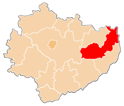 Location within the voivodeship | |
 Division into gminas | |
| Coordinates (Opatów): 50°48′18″N 21°25′29″E / 50.80500°N 21.42472°E | |
| Country | |
| Voivodeship | Świętokrzyskie |
| Seat | Opatów |
| Gminas | |
| Area | |
| • Total | 911.51 km2 (351.94 sq mi) |
| Population (2019) | |
| • Total | 53,942 |
| • Density | 59/km2 (150/sq mi) |
| • Urban | 11,035 |
| • Rural | 42,907 |
| Car plates | TOP |
| Website | http://www.opatow.pl |
Opatów County (Polish: powiat opatowski) is a unit of territorial administration and local government (powiat) in Świętokrzyskie Voivodeship, south-central Poland. It came into being on January 1, 1999, as a result of the Polish local government reforms passed in 1998. Its administrative seat and largest town is Opatów, which lies 58 kilometres (36 mi) east of the regional capital Kielce. The only other town in the county is Ożarów, lying 20 km (12 mi) north-east of Opatów.
The county covers an area of 911.51 square kilometres (351.9 sq mi). As of 2019 its total population is 53,942, out of which the population of Opatów is 6,466, that of Ożarów is 4,569, and the rural population is 42,907.[1]
YouTube Encyclopedic
-
1/1Views:2 309
-
The former Jewish ghetto in Opatów, Poland
Transcription
Neighbouring counties
Opatów County is bordered by Ostrowiec County and Lipsko County to the north, Opole Lubelskie County to the north-east, Kraśnik County and Sandomierz County to the east, Staszów County to the south-west, and Kielce County to the west.
Administrative division
The county is subdivided into eight gminas (two urban-rural and six rural). These are listed in the following table, in descending order of population.
| Gmina | Type | Area (km²) |
Population (2019) |
Seat |
| Gmina Opatów | urban-rural | 113.4 | 11,676 | Opatów |
| Gmina Ożarów | urban-rural | 183.3 | 10,741 | Ożarów |
| Gmina Iwaniska | rural | 105.0 | 6,648 | Iwaniska |
| Gmina Lipnik | rural | 81.7 | 5,231 | Lipnik |
| Gmina Tarłów | rural | 163.8 | 5,171 | Tarłów |
| Gmina Baćkowice | rural | 96.3 | 4,874 | Baćkowice |
| Gmina Wojciechowice | rural | 86.4 | 4,036 | Wojciechowice |
| Gmina Sadowie | rural | 81.7 | 3,959 | Sadowie |
References
- ^ GUS. "Population. Size and structure and vital statistics in Poland by territorial division in 2019. As of 30th June". stat.gov.pl. Retrieved 2020-09-14.
Seat: Opatów | ||
| Urban-rural gminas |  | |
| Rural gminas | ||
| City counties |
|  |
|---|---|---|
| Land counties | ||
| International | |
|---|---|
| National | |