
Highway 78 | |||||||
|---|---|---|---|---|---|---|---|
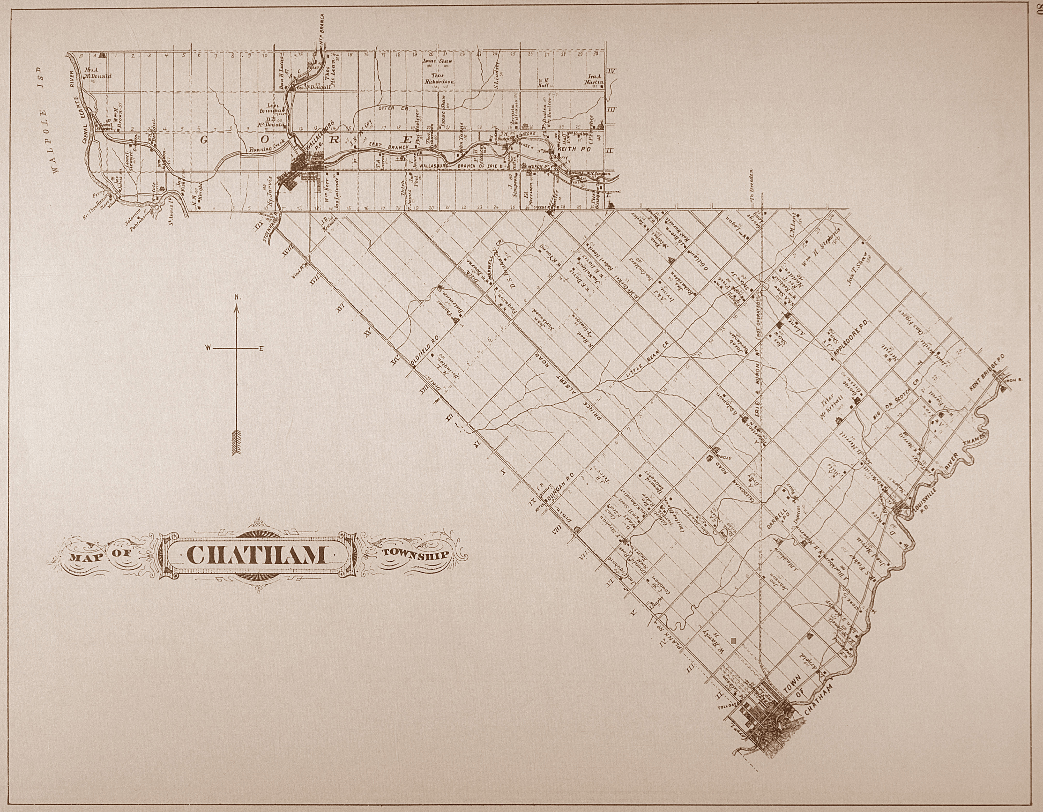
 A map of Highway 78 (as of December 31, 1997) Highway 78 Bypassed segments | |||||||
| Route information | |||||||
| Maintained by Ministry of Transportation of Ontario | |||||||
| Length | 17.60 km[1] (10.94 mi) | ||||||
| Existed | May 13, 1938[2] – January 1, 1998[3] | ||||||
| Major junctions | |||||||
| West end | |||||||
| East end | |||||||
| Location | |||||||
| Country | Canada | ||||||
| Province | Ontario | ||||||
| Counties | Chatham-Kent | ||||||
| Towns | Wallaceburg, Dresden | ||||||
| Highway system | |||||||
| |||||||
| |||||||

King's Highway 78, commonly referred to as Highway 78, was a provincially maintained highway in the Canadian province of Ontario. The 17.60-kilometre (10.94 mi) route connected Highway 40 (McNaughton Avenue) in downtown Wallaceburg with Highway 21 (St. George Street) in Dresden.
Highway 78 was established in May 1938, and generally followed the same route throughout its existence; the majority of changes occurred within Wallaceburg. In 1962 the route was almost moved to follow Kent County Road 15 (Baseline Road), but local opposition cancelled the proposal. During the mid-to-late 1960s it was signed concurrently with Highway 21 between Dresden and Thamesville. Responsibility for maintenance of the entire route was transferred to the municipality of Chatham-Kent on January 1, 1998. Since then, it has been known as Chatham-Kent Road 78.
Route description
Highway 78 was a 17.60 km (10.94 mi) route that connected Highway 40 in Wallaceburg with Highway 21 in Dresden. The highway began at the intersection of Dufferin Street, McNaughton Avenue and Wellington Street, immediately north of the Sydenham River. It travelled northeast alongside the river along a one-way pairing, with eastbound traffic following Dufferin Avenue and James Street, and westbound traffic following Wellington Street. The pairing bisected downtown Wallaceburg before reconvening prior to crossing the North Sydenham River on the Dundas Bridge.[1][4][5]
Curving east, James Street became Margaret Avenue. Highway 78 continued to generally parallel the Sydenham River until exiting Wallaceburg at Highland Drive. It travelled northeast into farmland and diverged north from the river before curving east and becoming McCreary Line. The remainder of the route was entirely straight, with only a minor swerve at the boundary between Chatham Township and Camden Township. The highway ended immediately north of Dresden at Highway 21, east of which the roadway continued as Kent County Road 29.[1][4][5]
History
Early history
The roads that became part of Highway 78 predated it by almost a century. The majority of the route followed the McCreary Line, the third concession of the Chatham and Camden Township gore, while a portion near Wallaceburg followed the riverfront road.[6] Originally, a ferry connected the opposite shores of the North Branch of the Sydenham River. In 1872,[note 1] Wallaceburg purchased an old railway bridge from Ohio and built the North Branch Bridge.[8] The roadway was paved c. 1920.[9]
Designation
Highway 78 was first designated as a provincial route by the Department of Highways (DHO), predecessor to the modern Ministry of Transportation of Ontario (MTO), in 1938.[10] The 10.25-mile (16.50 km) route, connecting Highway 40 with Highway 21, was assumed on April 13, 1938.[2] While the highway was already paved when it was established, it featured narrow pavement.[11] Highway 78 was extended 20.1 kilometres (12.5 mi) concurrently with Highway 21 between Dresden and Thamesville in 1963.[12][13] This concurrency remained in place until 1969, after which Highway 78 once again ended north of Dresden.[14][15]
Two projects were completed in the mid-1940s to straighten the route east of Wallaceburg. Originally, Highway 78 followed North River Line to Kimball Road, onto which it turned 90 degrees north before turning east onto Abraham Line. A similar pair of 90 degree turns existed at Mandaumin Road.[11] A straighter route was built at both locations in 1945.[16][17]
In 1962, a proposal was raised by the Wallaceburg Chamber of Commerce to have the DHO exchange Highway 78 with Kent County Road 15 (Base Line), which ran parallel to the highway but south of both Wallaceburg and Dresden.[12][18] Base Line bypassed the downtown areas of both towns and already received a greater portion of large truck traffic than Highway 78.[19] The concept was met with approval from Wallaceburg, Chatham Township, and Kent County officials, and surveying work was undertaken that summer.[20] Wallaceburg later rescinded its support in September after the proposal was met with disapproval from local farmers, residents and businesses alike.[9] While the DHO agreed to the swap, it set out the condition that it must be approved by a majority of local residents, effectively killing the proposal. Several months later, an agreement between all parties was reached whereby the DHO rebuilt Base Line to provincial highway standards but Kent County retained ownership of the road.[21]
As part of a series of budget cuts initiated by premier Mike Harris under his Common Sense Revolution platform in 1995, numerous highways deemed to no longer be of significance to the provincial network were decommissioned and responsibility for the routes transferred to a lower level of government, a process referred to as downloading. As it generally served a regional function, Highway 78 was downloaded in its entirety on January 1, 1998, and transferred to the newly-formed municipality of Chatham-Kent.[3][22] Since then, it has been known as Chatham-Kent Road 78.[23]
Wallaceburg
Within Wallaceburg, Highway 78 originally began at the intersection of James Street and Duncan / McDougal Streets, where Highway 40 turned from south to west.[11] When the Lord Selkirk Bridge was opened by the Minister of Highways, George Doucett, on November 23, 1950, Highway 40 was redirected across the Sydenham River along McNaughton Avenue instead of McDougal Street via Murray Street and King Street. As a result, Highway 78 was extended by 0.43 kilometres (0.27 mi) along James Street and Dufferin Avenue to the McNaughton Avenue / Wellington Street intersection.[24][25]
In January 1953, Wallaceburg mayor William Collins suggested converting James and Wellington Streets into a one-way pairing, following a similar experiment begun in Chatham in August 1951.[26][27] This was approved at the next town council meeting on February 3.[28] However, local businesses on James Street protested the proposal,[29] and it was ultimately shelved in August.[30] The concept resurfaced in April 1961,[31] and this time was approved by the town council in a 5–3 vote on April 18.[32] The conversion took place on July 27, in tandem with the opening of the Dundas Bridge.[33]
The Dundas Bridge, named after former Wallaceburg mayor Thomas B. Dundas,[34] was built to replace the North Branch Bridge, a two lane Pratt truss swing bridge built in 1872.[note 1] The old steel structure, itself a previously-used railroad bridge from Ohio,[35] was outdated and in a state of disrepair when surveying work to replace it began in late January 1958.[35][36][37] A temporary Bailey bridge was erected upstream, connecting Elizabeth Street with Park Street.[38] This was done to avoid the lengthy detour via Becher or Tupperville.[39] Construction began on October 20, 1959,[40] and it was unofficially opened to traffic on March 18, 1960.[41] Just seventeen days later, a girder failure caused the North Branch Bridge to collapse partially, and it was permanently closed.[38] Demolition of the old structure took place throughout the remainder of April and May,[42][43] with construction of the new bridge beginning on May 31.[44] Kent County council voted to name the new bridge on January 20, 1961. Unlike other places and roads in Ontario, the bridge was not named after the controversial anti-abolitionist Henry Dundas.[34][45] It was ceremoniously opened to traffic seven months later by Highway Minister Fred Cass on July 27,[46] with the temporary Bailey bridge removed the following week.[47]
The one-way system instituted in 1961 failed to alleviate traffic issues in downtown Wallaceburg, which led the town to commission a traffic study in the summer of 1964.[48][49] The resulting study, released in August 1967, recommended a realignment and widening of Wellington Street to serve as a thoroughfare around the historic downtown area along James Street, as well as removing a pair of 90 degree turns at Fork Street.[50][51] It took over a decade before the proposal was acted upon,[52] and several more years before the provincial government approved and funded the project.[53][54] Construction to replace Fork Street with an S-curve began August 4, 1980,[50] and was completed by the end of the year.[55] The realignment of Wellington Street north by 27 metres (89 ft), including widening it to four lanes, was completed in late 1987.[56]
Downloading
As part of a series of budget cuts initiated by premier Mike Harris under his Common Sense Revolution platform in 1995, numerous highways deemed to no longer be of significance to the provincial network were decommissioned and responsibility for the routes transferred to a lower level of government, a process referred to as downloading. Highway 78 was downloaded in its entirety and transferred to Kent County on January 1, 1998.[3]
Major intersections
The following table lists the major junctions along Highway 78, as noted by the Ministry of Transportation of Ontario in the 1997 Provincial Highways Distance Table.[1] The entire route was located in Kent County.[4]
| Location | km | mi | Destinations | Notes | |
|---|---|---|---|---|---|
| Wallaceburg | 0.00 | 0.00 | Eastbound Highway 78 followed James Street, westbound Highway 78 followed Wellington Street; beginning of Wallaceburg Connecting Link | ||
| 0.70 | 0.43 | Fork Street / Wellington Street | One-way pairing ends | ||
| 0.90 | 0.56 | Murray Street | |||
| 2.20 | 1.37 | Highland Crescent | End of Wallaceburg Connecting Link | ||
| Chatham Township | 2.80 | 1.74 | |||
| 3.60 | 2.24 | ||||
| 10.20 | 6.34 | ||||
| Dresden | 17.60 | 10.94 | |||
| 1.000 mi = 1.609 km; 1.000 km = 0.621 mi | |||||
Explanatory notes
References
- ^ a b c d Transportation Capital Branch (1997). "Provincial Highways Distance Table" (PDF). Provincial Highways Distance Table: King's Secondary Highways and Tertiary Roads. Ministry of Transportation of Ontario: 71. ISSN 0825-5350. Retrieved June 18, 2021 – via Legislative Assembly of Ontario.
- ^ a b "Appendix No. 3 – Schedule of Assumptions and Reversions of Sections of the King's Highway System for the Fiscal Year". Annual Report (Report) (1939 ed.). Department of Highways. October 26, 1939. p. 84. Retrieved January 16, 2022 – via Internet Archive.
- ^ a b c Highway Transfers List – "Who Does What" (Report). Ministry of Transportation of Ontario. June 20, 2001. p. 8.
- ^ a b c Ontario Road Map (Map). Cartography by Cartographic Mapping Unit, Surveys and Design Office. Ministry of Transportation of Ontario. 1996. §§ N2–3. Retrieved January 16, 2022 – via Archives of Ontario.
- ^ a b Google (January 14, 2022). "Highway 78 – Length and Route" (Map). Google Maps. Google. Retrieved January 14, 2022.
- ^ Map of Chatham Township (Map). Canadian County Digital Atlas Project at McGill University. 1880. Retrieved January 22, 2022.
- ^ "Full Span For Bridge". The Windsor Star. Vol. 84, no. 42. April 19, 1960. p. 5. Retrieved January 21, 2022 – via Newspapers.com.
- ^ "Last Swing For Old Span". The Windsor Star. Vol. 84, no. 35. April 9, 1960. p. 5-A. Retrieved January 20, 2022 – via Newspapers.com.
- ^ a b "Undecided On Road". The Windsor Star. Vol. 89, no. 15. September 19, 1962. p. 5. Retrieved January 21, 2022 – via Newspapers.com.
- ^ Ontario Road Map (Map). Cartography by D. Barclay. Ontario Department of Highways. 1938–39. § F10. Retrieved January 16, 2022 – via Archives of Ontario.
- ^ a b c Wallaceburg, Ontario – Map Sheet 040J09 (Map) (3 ed.). 1:63,360. Cartography by Geographical Section. Department of National Defence. Retrieved January 20, 2022.
- ^ a b Ontario Road Map (Map). Cartography by C.P. Robins. Department of Highways. 1962. §§ U28–29. Retrieved January 16, 2022 – via Archives of Ontario.
- ^ Ontario Road Map (Map). Cartography by C.P. Robins. Department of Highways. 1963. §§ U28–29. Retrieved January 16, 2022 – via Archives of Ontario.
- ^ Ontario Road Map (Map). Cartography by Photogrammetry Office. Department of Highways. 1969. §§ X17–Y18. Retrieved January 16, 2022 – via Archives of Ontario.
- ^ Ontario Road Map (Map). Cartography by Photogrammetry Office. Department of Highways. 1970. §§ X17–Y18. Retrieved January 16, 2022 – via Archives of Ontario.
- ^ Ontario Road Map (Map). Cartography by D. Barclay. Ontario Department of Highways. 1945–46. § F10. Retrieved January 22, 2022 – via Archives of Ontario.
- ^ Ontario Road Map (Map). Cartography by J.W. Whitelaw. Ontario Department of Highways. 1946. § R27. Retrieved January 22, 2022 – via Archives of Ontario.
- ^ "Base Line Project Supported". The Windsor Star. Vol. 88, no. 13. March 15, 1962. p. 5. Retrieved January 21, 2022 – via Newspapers.com.
- ^ "Wallaceburg Studying Base Line Swap Plan". The Windsor Star. Vol. 88, no. 65. May 16, 1962. p. 5. Retrieved January 21, 2022 – via Newspapers.com.
- ^ "Surveying Under Way". The Windsor Star. Vol. 88, no. 108. July 7, 1962. p. 5. Retrieved January 21, 2022 – via Newspapers.com.
- ^ "Committee In Charge Of Project". The Windsor Star. Vol. 89, no. 110. January 11, 1963. p. 5. Retrieved January 22, 2022 – via Newspapers.com.
- ^ Murray, Aileen (March 31, 2014). "Municipal amalgamation: The impact on economic development in Chatham-Kent". Papers in Canadian Economic Development. Vol. 10. University of Waterloo. Retrieved January 16, 2022.
- ^ Ontario Back Road Atlas (Map). Cartography by MapArt. Mapart Publishing. 2022. p. 6. §§ A–C5. ISBN 1-55198-226-9.
- ^ The Star's Wallaceburg Bureau (November 16, 1950). "New Wallaceburg Bridge to Be Opened Nov. 23". The Windsor Daily Star. Vol. 65, no. 64. p. 5. Retrieved January 16, 2022 – via Newspapers.com.
- ^ Collins, Bill (November 24, 1950). "New Bridge Dedicated By Pioneer". The Windsor Daily Star. Vol. 65, no. 71. p. 5. Retrieved January 16, 2022 – via Newspapers.com.
- ^ "2-Way Police Radio Due in Wallaceburg". The Windsor Daily Star. Vol. 69, no. 127. January 30, 1953. p. 5. Retrieved January 17, 2022 – via Newspapers.com.
- ^ "Peak Traffic Rules Made At Chatham". The Windsor Daily Star. Vol. 66, no. 151. August 27, 1951. p. 5. Retrieved January 17, 2022 – via Newspapers.com.
- ^ "Wallaceburg Sets One-Way Streets". The Windsor Daily Star. Vol. 69, no. 131. February 4, 1953. p. 5. Retrieved January 17, 2022 – via Newspapers.com.
- ^ The Star's Wallaceburg Bureau (March 4, 1953). "Oppose New Street Plan". The Windsor Daily Star. Vol. 70, no. 3. p. 5. Retrieved January 18, 2022 – via Newspapers.com.
- ^ Ward, Dick (August 14, 1953). "Protests Put Halt to Wallaceburg's One-Way Street Proposal". The Windsor Daily Star. Vol. 70, no. 139. p. 5. Retrieved January 18, 2022 – via Newspapers.com.
- ^ "Merchants Still Split On One-Way Street". The Windsor Star. Vol. 86, no. 36. April 12, 1961. p. 5. Retrieved January 18, 2022 – via Newspapers.com.
- ^ "Wallaceburg Plans One-Way Street Program". The Windsor Star. Vol. 86, no. 42. April 19, 1961. p. 5. Retrieved January 18, 2022 – via Newspapers.com.
- ^ "Traffic Flow Smooth". The Windsor Star. Vol. 86, no. 126. July 28, 1961. p. 5. Retrieved January 18, 2022 – via Newspapers.com.
- ^ a b "Memorial to Dundas". The Windsor Star. Vol. 85, no. 119. January 21, 1961. p. 5. Retrieved January 20, 2022 – via Newspapers.com.
- ^ a b "Old Bridge Faces Wreckers". The Windsor Star. Vol. 83, no. 121. January 23, 1960. p. 13-A. Retrieved January 21, 2022 – via Newspapers.com.
- ^ "County Sees 1958 Start on Wallaceburg N. Branch Bridge". The Windsor Daily Star. Vol. 78, no. 131. August 3, 1957. p. 7. Retrieved January 20, 2022 – via Newspapers.com.
- ^ "Surveying Work on North Branch Bridge to Start This Week". The Windsor Daily Star. Vol. 79, no. 123. January 27, 1958. p. 7. Retrieved January 20, 2022 – via Newspapers.com.
- ^ a b "Old Span Crumbles". The Windsor Star. Vol. 84, no. 31. April 5, 1960. p. 5. Retrieved January 20, 2022 – via Newspapers.com.
- ^ "Old Bridge Shut Down for Repair". The Windsor Daily Star. Vol. 83, no. 24. September 29, 1959. p. 5. Retrieved January 20, 2022 – via Newspapers.com.
- ^ "Start Work On Bridge". The Windsor Daily Star. Vol. 83, no. 41. October 20, 1959. p. 5. Retrieved January 20, 2022 – via Newspapers.com.
- ^ "Branch Span Now Useable". The Windsor Star. Vol. 84, no. 17. March 19, 1960. p. 5-A. Retrieved January 20, 2022 – via Newspapers.com.
- ^ "100 Watch Span Job". The Windsor Star. Vol. 84, no. 40. April 16, 1960. p. 5-A. Retrieved January 20, 2022 – via Newspapers.com.
- ^ "Old Bridge Work". The Windsor Star. Vol. 84, no. 64. May 14, 1960. p. 5-A. Retrieved January 21, 2022 – via Newspapers.com.
- ^ "Bridge Cribbing Start Made". The Windsor Star. Vol. 84, no. 77. May 31, 1960. p. 5. Retrieved January 21, 2022 – via Newspapers.com.
- ^ Gough, David (July 20, 2021). "What's In A Name? Examining Wallaceburg's Dundas". CKXS 99.1. Retrieved January 22, 2022.
- ^ "New Bridge Officially Opened at Wallaceburg". The Windsor Star. Vol. 86, no. 126. July 28, 1961. p. 5. Retrieved January 21, 2022 – via Newspapers.com.
- ^ "Lee Firm Gets Job". The Windsor Star. Vol. 86, no. 126. July 28, 1961. p. 5. Retrieved January 21, 2022 – via Newspapers.com.
- ^ "Solution Still Sought". The Windsor Star. Vol. 91, no. 85. December 11, 1963. p. 5. Retrieved January 24, 2022 – via Newspapers.com.
- ^ "Cost Study For Report". The Windsor Star. Vol. 92, no. 79. June 3, 1964. p. 5. Retrieved January 24, 2022 – via Newspapers.com.
- ^ a b Star Kent Bureau (August 1, 1980). "Motorists Must Detour". The Windsor Star. p. 3. Retrieved January 24, 2022 – via Newspapers.com.
- ^ Sommers, Jo Anne (February 23, 1977). "Renewal talks based on 10-year-old study". The Windsor Star. p. 3. Retrieved January 24, 2022 – via Newspapers.com.
- ^ Star Chatham Bureau (September 27, 1978). "Redevelopment plans outlined in Wallaceburg". The Windsor Star. p. 3. Retrieved January 24, 2022 – via Newspapers.com.
- ^ Star Kent Bureau (March 11, 1980). "Wallaceburg traffic plan up to council". The Windsor Star. p. 3. Retrieved January 24, 2022 – via Newspapers.com.
- ^ Star Kent Bureau (September 5, 1979). "Province looks favorably on town's street project". The Windsor Star. p. 3. Retrieved January 25, 2022 – via Newspapers.com.
- ^ Moore, Randy (December 30, 1980). "Wallaceburg: A 1980 survivor". The Windsor Star. p. 3. Retrieved January 24, 2022 – via Newspapers.com.
- ^ Johnston, Andy (August 12, 1987). "Paving this week: Realignment in final stages". Wallaceburg News.

