
YouTube Encyclopedic
-
1/3Views:7626281 861
-
ഓമശ്ശേരിയിൽ ഇത്രക്ക് അടിപൊളി സ്ഥലമോ..? The beauty of omassery ...
-
വൈകുന്നേരത്തെ പൊളി വ്യൂ... ||Omassery ||Cycling Ride || Evening vibe
-
ROYAD Farm House | Omassery | Owner Ashraf
Transcription
jazim pv
Omassery | |
|---|---|
Town | |
 Omassery | |
| Coordinates: 11°18′0″N 75°58′30″E / 11.30000°N 75.97500°E | |
| Country | |
| State | Kerala |
| District | Kozhikode |
| Lok Sabha constituency | Kozhikode |
| Government | |
| • Body | Omassery |
| • Member of Parliament | M. K. Raghavan |
| • M.L.A | M. K. Muneer |
| • Panchayath President | Abdul Nasar Pulikkal |
| Area | |
| • Total | 25.46 km2 (9.83 sq mi) |
| Population (2011) | |
| • Total | 25,420 |
| • Density | 998/km2 (2,580/sq mi) |
| Languages | |
| • Official | Malayalam, English |
| Time zone | UTC+5:30 (IST) |
| PIN | 673582 |
| Telephone code | 91495228 |
| Vehicle registration | KL-57 |
| Nearest city | Kozhikode, koduvally |
| Sex ratio | 1000:1032 ♂/♀ |
| Literacy rate | 88.05% |
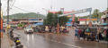
Omassery is a town in Kozhikode district, Kerala, India and it is a junction between Thiruvambady, Thamarassery, Mukkam, Koduvally, Kodenchery and Kattangal. Omassery is located 29 kilometers southeast of Kozhikode in the eastern part of Kerala; better known as Malabar (Northern Kerala). Omassery is a fast developing place and is well connected to the other parts of the state. Besides that, it is known as the gateway to the hill ranges of Western Ghats in Malabar.
Geography

Omassery is located at 11°18′0″N 75°58′30″E / 11.30000°N 75.97500°E. The total area of the Panchayat is 25.46 square kilometres (9.83 sq mi)[1]
Demographics
As of 2001 census the total population of the panchayat is 25,420,[1] which constitute 12511 Males and 12909 females. The population density is 998 per km2 which is more than the state average. The sex ratio is 1000:1032. The people are highly literate. The literacy rate is 88.05 (Male: 93.62 and female 82.76).
Towns and suburbs of Omassery
Koduvally, Kunnamangalam, Thamarassery, Mukkam, Thiruvambady, Kodenchery, NIT(REC)
Koodathai, Venappara, Neeleswaram, Ambalakkandy, Vennakode, Malayamma, Velimanna, Kallurutty, Puthur, north puthur Nadammal Poyil and Manipuram.
Panchayath Wards and present members
Omassery Panchayath consists of 19 wards. In ward number order, with ward, member name and party indicated:[2]
- Koodathai Shyni (Koodahai)
- Kakkadakunnu Shyni Babu (CPIM)
- Chemmaruthai Manu E J (INC)
- Peruvilly Gracy (INC)
- Korothiri Girija Sumod Kumar (CPIM)
- Omassery EAST CA Ayisha Teacher (Independent)
- Omassery WEST P.V. Abdu Rahiman Master (IUML)
- Ambalakkandy yoonus ambalakkandy (IUML)
- Allumthara ashokan (IUML)
- Vennakkode C.K. Kkadeeja Muhammed (IUML)
- NadammalPoyil M.C. Rafeenathulukhan (IUML)
- Kaniyarkandam Paranghottil Ibrahim (INDEPENDENT)
- Kulathakkara Sainudheen Bappu (IUML)
- Velimanna Thatha (IUML)
- Puthur. Abdul Nasar Pulikkal (IUML)
- Mangad WEST Chandramathi Puthanpurayil (CPIM)
- Mangad EAST Sre Eba Areekkal (CPIM)
- Chakkikave T.T. Mandjkumar (CPIM)
- Meppally K.K. Radakrishnan (CPIM)
Major Institutions
- Al irshad Arts And Science, College Thechyad Omassery
- G U P S Puthur
- Wadihuda Higher Secondary School (Unaided), Omassery
- Al Irshad Technical Higher Secondary School, Techyad Omassery
- Vidya Poshini ALP School, Omassery
- Vadihuda English School (CBSE), Omassery
- Al Irshad Central School (English Medium), Techyad Omassery
- Al Irshad High School (Malayalam Medium), Techyad Omassery
- Al Irshad Industrial School, Techyad Omassery
- Santhi School of Nursing, Omassery
- Santhi Paramedical Training Centre, Omassery
- Wadihuda Arabic College, Omassery
- Pleasant English School Omassery
- Pleasant Arts College., Omassery
- Al Irshad Women's College, Techyad Omassery
- Vadihuda Orphanage & Destitute Home, Omassery
- Izzathul Islam Madrassa, Omassery
- Winpoint Guidance Academy, Omassery
- Santhi College of Nursing, Omassery
- G.M.U.P. School Velimanna Omassery
- Sunanul Huda Madrasa, Omassery
- Badrul Huda Madrasa, Thazhe Omassery
- Al Madrasathul Islamiya, Omassery
- G.M.L.P. School Kedayathur
- Holy Family Venappara
- St. Mary's Higher Secondary School Koodathai
- Almanar Arabic College Omassery
- Track College Omassery
- DELTA PLUS INSTITUTE OF SCIENCE
Nonprofit organisations
- Karma Disaster Management Team, Omassery, a group of young energetic members who are ready to serve all peoples in need in any emergency situations.
- Sevana Charitable Society, Omassery
- Shihab Thangal Memorial Charitable Trust (SMCT), Omassery
- CMCO GCC, Cholakkal Mahall Charity Omassery, an initiation by 200+ peoples from Omassery Cholakkal Mahall who works in GCC countries
- Karunyam, a charity initiative by youths in Omassery.
- Karuna Charitable Society
- Youth Wing Puthoor
- Sukrutham, a charity initiative by Santi Hospital Omassery for the Kidney patients of the underprivileged sections of the society whose numbers are increasing day by day. Since its inception in May 2008 m ore than 2000 dialysis have been conducted out of which 68% received concession.[3]
- Pain and Palliative Care Clinic, a clinic guided by the Pain and Palliative Society of Calicut, Government Medical College which has a team of highly qualified and trained doctors accompanied by nurses and volunteers. The clinic was incepted in the year 2003, until now more than 250 patients have been registered in the clinic and among them about 55% were cancer patients.[4]
Hospitals
- Santhi Hospital Omassery, a 300 bedded hospital multi-specialty hospital. The hospital facilities reach an approximate population of over 10 lakh spread over 375 km2 (145 sq mi).[5]
- Govt. Community Health Centre, Omassery
- Govt. Ayurveda Dispensary, Omassery (Koodathai Bazar)
- Govt. Homeo Dispensary, Omassery
- Govt. Veterinary Hospital Thazhe Omassery
Other clinics
- Taj Yunani Clinic, Omassery
- Similiya Homeo Clinic, Omassery
- Dr Sudhir's Clinic, Thazhe Omasseri
- Calicut Center for Advanced Mental Health Care and Psychotherapy, Venappara
- Nagarjuna Ayurveda Oushadhasala, Omassery
- Good Life Ayurveda clinic Thazhe Omassery
- Darussyifa Ayurveda clinic Omassery
- Mother's Clinic Koduvally road Omassery
- Dr Mohandas evening clinic
- Areekyal Vaidhyar
Banks
- Esaf Bank Omassery
- Federal Bank, Omassery
- Kerala Gramin Bank, Omassery
- Kerala Bank, Omassery
- Omassery Merchantile co-operative Bank Omassery
- Omassery Regional Agriculture Society Omassery
- Omassery Service Co-Op. Bank
- Omassery Urban Society Bank Omassery
- State Bank Of India, Omassery
Non-banking financial companies
- Manappuram Finance Omassery
- Muthoot Fincorp Omassery
- Koshamattam finance Omassery
- MAXVALUE Credits and Investment Omassery
Religious places
- Anwarul Islam Masjid Omassery
- Chokur Sree Rama Temple
- Cholakkal Juma Masjid, Omassery
- Holy Family Church, Venappara
- Kaniyar Kandam Juma Masjid
- Koovvchalil Masjid
- Nadukil Shiva temple
- Pazhedath Shiva Temple
- Puthur Subrahmanya temple, Mangad
- Rayarukandy Sunni Masjid, Omassery
- Thechyad Juma Masjid
- Velimanna Juma Masjid
Transport

- By Air
- Calicut International Airport (Karipur), the nearest airport is just 36 kilometres away from this area.
- By Train
- The nearest Railway station is at Kozhikode.
How to reach by road
- Thiruvananthapuram - Kochi - Guruvayoor/Thrissur - Pattambi - Perinthalmanna - Manjeri - Areekode - Mukkam - Omassery
- Kozhikode - Kunnamangalam - REC (NIT) / Koduvally - Omassery
- Koyilandy - Thamarassery - Omassery
- Wayanad - Adivaram - Thamarassery - Omassery
- Nilambur - Areekode - Mukkam - Omassery
- Thusharagiri - Kodenchery - Omassery
- Kakkadampoyil - Koombarakoodaranji - Thiruvambady - Omassery
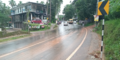
Omassery is the crossing of State Highways Koyilandy - Edavanna and Kappad-Thusharagiri-Adivaram. The location is well connected by roads from various corners and is a main junction for surrounding various panchayaths and villages. Moreover, it gives more geographical importance to this place as this is an important gateway to the hill ranges of western Ghat of Malabar. Thiruvambady, Thamarassery, Koduvally, Mukkam and Kodencheri are near by places of Omassery.
There is one bus stand and bus services available to places such as Kozhikode, Mukkam, Koduvally, Thamarassery, Thiruvambady, Kodenchery, Anakkampoyil.
The Kilometer chart from Kozhikode to Omassery is given below.

The Kilometer chart through road from Omassery is given below.
| Kozhikode - 29 km | Thamarassery - 9 km | Manjeri - 36 km | |
| Mukkam - 7 km | Malappuram - 48 km | Ernakulam - 190 km | Guruvayur - 115 km |
| Perinthalmanna - 60 km | Areekode - 20 km | Palakkad - 122 km | |
| Thiruvambady - 6 km | Thrissur - 133 km | Anakkampoyil - 19 km | |
| Koduvally - 6 km | Koyilandy - 37 km | Thiruvananthapuram - 414 km | |
| Kodencheri - 10 km | Kalpetta - 58 km | Nilambur - 50 km |
Image gallery


See also
References
- ^ a b "പൊതുവിവരങ്ങള് « ഓമശ്ശേരി ഗ്രാമപഞ്ചായത്ത് (Omassery Grama Panchayat)". Retrieved 1 October 2020.
- ^ "തദ്ദേശ സ്വയംഭരണ വകുപ്പ് | LSGD Kerala". lsgkerala.gov.in. Retrieved 1 October 2020.
- ^ "Social servies". Retrieved 1 October 2020.
- ^ "Pain and Palliative Care Clinic". Retrieved 1 October 2020.
- ^ "Santhi Hospital". Retrieved 1 October 2020.
External links
![]() Media related to Omassery at Wikimedia Commons
Media related to Omassery at Wikimedia Commons